Dd No E-1 Reservoir Report
Nearby: Dd No D-1 Lemar Lakes Dam
Last Updated: December 14, 2025
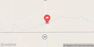
Dd No E-1, also known as Cimarron WS Dam E-1, is a crucial earth dam located in Dodge City, Kansas, designed by the Natural Resources Conservation Service.
°F
°F
mph
Wind
%
Humidity
Summary
Completed in 1959, this dam primarily serves the purpose of flood risk reduction along the Arkansas River. With a height of 16.2 feet and a storage capacity of 200 acre-feet, Dd No E-1 plays a significant role in managing water resources in the region.
Despite its importance, Dd No E-1 is currently rated as having a high hazard potential and poor condition assessment. The dam, with a hydraulic height of 16 feet and a spillway width of 75 feet, poses a moderate risk according to available data. Regular inspections are conducted, with the last one in March 2020, and an inspection frequency of 3 is in place to ensure the safety and functionality of the structure.
Located within the Kansas City District, Dd No E-1 is under state regulation by the Kansas Department of Agriculture. As water resource and climate enthusiasts, understanding the significance and condition of dams like Dd No E-1 is crucial for effective management and conservation of water resources in the face of changing climate patterns and increased risks of extreme weather events.
Year Completed |
1959 |
Dam Length |
1077 |
Dam Height |
16.2 |
River Or Stream |
ARKANSAS RIVER-TR |
Primary Dam Type |
Earth |
Surface Area |
11.09 |
Hydraulic Height |
16 |
Drainage Area |
0.85 |
Nid Storage |
200 |
Structural Height |
19 |
Outlet Gates |
None |
Hazard Potential |
High |
Foundations |
Unlisted/Unknown |
Nid Height |
19 |
Seasonal Comparison
Weather Forecast
Nearby Streamflow Levels
 Arkansas R At Garden City
|
0cfs |
 Farmers Ditch Nr Deerfield
|
0cfs |
 Arkansas R At Deerfield
|
0cfs |
 Pawnee R Nr Burdett
|
0cfs |
 Crooked C Nr Englewood
|
7cfs |
 Cimarron River Near Forgan
|
20cfs |
Dam Data Reference
Condition Assessment
SatisfactoryNo existing or potential dam safety deficiencies are recognized. Acceptable performance is expected under all loading conditions (static, hydrologic, seismic) in accordance with the minimum applicable state or federal regulatory criteria or tolerable risk guidelines.
Fair
No existing dam safety deficiencies are recognized for normal operating conditions. Rare or extreme hydrologic and/or seismic events may result in a dam safety deficiency. Risk may be in the range to take further action. Note: Rare or extreme event is defined by the regulatory agency based on their minimum
Poor A dam safety deficiency is recognized for normal operating conditions which may realistically occur. Remedial action is necessary. POOR may also be used when uncertainties exist as to critical analysis parameters which identify a potential dam safety deficiency. Investigations and studies are necessary.
Unsatisfactory
A dam safety deficiency is recognized that requires immediate or emergency remedial action for problem resolution.
Not Rated
The dam has not been inspected, is not under state or federal jurisdiction, or has been inspected but, for whatever reason, has not been rated.
Not Available
Dams for which the condition assessment is restricted to approved government users.
Hazard Potential Classification
HighDams assigned the high hazard potential classification are those where failure or mis-operation will probably cause loss of human life.
Significant
Dams assigned the significant hazard potential classification are those dams where failure or mis-operation results in no probable loss of human life but can cause economic loss, environment damage, disruption of lifeline facilities, or impact other concerns. Significant hazard potential classification dams are often located in predominantly rural or agricultural areas but could be in areas with population and significant infrastructure.
Low
Dams assigned the low hazard potential classification are those where failure or mis-operation results in no probable loss of human life and low economic and/or environmental losses. Losses are principally limited to the owner's property.
Undetermined
Dams for which a downstream hazard potential has not been designated or is not provided.
Not Available
Dams for which the downstream hazard potential is restricted to approved government users.

 Dd No E-1