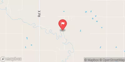
Frd No 12-5 Reservoir Report
Nearby: Frd No 12-1 Frd No 12-3
Last Updated: February 22, 2026
Frd No 12-5, also known as Upper Verdigris Watershed Dam 12-5, is a flood risk reduction structure located in Greenwood County, Kansas.
Summary
Built in 1965 by the USDA NRCS, this buttress dam stands at a structural height of 43 feet and has a maximum storage capacity of 350 acre-feet. Its primary purpose is flood risk reduction, serving to protect the surrounding area from potential flooding events along the Long Creek-TR.
Managed by the local government and regulated by the Kansas Department of Agriculture, Frd No 12-5 has a hazard potential rated as low and its condition assessment is currently not rated. With a spillway width of 40 feet and a maximum discharge capacity of 560 cubic feet per second, this dam plays a crucial role in managing water flow and mitigating flood risks in the region. As a key component of the water resource infrastructure in the area, Frd No 12-5 highlights the importance of sustainable water management practices in the face of changing climate conditions.
Overall, Frd No 12-5 is a vital piece of infrastructure in the Upper Verdigris Watershed, contributing to flood risk reduction efforts and water resource management in Greenwood County, Kansas. As climate change continues to impact water availability and extreme weather events, the significance of structures like Frd No 12-5 in protecting communities and ensuring water security becomes increasingly apparent. By understanding and supporting the maintenance and regulation of such dams, water resource and climate enthusiasts can play a role in safeguarding our natural resources for future generations.
°F
°F
mph
Wind
%
Humidity
15-Day Weather Outlook
Year Completed |
1965 |
Dam Length |
545 |
Dam Height |
43 |
River Or Stream |
LONG CREEK-TR |
Hydraulic Height |
40 |
Nid Storage |
350 |
Structural Height |
43 |
Outlet Gates |
None |
Hazard Potential |
Low |
Foundations |
Unlisted/Unknown |
Nid Height |
43 |
Seasonal Comparison
5-Day Hourly Forecast Detail
Nearby Streamflow Levels
 Verdigris R Nr Virgil
|
234cfs |
 Neosho R At Burlington
|
4610cfs |
 Otter C At Climax
|
29cfs |
 Cottonwood R Nr Plymouth
|
898cfs |
 Neosho R Nr Americus
|
109cfs |
 Marais Des Cygnes R Nr Reading
|
43cfs |
Dam Data Reference
Condition Assessment
SatisfactoryNo existing or potential dam safety deficiencies are recognized. Acceptable performance is expected under all loading conditions (static, hydrologic, seismic) in accordance with the minimum applicable state or federal regulatory criteria or tolerable risk guidelines.
Fair
No existing dam safety deficiencies are recognized for normal operating conditions. Rare or extreme hydrologic and/or seismic events may result in a dam safety deficiency. Risk may be in the range to take further action. Note: Rare or extreme event is defined by the regulatory agency based on their minimum
Poor A dam safety deficiency is recognized for normal operating conditions which may realistically occur. Remedial action is necessary. POOR may also be used when uncertainties exist as to critical analysis parameters which identify a potential dam safety deficiency. Investigations and studies are necessary.
Unsatisfactory
A dam safety deficiency is recognized that requires immediate or emergency remedial action for problem resolution.
Not Rated
The dam has not been inspected, is not under state or federal jurisdiction, or has been inspected but, for whatever reason, has not been rated.
Not Available
Dams for which the condition assessment is restricted to approved government users.
Hazard Potential Classification
HighDams assigned the high hazard potential classification are those where failure or mis-operation will probably cause loss of human life.
Significant
Dams assigned the significant hazard potential classification are those dams where failure or mis-operation results in no probable loss of human life but can cause economic loss, environment damage, disruption of lifeline facilities, or impact other concerns. Significant hazard potential classification dams are often located in predominantly rural or agricultural areas but could be in areas with population and significant infrastructure.
Low
Dams assigned the low hazard potential classification are those where failure or mis-operation results in no probable loss of human life and low economic and/or environmental losses. Losses are principally limited to the owner's property.
Undetermined
Dams for which a downstream hazard potential has not been designated or is not provided.
Not Available
Dams for which the downstream hazard potential is restricted to approved government users.

 Frd No 12-5