Summary
Built in 1965 by the USDA NRCS, this earth dam stands at a height of 50.8 feet and serves the primary purpose of flood risk reduction along the White Clay Creek-TR. With a normal storage capacity of 32 acre-feet and a maximum discharge capability of 1100 cubic feet per second, this dam plays a crucial role in managing water resources in the area.
The dam's satisfactory condition assessment and high hazard potential highlight its importance in safeguarding against flooding events. The Kansas Department of Agriculture oversees its regulatory and inspection processes, ensuring that it meets state standards for safety and functionality. Despite being non-federally owned, Frd No 22 remains a critical infrastructure for flood risk mitigation in the region, with a history of successful operations dating back to its completion in 1965.
As climate change continues to impact weather patterns, structures like Frd No 22 become increasingly essential in managing water resources and protecting communities from the dangers of flooding. With a solid track record of performance and maintenance, this earth dam exemplifies the collaborative efforts between local government agencies and the USDA NRCS to ensure the safety and resilience of water infrastructure in Atchison, Kansas.
°F
°F
mph
Wind
%
Humidity
15-Day Weather Outlook
Year Completed |
1965 |
Dam Length |
530 |
Dam Height |
50.8 |
River Or Stream |
WHITE CLAY CREEK-TR |
Primary Dam Type |
Earth |
Surface Area |
3.74 |
Hydraulic Height |
46 |
Drainage Area |
0.14 |
Nid Storage |
174.21 |
Structural Height |
58 |
Outlet Gates |
None |
Hazard Potential |
High |
Foundations |
Unlisted/Unknown |
Nid Height |
58 |
Seasonal Comparison
5-Day Hourly Forecast Detail
Nearby Streamflow Levels
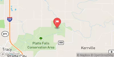
 Stranger C Nr Potter
|
199cfs |
 Delaware R Nr Muscotah
|
30cfs |
 Missouri River At St. Joseph
|
22300cfs |
 Platte River At Sharps Station
|
87cfs |
 Platte River Near Agency
|
91cfs |
 Stranger C Nr Tonganoxie
|
13cfs |
Dam Data Reference
Condition Assessment
SatisfactoryNo existing or potential dam safety deficiencies are recognized. Acceptable performance is expected under all loading conditions (static, hydrologic, seismic) in accordance with the minimum applicable state or federal regulatory criteria or tolerable risk guidelines.
Fair
No existing dam safety deficiencies are recognized for normal operating conditions. Rare or extreme hydrologic and/or seismic events may result in a dam safety deficiency. Risk may be in the range to take further action. Note: Rare or extreme event is defined by the regulatory agency based on their minimum
Poor A dam safety deficiency is recognized for normal operating conditions which may realistically occur. Remedial action is necessary. POOR may also be used when uncertainties exist as to critical analysis parameters which identify a potential dam safety deficiency. Investigations and studies are necessary.
Unsatisfactory
A dam safety deficiency is recognized that requires immediate or emergency remedial action for problem resolution.
Not Rated
The dam has not been inspected, is not under state or federal jurisdiction, or has been inspected but, for whatever reason, has not been rated.
Not Available
Dams for which the condition assessment is restricted to approved government users.
Hazard Potential Classification
HighDams assigned the high hazard potential classification are those where failure or mis-operation will probably cause loss of human life.
Significant
Dams assigned the significant hazard potential classification are those dams where failure or mis-operation results in no probable loss of human life but can cause economic loss, environment damage, disruption of lifeline facilities, or impact other concerns. Significant hazard potential classification dams are often located in predominantly rural or agricultural areas but could be in areas with population and significant infrastructure.
Low
Dams assigned the low hazard potential classification are those where failure or mis-operation results in no probable loss of human life and low economic and/or environmental losses. Losses are principally limited to the owner's property.
Undetermined
Dams for which a downstream hazard potential has not been designated or is not provided.
Not Available
Dams for which the downstream hazard potential is restricted to approved government users.

 Frd No 22