Dd No N-2 (Gross) Reservoir Report
Nearby: Frd No 2 (Nebo Creek) Gs Dd No N-5
Last Updated: February 23, 2026
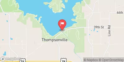
Dd No N-2 (Gross), also known as Delaware WS Joint District No 10 N2, is a flood risk reduction structure located in Half Mound, Kansas.
Summary
Owned by the local government and regulated by the Kansas Department of Agriculture, this earth dam was designed by the USDA NRCS and completed in 1977. With a height of 31 feet and a storage capacity of 135.08 acre-feet, it serves to protect the surrounding area from potential flooding events along the Nebo Creek-TR river or stream.
The dam has a low hazard potential and is currently rated as 'Not Rated' in terms of condition assessment. Despite its age, Dd No N-2 (Gross) continues to fulfill its primary purpose of flood risk reduction effectively. The structure does not have outlet gates and features an uncontrolled spillway with a width of 90 feet. With a moderate risk assessment score of 3, the dam is regularly inspected and meets state regulatory guidelines for operations and maintenance.
Overall, Dd No N-2 (Gross) is an essential infrastructure for managing flood risks in the Jackson County area of Kansas. Maintaining the integrity and functionality of this earth dam is crucial for protecting the community and surrounding properties from potential water-related disasters. As water resource and climate enthusiasts, understanding the design, purpose, and current status of Dd No N-2 (Gross) provides valuable insights into the ongoing efforts to safeguard the region against flooding events.
°F
°F
mph
Wind
%
Humidity
15-Day Weather Outlook
Year Completed |
1977 |
Dam Length |
890 |
Dam Height |
31 |
River Or Stream |
NEBO CREEK-TR |
Primary Dam Type |
Earth |
Surface Area |
7.5 |
Hydraulic Height |
25 |
Nid Storage |
135.08 |
Structural Height |
31 |
Outlet Gates |
None |
Hazard Potential |
Low |
Foundations |
Unlisted/Unknown |
Nid Height |
31 |
Seasonal Comparison
5-Day Hourly Forecast Detail
Nearby Streamflow Levels
 Delaware R Nr Muscotah
|
30cfs |
 Soldier C Nr Delia
|
4cfs |
 Soldier C Nr Topeka
|
9cfs |
 Delaware R Bl Perry Dam
|
433cfs |
 Stranger C Nr Potter
|
199cfs |
 Kansas R At Topeka
|
1120cfs |
Dam Data Reference
Condition Assessment
SatisfactoryNo existing or potential dam safety deficiencies are recognized. Acceptable performance is expected under all loading conditions (static, hydrologic, seismic) in accordance with the minimum applicable state or federal regulatory criteria or tolerable risk guidelines.
Fair
No existing dam safety deficiencies are recognized for normal operating conditions. Rare or extreme hydrologic and/or seismic events may result in a dam safety deficiency. Risk may be in the range to take further action. Note: Rare or extreme event is defined by the regulatory agency based on their minimum
Poor A dam safety deficiency is recognized for normal operating conditions which may realistically occur. Remedial action is necessary. POOR may also be used when uncertainties exist as to critical analysis parameters which identify a potential dam safety deficiency. Investigations and studies are necessary.
Unsatisfactory
A dam safety deficiency is recognized that requires immediate or emergency remedial action for problem resolution.
Not Rated
The dam has not been inspected, is not under state or federal jurisdiction, or has been inspected but, for whatever reason, has not been rated.
Not Available
Dams for which the condition assessment is restricted to approved government users.
Hazard Potential Classification
HighDams assigned the high hazard potential classification are those where failure or mis-operation will probably cause loss of human life.
Significant
Dams assigned the significant hazard potential classification are those dams where failure or mis-operation results in no probable loss of human life but can cause economic loss, environment damage, disruption of lifeline facilities, or impact other concerns. Significant hazard potential classification dams are often located in predominantly rural or agricultural areas but could be in areas with population and significant infrastructure.
Low
Dams assigned the low hazard potential classification are those where failure or mis-operation results in no probable loss of human life and low economic and/or environmental losses. Losses are principally limited to the owner's property.
Undetermined
Dams for which a downstream hazard potential has not been designated or is not provided.
Not Available
Dams for which the downstream hazard potential is restricted to approved government users.
Area Campgrounds
| Location | Reservations | Toilets |
|---|---|---|
 Main Camp Site
|
||
 Geremy's Point
|
||
 God's Country
|
||
 Banner Creek
|

 Dd No N-2 (Gross)