Summary
Owned by the local government and regulated by the Kansas Department of Agriculture, this earth dam was completed in 1976 and stands at a height of 70 feet along the South Fork Wildcat Creek. Its primary purpose is flood risk reduction, with a storage capacity of 3953.93 acre-feet and a drainage area of 9.02 square miles.
Managed by the USDA NRCS, Frd No 18 has a low hazard potential and a moderate risk assessment rating. The dam's spillway is uncontrolled with a width of 180 feet, serving a surface area of 43.33 acres. Despite its age, the dam's condition is currently not rated, and there have been no recent inspections recorded. With a structural height of 70 feet and a hydraulic height of 66 feet, Frd No 18 plays a crucial role in mitigating flood risks in the area.
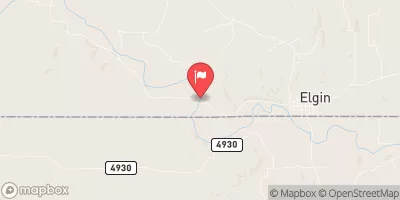
The dam's location in Elk County, Kansas, makes it a vital component of the local water resource infrastructure. While there are no associated structures or outlet gates, Frd No 18 continues to provide essential flood protection for the surrounding community. As water resource and climate enthusiasts, understanding the importance of structures like Frd No 18 is essential for ensuring the sustainable management of our water resources in the face of changing environmental conditions.
°F
°F
mph
Wind
%
Humidity
15-Day Weather Outlook
Year Completed |
1976 |
Dam Length |
1620 |
Dam Height |
70 |
River Or Stream |
SOUTH FORK WILDCAT CREEK |
Primary Dam Type |
Earth |
Surface Area |
43.33 |
Hydraulic Height |
66 |
Drainage Area |
9.02 |
Nid Storage |
3953.93 |
Structural Height |
70 |
Outlet Gates |
None |
Hazard Potential |
Low |
Foundations |
Unlisted/Unknown |
Nid Height |
70 |
Seasonal Comparison
5-Day Hourly Forecast Detail
Nearby Streamflow Levels
 Elk R At Elk Falls
|
38cfs |
 Caney R Nr Elgin
|
58cfs |
 Otter C At Climax
|
27cfs |
 Fall R At Fredonia
|
858cfs |
 Verdigris R Nr Altoona
|
1810cfs |
 Verdigris R At Independence
|
3740cfs |
Dam Data Reference
Condition Assessment
SatisfactoryNo existing or potential dam safety deficiencies are recognized. Acceptable performance is expected under all loading conditions (static, hydrologic, seismic) in accordance with the minimum applicable state or federal regulatory criteria or tolerable risk guidelines.
Fair
No existing dam safety deficiencies are recognized for normal operating conditions. Rare or extreme hydrologic and/or seismic events may result in a dam safety deficiency. Risk may be in the range to take further action. Note: Rare or extreme event is defined by the regulatory agency based on their minimum
Poor A dam safety deficiency is recognized for normal operating conditions which may realistically occur. Remedial action is necessary. POOR may also be used when uncertainties exist as to critical analysis parameters which identify a potential dam safety deficiency. Investigations and studies are necessary.
Unsatisfactory
A dam safety deficiency is recognized that requires immediate or emergency remedial action for problem resolution.
Not Rated
The dam has not been inspected, is not under state or federal jurisdiction, or has been inspected but, for whatever reason, has not been rated.
Not Available
Dams for which the condition assessment is restricted to approved government users.
Hazard Potential Classification
HighDams assigned the high hazard potential classification are those where failure or mis-operation will probably cause loss of human life.
Significant
Dams assigned the significant hazard potential classification are those dams where failure or mis-operation results in no probable loss of human life but can cause economic loss, environment damage, disruption of lifeline facilities, or impact other concerns. Significant hazard potential classification dams are often located in predominantly rural or agricultural areas but could be in areas with population and significant infrastructure.
Low
Dams assigned the low hazard potential classification are those where failure or mis-operation results in no probable loss of human life and low economic and/or environmental losses. Losses are principally limited to the owner's property.
Undetermined
Dams for which a downstream hazard potential has not been designated or is not provided.
Not Available
Dams for which the downstream hazard potential is restricted to approved government users.

 Frd No 18