Frd No 16 Reservoir Report
Nearby: Frd No 17 Dd No 3 (Sp-3)
Last Updated: February 22, 2026
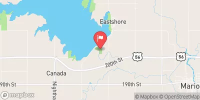
Frd No 16, also known as Upper Walnut WS Joint District No 33, is a local government-owned earth dam located in Butler County, Kansas.
Summary
Constructed in 1976 by the USDA NRCS, this dam serves the primary purpose of flood risk reduction along the Cole Creek. With a structural height of 26 feet and a length of 1525 feet, Frd No 16 has a storage capacity of 1476.38 acre-feet and a normal storage level of 63 feet.
The dam is regulated by the Kansas Department of Agriculture and is classified as having a low hazard potential. Despite its moderate risk assessment rating, the condition of Frd No 16 is currently not rated, highlighting the need for further assessment and maintenance to ensure its effectiveness in flood risk management. The dam features an uncontrolled spillway with a width of 40 feet and no outlet gates, indicating its reliance on natural overflow mechanisms during high water events.
As climate change continues to impact water resources and increase the frequency of extreme weather events, the maintenance and monitoring of infrastructure like Frd No 16 becomes crucial in protecting communities from potential flooding. With its strategic location and design elements, this dam plays a vital role in mitigating flood risks along the Cole Creek and underscores the importance of sustainable water resource management in the face of a changing climate.
°F
°F
mph
Wind
%
Humidity
15-Day Weather Outlook
Year Completed |
1976 |
Dam Length |
1525 |
Dam Height |
26 |
River Or Stream |
COLE CREEK |
Primary Dam Type |
Earth |
Surface Area |
24.86 |
Hydraulic Height |
22 |
Drainage Area |
3.26 |
Nid Storage |
1476.38 |
Structural Height |
26 |
Outlet Gates |
None |
Hazard Potential |
Low |
Foundations |
Unlisted/Unknown |
Nid Height |
26 |
Seasonal Comparison
5-Day Hourly Forecast Detail
Nearby Streamflow Levels
 Cedar C Nr Cedar Point
|
61cfs |
 Cottonwood R Nr Florence
|
617cfs |
 Whitewater R At Towanda
|
105cfs |
 N Cottonwood R Bl Marion Lk
|
409cfs |
 Cottonwood R Nr Plymouth
|
898cfs |
 L Arkansas R At Valley Center
|
80cfs |
Dam Data Reference
Condition Assessment
SatisfactoryNo existing or potential dam safety deficiencies are recognized. Acceptable performance is expected under all loading conditions (static, hydrologic, seismic) in accordance with the minimum applicable state or federal regulatory criteria or tolerable risk guidelines.
Fair
No existing dam safety deficiencies are recognized for normal operating conditions. Rare or extreme hydrologic and/or seismic events may result in a dam safety deficiency. Risk may be in the range to take further action. Note: Rare or extreme event is defined by the regulatory agency based on their minimum
Poor A dam safety deficiency is recognized for normal operating conditions which may realistically occur. Remedial action is necessary. POOR may also be used when uncertainties exist as to critical analysis parameters which identify a potential dam safety deficiency. Investigations and studies are necessary.
Unsatisfactory
A dam safety deficiency is recognized that requires immediate or emergency remedial action for problem resolution.
Not Rated
The dam has not been inspected, is not under state or federal jurisdiction, or has been inspected but, for whatever reason, has not been rated.
Not Available
Dams for which the condition assessment is restricted to approved government users.
Hazard Potential Classification
HighDams assigned the high hazard potential classification are those where failure or mis-operation will probably cause loss of human life.
Significant
Dams assigned the significant hazard potential classification are those dams where failure or mis-operation results in no probable loss of human life but can cause economic loss, environment damage, disruption of lifeline facilities, or impact other concerns. Significant hazard potential classification dams are often located in predominantly rural or agricultural areas but could be in areas with population and significant infrastructure.
Low
Dams assigned the low hazard potential classification are those where failure or mis-operation results in no probable loss of human life and low economic and/or environmental losses. Losses are principally limited to the owner's property.
Undetermined
Dams for which a downstream hazard potential has not been designated or is not provided.
Not Available
Dams for which the downstream hazard potential is restricted to approved government users.

 Frd No 16