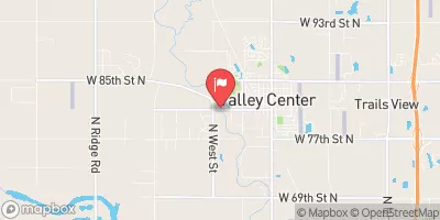
Summary
Built in 1977 by USDA NRCS, this earth dam stands at a height of 34 feet and serves the primary purpose of flood risk reduction. With a storage capacity of 1702.39 acre-feet and a normal storage level of 99 feet, this dam plays a crucial role in managing water flow in the area.
Although classified as having low hazard potential, Frd No 26 is regulated by the Kansas Department of Agriculture and undergoes regular inspections, permitting, and enforcement to ensure its structural integrity and compliance with state regulations. With a moderate risk assessment rating of 3, this dam is equipped with an uncontrolled spillway and has a surface area of 25.21 acres, serving a drainage area of 4.67 square miles. Despite not having outlet gates, this structure plays a vital role in mitigating flood risks and protecting the surrounding communities.
As an essential component of flood risk management in the region, Frd No 26 stands as a testament to effective water resource infrastructure. With its strategic location and design, this dam serves as a critical line of defense against potential flooding events, showcasing the importance of sustainable water management practices in the face of changing climate patterns.
°F
°F
mph
Wind
%
Humidity
15-Day Weather Outlook
Year Completed |
1977 |
Dam Length |
2710 |
Dam Height |
34 |
River Or Stream |
BEMIS CREEK |
Primary Dam Type |
Earth |
Surface Area |
25.21 |
Hydraulic Height |
30 |
Drainage Area |
4.67 |
Nid Storage |
1702.39 |
Structural Height |
34 |
Outlet Gates |
None |
Hazard Potential |
Low |
Foundations |
Unlisted/Unknown |
Nid Height |
34 |
Seasonal Comparison
5-Day Hourly Forecast Detail
Nearby Streamflow Levels
 Whitewater R At Towanda
|
105cfs |
 Cedar C Nr Cedar Point
|
61cfs |
 Otter C At Climax
|
29cfs |
 Cottonwood R Nr Florence
|
617cfs |
 Verdigris R Nr Virgil
|
234cfs |
 L Arkansas R At Valley Center
|
80cfs |
Dam Data Reference
Condition Assessment
SatisfactoryNo existing or potential dam safety deficiencies are recognized. Acceptable performance is expected under all loading conditions (static, hydrologic, seismic) in accordance with the minimum applicable state or federal regulatory criteria or tolerable risk guidelines.
Fair
No existing dam safety deficiencies are recognized for normal operating conditions. Rare or extreme hydrologic and/or seismic events may result in a dam safety deficiency. Risk may be in the range to take further action. Note: Rare or extreme event is defined by the regulatory agency based on their minimum
Poor A dam safety deficiency is recognized for normal operating conditions which may realistically occur. Remedial action is necessary. POOR may also be used when uncertainties exist as to critical analysis parameters which identify a potential dam safety deficiency. Investigations and studies are necessary.
Unsatisfactory
A dam safety deficiency is recognized that requires immediate or emergency remedial action for problem resolution.
Not Rated
The dam has not been inspected, is not under state or federal jurisdiction, or has been inspected but, for whatever reason, has not been rated.
Not Available
Dams for which the condition assessment is restricted to approved government users.
Hazard Potential Classification
HighDams assigned the high hazard potential classification are those where failure or mis-operation will probably cause loss of human life.
Significant
Dams assigned the significant hazard potential classification are those dams where failure or mis-operation results in no probable loss of human life but can cause economic loss, environment damage, disruption of lifeline facilities, or impact other concerns. Significant hazard potential classification dams are often located in predominantly rural or agricultural areas but could be in areas with population and significant infrastructure.
Low
Dams assigned the low hazard potential classification are those where failure or mis-operation results in no probable loss of human life and low economic and/or environmental losses. Losses are principally limited to the owner's property.
Undetermined
Dams for which a downstream hazard potential has not been designated or is not provided.
Not Available
Dams for which the downstream hazard potential is restricted to approved government users.

 Frd No 26