Legacy Lakes Reservoir Report
Nearby: Lake Sherwood Lauren's Bay Pond
Last Updated: February 22, 2026
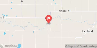
Legacy Lakes in Shawnee, Kansas, is a private water resource managed by the USDA NRCS and regulated by the Kansas Department of Agriculture.
Summary
This earth dam, completed in 1966, serves multiple purposes including fire protection, stock, and small fish pond management. With a height of 26 feet and a length of 600 feet, Legacy Lakes has a storage capacity of 78 acre-feet and covers a surface area of 3.94 acres.
Despite its age, Legacy Lakes has a high hazard potential and poor condition assessment, indicating the need for maintenance and potential upgrades. The dam's spillway, controlled and 66 feet wide, can handle a maximum discharge of 680 cubic feet per second. The risk assessment for this dam is very high, emphasizing the importance of monitoring and management measures to ensure the safety of the surrounding area and downstream communities.
Given its location near the Shungunga Creek and designation as a very high-risk structure, Legacy Lakes represents a critical water resource for the region. Climate and water resource enthusiasts should closely monitor any developments related to the dam's condition and management to protect the local ecosystem and communities from potential hazards.
°F
°F
mph
Wind
%
Humidity
15-Day Weather Outlook
Year Completed |
1966 |
Dam Length |
600 |
Dam Height |
26 |
River Or Stream |
SHUNGUNGA CREEK-TR |
Primary Dam Type |
Earth |
Surface Area |
3.94 |
Hydraulic Height |
23 |
Drainage Area |
0.43 |
Nid Storage |
78 |
Structural Height |
24 |
Outlet Gates |
None |
Hazard Potential |
High |
Foundations |
Unlisted/Unknown |
Nid Height |
26 |
Seasonal Comparison
5-Day Hourly Forecast Detail
Nearby Streamflow Levels
 Soldier C Nr Topeka
|
12cfs |
 Kansas R At Topeka
|
1130cfs |
 Wakarusa R Nr Richland
|
12cfs |
 Soldier C Nr Delia
|
4cfs |
 Dragoon C Nr Burlingame
|
24cfs |
 Mill C Nr Paxico
|
54cfs |
Dam Data Reference
Condition Assessment
SatisfactoryNo existing or potential dam safety deficiencies are recognized. Acceptable performance is expected under all loading conditions (static, hydrologic, seismic) in accordance with the minimum applicable state or federal regulatory criteria or tolerable risk guidelines.
Fair
No existing dam safety deficiencies are recognized for normal operating conditions. Rare or extreme hydrologic and/or seismic events may result in a dam safety deficiency. Risk may be in the range to take further action. Note: Rare or extreme event is defined by the regulatory agency based on their minimum
Poor A dam safety deficiency is recognized for normal operating conditions which may realistically occur. Remedial action is necessary. POOR may also be used when uncertainties exist as to critical analysis parameters which identify a potential dam safety deficiency. Investigations and studies are necessary.
Unsatisfactory
A dam safety deficiency is recognized that requires immediate or emergency remedial action for problem resolution.
Not Rated
The dam has not been inspected, is not under state or federal jurisdiction, or has been inspected but, for whatever reason, has not been rated.
Not Available
Dams for which the condition assessment is restricted to approved government users.
Hazard Potential Classification
HighDams assigned the high hazard potential classification are those where failure or mis-operation will probably cause loss of human life.
Significant
Dams assigned the significant hazard potential classification are those dams where failure or mis-operation results in no probable loss of human life but can cause economic loss, environment damage, disruption of lifeline facilities, or impact other concerns. Significant hazard potential classification dams are often located in predominantly rural or agricultural areas but could be in areas with population and significant infrastructure.
Low
Dams assigned the low hazard potential classification are those where failure or mis-operation results in no probable loss of human life and low economic and/or environmental losses. Losses are principally limited to the owner's property.
Undetermined
Dams for which a downstream hazard potential has not been designated or is not provided.
Not Available
Dams for which the downstream hazard potential is restricted to approved government users.

 Legacy Lakes