Summary
The dam stands at a height of 30 feet with a length of 2090 feet, providing a storage capacity of 631.4 acre-feet and serving a drainage area of 1.23 square miles. Despite being classified as having a low hazard potential, the dam is considered to have a moderate risk level, with no recent condition assessment available.
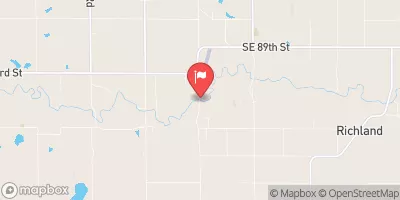
Managed by the Kansas Department of Agriculture, Frd No 3 is equipped with an uncontrolled spillway, 60 feet in width, and has no outlet gates or associated structures. The dam is located in the city of Wakarusa, with a latitude of 38.90526125 and longitude of -95.74227359. While the dam has not been recently inspected, it is regulated, permitted, and inspected by state authorities, ensuring its compliance with safety standards and enforcement measures to mitigate any potential risks.
With a focus on flood risk reduction, Frd No 3 plays a crucial role in protecting the surrounding area from potential flooding events. The dam's construction by the Natural Resources Conservation Service and its state-regulated status indicate a commitment to water resource management and climate resilience. As water resource and climate enthusiasts, understanding the design, purpose, and risk assessment of Frd No 3 provides valuable insight into the ongoing efforts to safeguard communities and the environment from the impacts of extreme weather events.
°F
°F
mph
Wind
%
Humidity
15-Day Weather Outlook
Year Completed |
1980 |
Dam Length |
2090 |
Dam Height |
30 |
River Or Stream |
SIX MILE CREEK-TR |
Primary Dam Type |
Earth |
Surface Area |
17.4 |
Drainage Area |
1.23 |
Nid Storage |
631.4 |
Outlet Gates |
None |
Hazard Potential |
Low |
Foundations |
Unlisted/Unknown |
Nid Height |
30 |
Seasonal Comparison
5-Day Hourly Forecast Detail
Nearby Streamflow Levels
 Wakarusa R Nr Richland
|
12cfs |
 Kansas R At Topeka
|
1130cfs |
 Soldier C Nr Topeka
|
12cfs |
 Dragoon C Nr Burlingame
|
24cfs |
 Hundred And Ten Mile C Nr Quenemo
|
485cfs |
 Salt C At Lyndon
|
24cfs |
Dam Data Reference
Condition Assessment
SatisfactoryNo existing or potential dam safety deficiencies are recognized. Acceptable performance is expected under all loading conditions (static, hydrologic, seismic) in accordance with the minimum applicable state or federal regulatory criteria or tolerable risk guidelines.
Fair
No existing dam safety deficiencies are recognized for normal operating conditions. Rare or extreme hydrologic and/or seismic events may result in a dam safety deficiency. Risk may be in the range to take further action. Note: Rare or extreme event is defined by the regulatory agency based on their minimum
Poor A dam safety deficiency is recognized for normal operating conditions which may realistically occur. Remedial action is necessary. POOR may also be used when uncertainties exist as to critical analysis parameters which identify a potential dam safety deficiency. Investigations and studies are necessary.
Unsatisfactory
A dam safety deficiency is recognized that requires immediate or emergency remedial action for problem resolution.
Not Rated
The dam has not been inspected, is not under state or federal jurisdiction, or has been inspected but, for whatever reason, has not been rated.
Not Available
Dams for which the condition assessment is restricted to approved government users.
Hazard Potential Classification
HighDams assigned the high hazard potential classification are those where failure or mis-operation will probably cause loss of human life.
Significant
Dams assigned the significant hazard potential classification are those dams where failure or mis-operation results in no probable loss of human life but can cause economic loss, environment damage, disruption of lifeline facilities, or impact other concerns. Significant hazard potential classification dams are often located in predominantly rural or agricultural areas but could be in areas with population and significant infrastructure.
Low
Dams assigned the low hazard potential classification are those where failure or mis-operation results in no probable loss of human life and low economic and/or environmental losses. Losses are principally limited to the owner's property.
Undetermined
Dams for which a downstream hazard potential has not been designated or is not provided.
Not Available
Dams for which the downstream hazard potential is restricted to approved government users.

 Frd No 3