Summary
Completed in 1982, this dam plays a crucial role in flood risk reduction along the Eagle Creek-TR river or stream. With a height of 21 feet and a length of 1300 feet, Dd No 106 has a storage capacity of 264.1 acre-feet and a surface area of 9.52 acres, serving as a vital structure for water resource management in Lyon County.
Managed by the Kansas Department of Agriculture, Dd No 106 is in a low hazard potential category with a moderate risk assessment rating. Despite not being currently rated for condition assessment, the dam is regularly inspected, permitted, and enforced by state regulatory agencies. With no associated structures or outlet gates, this dam is equipped with an uncontrolled spillway with a width of 100 feet. The primary purpose of Dd No 106 is flood risk reduction, emphasizing its importance in mitigating potential water-related disasters in the region.
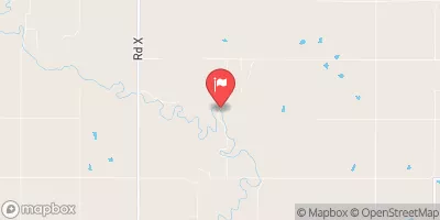
The geographical coordinates of Dd No 106 are 38.27855765 latitude and -96.26772375 longitude, situated in a rural area of Kansas. Although not owned or funded by federal agencies, this dam serves as a vital infrastructure for the local community, ensuring the safety and security of residents in the event of flooding. With a history of effective operation and maintenance, Dd No 106 stands as a testament to the importance of sustainable water resource management and climate resilience in the face of changing environmental conditions.
°F
°F
mph
Wind
%
Humidity
15-Day Weather Outlook
Year Completed |
1982 |
Dam Length |
1300 |
Dam Height |
21 |
River Or Stream |
EAGLE CREEK-TR |
Primary Dam Type |
Earth |
Surface Area |
9.52 |
Drainage Area |
0.63 |
Nid Storage |
264.1 |
Outlet Gates |
None |
Hazard Potential |
Low |
Foundations |
Unlisted/Unknown |
Nid Height |
21 |
Seasonal Comparison
5-Day Hourly Forecast Detail
Nearby Streamflow Levels
 Cottonwood R Nr Plymouth
|
934cfs |
 Neosho R Nr Americus
|
216cfs |
 Marais Des Cygnes R Nr Reading
|
50cfs |
 Verdigris R Nr Virgil
|
270cfs |
 Neosho R At Council Grove
|
1cfs |
 Neosho R At Burlington
|
4660cfs |
Dam Data Reference
Condition Assessment
SatisfactoryNo existing or potential dam safety deficiencies are recognized. Acceptable performance is expected under all loading conditions (static, hydrologic, seismic) in accordance with the minimum applicable state or federal regulatory criteria or tolerable risk guidelines.
Fair
No existing dam safety deficiencies are recognized for normal operating conditions. Rare or extreme hydrologic and/or seismic events may result in a dam safety deficiency. Risk may be in the range to take further action. Note: Rare or extreme event is defined by the regulatory agency based on their minimum
Poor A dam safety deficiency is recognized for normal operating conditions which may realistically occur. Remedial action is necessary. POOR may also be used when uncertainties exist as to critical analysis parameters which identify a potential dam safety deficiency. Investigations and studies are necessary.
Unsatisfactory
A dam safety deficiency is recognized that requires immediate or emergency remedial action for problem resolution.
Not Rated
The dam has not been inspected, is not under state or federal jurisdiction, or has been inspected but, for whatever reason, has not been rated.
Not Available
Dams for which the condition assessment is restricted to approved government users.
Hazard Potential Classification
HighDams assigned the high hazard potential classification are those where failure or mis-operation will probably cause loss of human life.
Significant
Dams assigned the significant hazard potential classification are those dams where failure or mis-operation results in no probable loss of human life but can cause economic loss, environment damage, disruption of lifeline facilities, or impact other concerns. Significant hazard potential classification dams are often located in predominantly rural or agricultural areas but could be in areas with population and significant infrastructure.
Low
Dams assigned the low hazard potential classification are those where failure or mis-operation results in no probable loss of human life and low economic and/or environmental losses. Losses are principally limited to the owner's property.
Undetermined
Dams for which a downstream hazard potential has not been designated or is not provided.
Not Available
Dams for which the downstream hazard potential is restricted to approved government users.

 Dd No 106