Summary
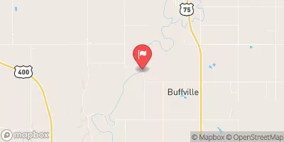
Completed in 1979, this earth dam stands at a height of 43.5 feet and has a length of 1200 feet, providing a storage capacity of 2813 acre-feet. Despite being classified as having a low hazard potential, the dam has not been rated for its condition, with the last inspection dating back to September 1996.
The dam, owned by the local government and regulated by the Kansas Department of Agriculture, serves as a critical infrastructure for flood control in the region. With a moderate risk assessment rating of 3, it is essential for the dam to undergo regular inspections and maintenance to ensure its functionality in case of emergencies. The dam's spillway, with a width of 54 feet, is uncontrolled, making it crucial for proper monitoring and management during times of high water flow.
Overall, Frd No 10 plays a significant role in managing flood risk in Elk County, Kansas, serving as a vital piece of infrastructure designed to protect the surrounding community from potential water-related disasters. As climate change continues to impact weather patterns, it is imperative that structures like Frd No 10 are properly maintained and managed to ensure their effectiveness in safeguarding against flooding events in the future.
°F
°F
mph
Wind
%
Humidity
15-Day Weather Outlook
Year Completed |
1979 |
Dam Length |
1200 |
Dam Height |
43.5 |
River Or Stream |
WEST PAINTERHOOD CREEK |
Primary Dam Type |
Earth |
Surface Area |
34.33 |
Drainage Area |
4.76 |
Nid Storage |
2813 |
Outlet Gates |
None |
Hazard Potential |
Low |
Foundations |
Unlisted/Unknown |
Nid Height |
44 |
Seasonal Comparison
5-Day Hourly Forecast Detail
Nearby Streamflow Levels
 Elk R At Elk Falls
|
38cfs |
 Fall R At Fredonia
|
858cfs |
 Otter C At Climax
|
27cfs |
 Verdigris R Nr Altoona
|
1810cfs |
 Verdigris R At Independence
|
3740cfs |
 Verdigris R Nr Virgil
|
199cfs |
Dam Data Reference
Condition Assessment
SatisfactoryNo existing or potential dam safety deficiencies are recognized. Acceptable performance is expected under all loading conditions (static, hydrologic, seismic) in accordance with the minimum applicable state or federal regulatory criteria or tolerable risk guidelines.
Fair
No existing dam safety deficiencies are recognized for normal operating conditions. Rare or extreme hydrologic and/or seismic events may result in a dam safety deficiency. Risk may be in the range to take further action. Note: Rare or extreme event is defined by the regulatory agency based on their minimum
Poor A dam safety deficiency is recognized for normal operating conditions which may realistically occur. Remedial action is necessary. POOR may also be used when uncertainties exist as to critical analysis parameters which identify a potential dam safety deficiency. Investigations and studies are necessary.
Unsatisfactory
A dam safety deficiency is recognized that requires immediate or emergency remedial action for problem resolution.
Not Rated
The dam has not been inspected, is not under state or federal jurisdiction, or has been inspected but, for whatever reason, has not been rated.
Not Available
Dams for which the condition assessment is restricted to approved government users.
Hazard Potential Classification
HighDams assigned the high hazard potential classification are those where failure or mis-operation will probably cause loss of human life.
Significant
Dams assigned the significant hazard potential classification are those dams where failure or mis-operation results in no probable loss of human life but can cause economic loss, environment damage, disruption of lifeline facilities, or impact other concerns. Significant hazard potential classification dams are often located in predominantly rural or agricultural areas but could be in areas with population and significant infrastructure.
Low
Dams assigned the low hazard potential classification are those where failure or mis-operation results in no probable loss of human life and low economic and/or environmental losses. Losses are principally limited to the owner's property.
Undetermined
Dams for which a downstream hazard potential has not been designated or is not provided.
Not Available
Dams for which the downstream hazard potential is restricted to approved government users.

 Frd No 10