Summary
Completed in 1988, this dam stands at 26 feet high and stretches 1,992 feet in length, with a storage capacity of 2,842 acre-feet and a drainage area of 11.25 square miles. The dam has a low hazard potential and is currently rated as "Not Rated" in terms of condition assessment.
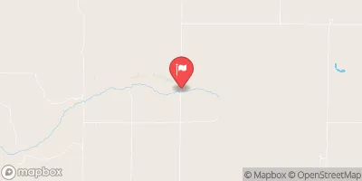
Located in Alexander, Kansas, Frd No 33 is regulated by the Kansas Dept. of Agriculture and is subject to state permitting, inspection, and enforcement. The dam features an uncontrolled spillway with a width of 40 feet, and no outlet gates for water release. While the risk assessment for this dam is moderate, the emergency action plan status, inundation maps, and risk management measures are currently not available. Overall, Frd No 33 serves as a crucial infrastructure for flood control in the region, highlighting the importance of water resource management in mitigating climate-related risks.
Year Completed |
1988 |
Dam Length |
1992 |
Dam Height |
26 |
River Or Stream |
ALEXANDER DRY CREEK-TR |
Primary Dam Type |
Earth |
Surface Area |
64 |
Drainage Area |
11.25 |
Nid Storage |
2842 |
Outlet Gates |
None |
Hazard Potential |
Low |
Foundations |
Unlisted/Unknown |
Nid Height |
26 |
Seasonal Comparison
Hourly Weather Forecast
Nearby Streamflow Levels
 Walnut C At Nekoma
|
3cfs |
 Pawnee R Nr Burdett
|
0cfs |
 Smoky Hill R Nr Schoenchen
|
2cfs |
 Smoky Hill R Bl Schoenchen
|
2cfs |
 Smoky Hill R Nr Arnold
|
1cfs |
 Pawnee R At Rozel
|
4cfs |
Dam Data Reference
Condition Assessment
SatisfactoryNo existing or potential dam safety deficiencies are recognized. Acceptable performance is expected under all loading conditions (static, hydrologic, seismic) in accordance with the minimum applicable state or federal regulatory criteria or tolerable risk guidelines.
Fair
No existing dam safety deficiencies are recognized for normal operating conditions. Rare or extreme hydrologic and/or seismic events may result in a dam safety deficiency. Risk may be in the range to take further action. Note: Rare or extreme event is defined by the regulatory agency based on their minimum
Poor A dam safety deficiency is recognized for normal operating conditions which may realistically occur. Remedial action is necessary. POOR may also be used when uncertainties exist as to critical analysis parameters which identify a potential dam safety deficiency. Investigations and studies are necessary.
Unsatisfactory
A dam safety deficiency is recognized that requires immediate or emergency remedial action for problem resolution.
Not Rated
The dam has not been inspected, is not under state or federal jurisdiction, or has been inspected but, for whatever reason, has not been rated.
Not Available
Dams for which the condition assessment is restricted to approved government users.
Hazard Potential Classification
HighDams assigned the high hazard potential classification are those where failure or mis-operation will probably cause loss of human life.
Significant
Dams assigned the significant hazard potential classification are those dams where failure or mis-operation results in no probable loss of human life but can cause economic loss, environment damage, disruption of lifeline facilities, or impact other concerns. Significant hazard potential classification dams are often located in predominantly rural or agricultural areas but could be in areas with population and significant infrastructure.
Low
Dams assigned the low hazard potential classification are those where failure or mis-operation results in no probable loss of human life and low economic and/or environmental losses. Losses are principally limited to the owner's property.
Undetermined
Dams for which a downstream hazard potential has not been designated or is not provided.
Not Available
Dams for which the downstream hazard potential is restricted to approved government users.

 Frd No 33