Frd No 14 Reservoir Report
Nearby: Frd No 13 Dd No 106 (Hazen)
Last Updated: February 21, 2026
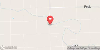
Frd No 14 is a flood risk reduction dam located in Butler County, Kansas, specifically in the city of Douglas.
Summary
Built in 1982, this earth dam stands at a height of 23.8 feet and has a storage capacity of 418.3 acre-feet. It serves the primary purpose of flood risk reduction along Eight Mile Creek-TR, with a drainage area of 1.09 square miles.
Managed by the local government and regulated by the Kansas Department of Agriculture, Frd No 14 has a low hazard potential and is currently rated as "Not Rated" in terms of condition assessment. Despite its moderate risk level, the dam has not been assigned a Dam Safety Action Classification (DSAC) date, indicating a need for further risk assessment and management measures. With a spillway width of 40 feet and a maximum discharge capacity of 1194 cubic feet per second, this dam plays a crucial role in mitigating flood risks in the area.
Overall, Frd No 14 is a vital piece of infrastructure in the region, ensuring the safety of nearby communities from potential flooding events. As a key component of flood risk reduction efforts, this dam underscores the importance of water resource management and climate resilience in safeguarding our environment and communities.
°F
°F
mph
Wind
%
Humidity
15-Day Weather Outlook
Year Completed |
1982 |
Dam Length |
2100 |
Dam Height |
23.8 |
River Or Stream |
EIGHT MILE CREEK-TR |
Primary Dam Type |
Earth |
Surface Area |
12.8 |
Drainage Area |
1.09 |
Nid Storage |
418.3 |
Outlet Gates |
None |
Hazard Potential |
Low |
Foundations |
Unlisted/Unknown |
Nid Height |
24 |
Seasonal Comparison
5-Day Hourly Forecast Detail
Nearby Streamflow Levels
 Arkansas R At Derby
|
455cfs |
 Arkansas R At Wichita
|
361cfs |
 Whitewater R At Towanda
|
125cfs |
 Floodway At Arkansas R At Wichita
|
0cfs |
 Ninnescah R Nr Peck
|
633cfs |
 Arkansas R Nr Maize
|
203cfs |
Dam Data Reference
Condition Assessment
SatisfactoryNo existing or potential dam safety deficiencies are recognized. Acceptable performance is expected under all loading conditions (static, hydrologic, seismic) in accordance with the minimum applicable state or federal regulatory criteria or tolerable risk guidelines.
Fair
No existing dam safety deficiencies are recognized for normal operating conditions. Rare or extreme hydrologic and/or seismic events may result in a dam safety deficiency. Risk may be in the range to take further action. Note: Rare or extreme event is defined by the regulatory agency based on their minimum
Poor A dam safety deficiency is recognized for normal operating conditions which may realistically occur. Remedial action is necessary. POOR may also be used when uncertainties exist as to critical analysis parameters which identify a potential dam safety deficiency. Investigations and studies are necessary.
Unsatisfactory
A dam safety deficiency is recognized that requires immediate or emergency remedial action for problem resolution.
Not Rated
The dam has not been inspected, is not under state or federal jurisdiction, or has been inspected but, for whatever reason, has not been rated.
Not Available
Dams for which the condition assessment is restricted to approved government users.
Hazard Potential Classification
HighDams assigned the high hazard potential classification are those where failure or mis-operation will probably cause loss of human life.
Significant
Dams assigned the significant hazard potential classification are those dams where failure or mis-operation results in no probable loss of human life but can cause economic loss, environment damage, disruption of lifeline facilities, or impact other concerns. Significant hazard potential classification dams are often located in predominantly rural or agricultural areas but could be in areas with population and significant infrastructure.
Low
Dams assigned the low hazard potential classification are those where failure or mis-operation results in no probable loss of human life and low economic and/or environmental losses. Losses are principally limited to the owner's property.
Undetermined
Dams for which a downstream hazard potential has not been designated or is not provided.
Not Available
Dams for which the downstream hazard potential is restricted to approved government users.

 Frd No 14
 Augusta - Santa Fe Lake
 Mulvane-Cedar Brook Pond
 Augusta City Lake
 Wichita Emery Park Pond