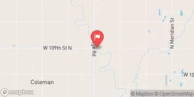
Dd Sp-8 Reservoir Report
Nearby: Dd No Sp-9 Dd No 2 (Harvey)
Last Updated: February 22, 2026
Dd Sp-8, located in Butler, Kansas, is a local government-owned earth dam completed in 1992 with a primary purpose not specified.
Summary
This dam on Diamond Creek-TR has a height of 20 feet and a length of 1600 feet, providing a storage capacity of 360 acre-feet. With a surface area of 7.6 acres and a drainage area of 0.7 square miles, Dd Sp-8 has a low hazard potential and a moderate risk assessment rating of 3.
Despite being designed by GENE F. BOHNENBLUST, P.E, Dd Sp-8 is not regulated or permitted by the state of Kansas. The dam, with an uncontrolled spillway type and no outlet gates, does not have a designated emergency action plan or updated contacts. With a condition assessment of "Not Rated," the dam's risk management measures and risk characterization summary remain unspecified. The surrounding area, represented by Congressman Ron Estes (R), benefits from the dam's moderate risk assessment and low hazard potential status.
Overall, Dd Sp-8 serves as a vital water resource structure in Butler, Kansas, with a focus on flood control and water storage. As a part of the Kansas City District and with no associated structures or federal funding, this earth dam stands as an essential component in managing the flow of Diamond Creek-TR. Its location, size, and risk assessment highlight the importance of monitoring and maintaining this critical infrastructure for water resource and climate enthusiasts in the region.
°F
°F
mph
Wind
%
Humidity
15-Day Weather Outlook
Year Completed |
1992 |
Dam Length |
1600 |
Dam Height |
20 |
River Or Stream |
DIAMOND CREEK-TR |
Primary Dam Type |
Earth |
Surface Area |
7.6 |
Drainage Area |
0.7 |
Nid Storage |
360 |
Outlet Gates |
None |
Hazard Potential |
Low |
Foundations |
Unlisted/Unknown |
Nid Height |
20 |
Seasonal Comparison
5-Day Hourly Forecast Detail
Nearby Streamflow Levels
 Whitewater R At Towanda
|
125cfs |
 Cedar C Nr Cedar Point
|
64cfs |
 Cottonwood R Nr Florence
|
251cfs |
 L Arkansas R At Valley Center
|
95cfs |
 L Arkansas R Nr Sedgwick
|
84cfs |
 Floodway At L Arkansas R At Valley Center
|
0cfs |
Dam Data Reference
Condition Assessment
SatisfactoryNo existing or potential dam safety deficiencies are recognized. Acceptable performance is expected under all loading conditions (static, hydrologic, seismic) in accordance with the minimum applicable state or federal regulatory criteria or tolerable risk guidelines.
Fair
No existing dam safety deficiencies are recognized for normal operating conditions. Rare or extreme hydrologic and/or seismic events may result in a dam safety deficiency. Risk may be in the range to take further action. Note: Rare or extreme event is defined by the regulatory agency based on their minimum
Poor A dam safety deficiency is recognized for normal operating conditions which may realistically occur. Remedial action is necessary. POOR may also be used when uncertainties exist as to critical analysis parameters which identify a potential dam safety deficiency. Investigations and studies are necessary.
Unsatisfactory
A dam safety deficiency is recognized that requires immediate or emergency remedial action for problem resolution.
Not Rated
The dam has not been inspected, is not under state or federal jurisdiction, or has been inspected but, for whatever reason, has not been rated.
Not Available
Dams for which the condition assessment is restricted to approved government users.
Hazard Potential Classification
HighDams assigned the high hazard potential classification are those where failure or mis-operation will probably cause loss of human life.
Significant
Dams assigned the significant hazard potential classification are those dams where failure or mis-operation results in no probable loss of human life but can cause economic loss, environment damage, disruption of lifeline facilities, or impact other concerns. Significant hazard potential classification dams are often located in predominantly rural or agricultural areas but could be in areas with population and significant infrastructure.
Low
Dams assigned the low hazard potential classification are those where failure or mis-operation results in no probable loss of human life and low economic and/or environmental losses. Losses are principally limited to the owner's property.
Undetermined
Dams for which a downstream hazard potential has not been designated or is not provided.
Not Available
Dams for which the downstream hazard potential is restricted to approved government users.

 Dd Sp-8