Dd No B-9 (Labette-Hackberry) Reservoir Report
Last Updated: January 11, 2026
Dd No B-9 (Labette-Hackberry) is a local government-owned earth dam located in Parsons, Kansas, along the Labette Creek.
°F
°F
mph
Wind
%
Humidity
Summary
With a primary purpose of flood risk reduction, this dam stands at a height of 14 feet and spans a length of 1520 feet. It has a storage capacity of 188.68 acre-feet and a normal storage of 15.84 acre-feet, with a surface area of 7.39 acres and a drainage area of 0.57 square miles.
Despite being classified as having a low hazard potential, the condition assessment of Dd No B-9 is currently listed as "Not Rated". The dam features an uncontrolled spillway with a width of 100 feet, and no outlet gates. While the risk assessment for this dam is moderate, with a rating of 3, there are currently no specific risk management measures in place. With no recent inspection dates or emergency action plans reported, the overall state of readiness and maintenance for Dd No B-9 remains unclear, raising potential concerns for its long-term effectiveness in flood risk reduction efforts in the region.
In conclusion, Dd No B-9 (Labette-Hackberry) is a key structure in the flood risk reduction efforts along the Labette Creek in Parsons, Kansas. Despite its moderate risk assessment rating and lack of recent condition assessments or emergency action plans, the dam serves as a vital component of the local watershed infrastructure. Continued monitoring and maintenance of Dd No B-9 will be crucial in ensuring its effectiveness in protecting the surrounding community from potential flood events.
Dam Length |
1520 |
Dam Height |
14 |
River Or Stream |
LABETTE CREEK-TR |
Primary Dam Type |
Earth |
Surface Area |
7.39 |
Drainage Area |
0.57 |
Nid Storage |
188.68 |
Outlet Gates |
None |
Hazard Potential |
Low |
Foundations |
Unlisted/Unknown |
Nid Height |
14 |
Seasonal Comparison
Weather Forecast
Nearby Streamflow Levels
 Neosho R Nr Parsons
|
2370cfs |
 Lightning C Nr Mccune
|
2cfs |
 Labette C Nr Oswego
|
8cfs |
 Verdigris R Nr Altoona
|
466cfs |
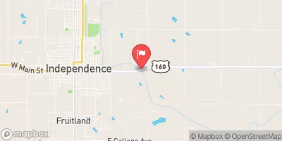 Verdigris R At Independence
|
1550cfs |
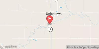 Marmaton R Nr Uniontown
|
0cfs |
Dam Data Reference
Condition Assessment
SatisfactoryNo existing or potential dam safety deficiencies are recognized. Acceptable performance is expected under all loading conditions (static, hydrologic, seismic) in accordance with the minimum applicable state or federal regulatory criteria or tolerable risk guidelines.
Fair
No existing dam safety deficiencies are recognized for normal operating conditions. Rare or extreme hydrologic and/or seismic events may result in a dam safety deficiency. Risk may be in the range to take further action. Note: Rare or extreme event is defined by the regulatory agency based on their minimum
Poor A dam safety deficiency is recognized for normal operating conditions which may realistically occur. Remedial action is necessary. POOR may also be used when uncertainties exist as to critical analysis parameters which identify a potential dam safety deficiency. Investigations and studies are necessary.
Unsatisfactory
A dam safety deficiency is recognized that requires immediate or emergency remedial action for problem resolution.
Not Rated
The dam has not been inspected, is not under state or federal jurisdiction, or has been inspected but, for whatever reason, has not been rated.
Not Available
Dams for which the condition assessment is restricted to approved government users.
Hazard Potential Classification
HighDams assigned the high hazard potential classification are those where failure or mis-operation will probably cause loss of human life.
Significant
Dams assigned the significant hazard potential classification are those dams where failure or mis-operation results in no probable loss of human life but can cause economic loss, environment damage, disruption of lifeline facilities, or impact other concerns. Significant hazard potential classification dams are often located in predominantly rural or agricultural areas but could be in areas with population and significant infrastructure.
Low
Dams assigned the low hazard potential classification are those where failure or mis-operation results in no probable loss of human life and low economic and/or environmental losses. Losses are principally limited to the owner's property.
Undetermined
Dams for which a downstream hazard potential has not been designated or is not provided.
Not Available
Dams for which the downstream hazard potential is restricted to approved government users.
Area Campgrounds
| Location | Reservations | Toilets |
|---|---|---|
 Lake Parsons
|
||
 Erie City Park
|
||
 Marvel Park
|

 Dd No B-9 (Labette-Hackberry)