Frd No 52 Reservoir Report
Nearby: Dd No 143 Dd No 5-15 (Goodman)
Last Updated: February 3, 2026
Frd No 52, located in Ness County, Kansas, is a local government-owned earth dam designed by USDA NRCS in 1984 for flood risk reduction along the South Fork Walnut Creek.
°F
°F
mph
Wind
%
Humidity
15-Day Weather Outlook
Summary
The dam stands at a height of 47.5 feet and has a storage capacity of 7,343 acre-feet, serving a drainage area of 35.9 square miles. Despite its low hazard potential, the dam is regulated by the Kansas Department of Agriculture and undergoes state inspections and enforcement to ensure its structural integrity and safety.
This structure plays a crucial role in mitigating flood risks in the region, with a moderate risk assessment rating of 3. With a spillway width of 100 feet and uncontrolled spillway type, Frd No 52 is equipped to handle maximum discharges of up to 6,262 cubic feet per second. While the dam has not been rated for its current condition, it remains operational and continues to provide flood protection to the surrounding area. As a significant asset in the area's water resource management, Frd No 52 exemplifies the collaboration between local government and federal agencies in safeguarding communities from potential flooding events.
Year Completed |
1984 |
Dam Length |
3835 |
Dam Height |
47.5 |
River Or Stream |
SOUTH FORK WALNUT CREEK-TR |
Primary Dam Type |
Earth |
Surface Area |
54 |
Drainage Area |
35.9 |
Nid Storage |
7343 |
Outlet Gates |
None |
Hazard Potential |
Low |
Foundations |
Unlisted/Unknown |
Nid Height |
48 |
Seasonal Comparison
Hourly Weather Forecast
Nearby Streamflow Levels
 Smoky Hill R Nr Arnold
|
1cfs |
 Pawnee R Nr Burdett
|
0cfs |
 Walnut C At Nekoma
|
3cfs |
 Smoky Hill R At Elkader
|
0cfs |
 Pawnee R At Rozel
|
4cfs |
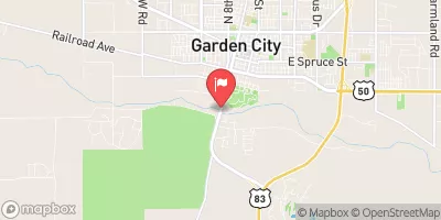 Arkansas R At Garden City
|
0cfs |
Dam Data Reference
Condition Assessment
SatisfactoryNo existing or potential dam safety deficiencies are recognized. Acceptable performance is expected under all loading conditions (static, hydrologic, seismic) in accordance with the minimum applicable state or federal regulatory criteria or tolerable risk guidelines.
Fair
No existing dam safety deficiencies are recognized for normal operating conditions. Rare or extreme hydrologic and/or seismic events may result in a dam safety deficiency. Risk may be in the range to take further action. Note: Rare or extreme event is defined by the regulatory agency based on their minimum
Poor A dam safety deficiency is recognized for normal operating conditions which may realistically occur. Remedial action is necessary. POOR may also be used when uncertainties exist as to critical analysis parameters which identify a potential dam safety deficiency. Investigations and studies are necessary.
Unsatisfactory
A dam safety deficiency is recognized that requires immediate or emergency remedial action for problem resolution.
Not Rated
The dam has not been inspected, is not under state or federal jurisdiction, or has been inspected but, for whatever reason, has not been rated.
Not Available
Dams for which the condition assessment is restricted to approved government users.
Hazard Potential Classification
HighDams assigned the high hazard potential classification are those where failure or mis-operation will probably cause loss of human life.
Significant
Dams assigned the significant hazard potential classification are those dams where failure or mis-operation results in no probable loss of human life but can cause economic loss, environment damage, disruption of lifeline facilities, or impact other concerns. Significant hazard potential classification dams are often located in predominantly rural or agricultural areas but could be in areas with population and significant infrastructure.
Low
Dams assigned the low hazard potential classification are those where failure or mis-operation results in no probable loss of human life and low economic and/or environmental losses. Losses are principally limited to the owner's property.
Undetermined
Dams for which a downstream hazard potential has not been designated or is not provided.
Not Available
Dams for which the downstream hazard potential is restricted to approved government users.

 Frd No 52