Summary
The primary purpose of the dam is flood risk reduction along the Wet Walnut Creek-TR river or stream. With a structural height of 29 feet and a length of 1900 feet, Frd No 18 has a storage capacity of 1630 acre-feet and a drainage area of 7.17 square miles.
Despite being classified as having a low hazard potential, Frd No 18 is considered to have a moderate risk level. The dam has a spillway width of 50 feet and no outlet gates. The condition assessment is currently listed as "Not Rated" with the last inspection date being in September 1991. The dam is regulated by the Kansas Department of Agriculture and has state permitting, inspection, and enforcement in place to ensure its safety and compliance with regulations.
Overall, Frd No 18 serves a vital role in mitigating flood risks in Rush County, Kansas. With its strategic location and design, this earth dam plays a significant part in protecting the surrounding area from potential flooding events. The collaboration between local government, USDA NRCS, and state regulatory agencies ensures that Frd No 18 is maintained and operated effectively for the benefit of the community and the environment.
Year Completed |
1992 |
Dam Length |
1900 |
Dam Height |
29 |
River Or Stream |
WET WALNUT CREEK-TR |
Primary Dam Type |
Earth |
Surface Area |
33 |
Drainage Area |
7.17 |
Nid Storage |
1630 |
Outlet Gates |
None |
Hazard Potential |
Low |
Foundations |
Unlisted/Unknown |
Nid Height |
29 |
Seasonal Comparison
Hourly Weather Forecast
Nearby Streamflow Levels
 Walnut C At Nekoma
|
3cfs |
 Pawnee R At Rozel
|
4cfs |
 Pawnee R Nr Burdett
|
0cfs |
 Smoky Hill R Nr Schoenchen
|
2cfs |
 Smoky Hill R Bl Schoenchen
|
2cfs |
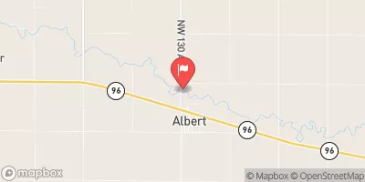 Walnut C At Albert
|
3cfs |
Dam Data Reference
Condition Assessment
SatisfactoryNo existing or potential dam safety deficiencies are recognized. Acceptable performance is expected under all loading conditions (static, hydrologic, seismic) in accordance with the minimum applicable state or federal regulatory criteria or tolerable risk guidelines.
Fair
No existing dam safety deficiencies are recognized for normal operating conditions. Rare or extreme hydrologic and/or seismic events may result in a dam safety deficiency. Risk may be in the range to take further action. Note: Rare or extreme event is defined by the regulatory agency based on their minimum
Poor A dam safety deficiency is recognized for normal operating conditions which may realistically occur. Remedial action is necessary. POOR may also be used when uncertainties exist as to critical analysis parameters which identify a potential dam safety deficiency. Investigations and studies are necessary.
Unsatisfactory
A dam safety deficiency is recognized that requires immediate or emergency remedial action for problem resolution.
Not Rated
The dam has not been inspected, is not under state or federal jurisdiction, or has been inspected but, for whatever reason, has not been rated.
Not Available
Dams for which the condition assessment is restricted to approved government users.
Hazard Potential Classification
HighDams assigned the high hazard potential classification are those where failure or mis-operation will probably cause loss of human life.
Significant
Dams assigned the significant hazard potential classification are those dams where failure or mis-operation results in no probable loss of human life but can cause economic loss, environment damage, disruption of lifeline facilities, or impact other concerns. Significant hazard potential classification dams are often located in predominantly rural or agricultural areas but could be in areas with population and significant infrastructure.
Low
Dams assigned the low hazard potential classification are those where failure or mis-operation results in no probable loss of human life and low economic and/or environmental losses. Losses are principally limited to the owner's property.
Undetermined
Dams for which a downstream hazard potential has not been designated or is not provided.
Not Available
Dams for which the downstream hazard potential is restricted to approved government users.

 Frd No 18