Dd No G-12 Reservoir Report
Nearby: Dd No G-6 (Benton) Welda Lake
Last Updated: February 23, 2026
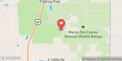
Dd No G-12, located in Anderson County, Kansas, is a flood risk reduction dam constructed in 1993 along the Pottawatomie Creek.
Summary
Designed by Dale Steward, P.E., this earth dam stands at a height of 24.5 feet and has a length of 750 feet, providing a storage capacity of 522.8 acre-feet. With a low hazard potential and a moderate risk assessment rating, this dam plays a crucial role in mitigating flood risks in the area.
Managed by the local government and regulated by the Kansas Department of Agriculture, Dd No G-12 serves as a vital infrastructure for water resource management in the region. Its primary purpose is flood risk reduction, and it has a spillway width of 40 feet with a maximum discharge capacity of 1000 cubic feet per second. Despite not being rated for its condition assessment, the dam is inspected regularly to ensure its structural integrity and safety.
Situated within the Tulsa District of the US Army Corps of Engineers, Dd No G-12 is a key component in the overall water management system of the area. With its strategic location and design characteristics, this dam contributes to the sustainable utilization of water resources and the protection of communities against flooding events. As a significant piece of infrastructure in the region, its importance for climate resilience and water security cannot be understated.
°F
°F
mph
Wind
%
Humidity
15-Day Weather Outlook
Year Completed |
1993 |
Dam Length |
750 |
Dam Height |
24.5 |
River Or Stream |
POTTAWATOMIE CREEK |
Primary Dam Type |
Earth |
Surface Area |
13.2 |
Drainage Area |
1.22 |
Nid Storage |
522.8 |
Outlet Gates |
None |
Hazard Potential |
Low |
Foundations |
Unlisted/Unknown |
Nid Height |
25 |
Seasonal Comparison
5-Day Hourly Forecast Detail
Nearby Streamflow Levels
 Pottawatomie C Nr Scipio
|
15cfs |
 Pottawatomie C At Lane
|
212cfs |
 Neosho R Nr Iola
|
5290cfs |
 Marais Des Cygnes R At La Cygne
|
2930cfs |
 Marmaton R Nr Uniontown
|
3cfs |
 Marais Des Cygnes R Nr Ks-Mo St Line
|
2820cfs |
Dam Data Reference
Condition Assessment
SatisfactoryNo existing or potential dam safety deficiencies are recognized. Acceptable performance is expected under all loading conditions (static, hydrologic, seismic) in accordance with the minimum applicable state or federal regulatory criteria or tolerable risk guidelines.
Fair
No existing dam safety deficiencies are recognized for normal operating conditions. Rare or extreme hydrologic and/or seismic events may result in a dam safety deficiency. Risk may be in the range to take further action. Note: Rare or extreme event is defined by the regulatory agency based on their minimum
Poor A dam safety deficiency is recognized for normal operating conditions which may realistically occur. Remedial action is necessary. POOR may also be used when uncertainties exist as to critical analysis parameters which identify a potential dam safety deficiency. Investigations and studies are necessary.
Unsatisfactory
A dam safety deficiency is recognized that requires immediate or emergency remedial action for problem resolution.
Not Rated
The dam has not been inspected, is not under state or federal jurisdiction, or has been inspected but, for whatever reason, has not been rated.
Not Available
Dams for which the condition assessment is restricted to approved government users.
Hazard Potential Classification
HighDams assigned the high hazard potential classification are those where failure or mis-operation will probably cause loss of human life.
Significant
Dams assigned the significant hazard potential classification are those dams where failure or mis-operation results in no probable loss of human life but can cause economic loss, environment damage, disruption of lifeline facilities, or impact other concerns. Significant hazard potential classification dams are often located in predominantly rural or agricultural areas but could be in areas with population and significant infrastructure.
Low
Dams assigned the low hazard potential classification are those where failure or mis-operation results in no probable loss of human life and low economic and/or environmental losses. Losses are principally limited to the owner's property.
Undetermined
Dams for which a downstream hazard potential has not been designated or is not provided.
Not Available
Dams for which the downstream hazard potential is restricted to approved government users.

 Dd No G-12