Summary
Built in 1993 by the USDA NRCS, this earth dam stands at a height of 30.9 feet and spans 2400 feet in length, with a storage capacity of 1948 acre-feet. The dam serves to protect the surrounding area from potential flooding events, with a moderate risk assessment rating of 3.
The dam is regulated by the Kansas Department of Agriculture and undergoes regular inspections, although its hazard potential is considered low. Despite its age, Frd No 14 remains in good condition and has not experienced any significant modifications since its completion. The structure has a spillway width of 120 feet and a maximum discharge capacity of 2746 cubic feet per second, ensuring efficient water flow management during high-risk periods. With its primary purpose being flood risk reduction, Frd No 14 plays a crucial role in safeguarding the Rush County community from potential water-related emergencies.
Overall, Frd No 14 stands as a reliable flood protection infrastructure in Rush County, Kansas, designed to mitigate the risk of inundation along Wet Walnut Creek. With its modest storage capacity, low hazard potential, and efficient water management features, the dam continues to uphold its primary function of flood risk reduction. The collaboration between local government agencies, the USDA NRCS, and the Kansas Department of Agriculture underscores the commitment to ensuring the safety and resilience of the surrounding community in the face of potential water resource challenges and climate fluctuations.
Year Completed |
1993 |
Dam Length |
2400 |
Dam Height |
30.9 |
River Or Stream |
WET WALNUT CREEK-TR |
Primary Dam Type |
Earth |
Surface Area |
35 |
Drainage Area |
7.85 |
Nid Storage |
1948 |
Outlet Gates |
None |
Hazard Potential |
Low |
Foundations |
Unlisted/Unknown |
Nid Height |
31 |
Seasonal Comparison
Hourly Weather Forecast
Nearby Streamflow Levels
 Walnut C At Nekoma
|
3cfs |
 Pawnee R At Rozel
|
4cfs |
 Walnut C At Albert
|
3cfs |
 Smoky Hill R Nr Schoenchen
|
2cfs |
 Smoky Hill R Bl Schoenchen
|
2cfs |
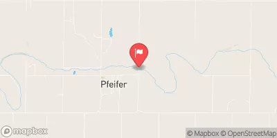 Smoky Hill R At Pfeifer
|
2cfs |
Dam Data Reference
Condition Assessment
SatisfactoryNo existing or potential dam safety deficiencies are recognized. Acceptable performance is expected under all loading conditions (static, hydrologic, seismic) in accordance with the minimum applicable state or federal regulatory criteria or tolerable risk guidelines.
Fair
No existing dam safety deficiencies are recognized for normal operating conditions. Rare or extreme hydrologic and/or seismic events may result in a dam safety deficiency. Risk may be in the range to take further action. Note: Rare or extreme event is defined by the regulatory agency based on their minimum
Poor A dam safety deficiency is recognized for normal operating conditions which may realistically occur. Remedial action is necessary. POOR may also be used when uncertainties exist as to critical analysis parameters which identify a potential dam safety deficiency. Investigations and studies are necessary.
Unsatisfactory
A dam safety deficiency is recognized that requires immediate or emergency remedial action for problem resolution.
Not Rated
The dam has not been inspected, is not under state or federal jurisdiction, or has been inspected but, for whatever reason, has not been rated.
Not Available
Dams for which the condition assessment is restricted to approved government users.
Hazard Potential Classification
HighDams assigned the high hazard potential classification are those where failure or mis-operation will probably cause loss of human life.
Significant
Dams assigned the significant hazard potential classification are those dams where failure or mis-operation results in no probable loss of human life but can cause economic loss, environment damage, disruption of lifeline facilities, or impact other concerns. Significant hazard potential classification dams are often located in predominantly rural or agricultural areas but could be in areas with population and significant infrastructure.
Low
Dams assigned the low hazard potential classification are those where failure or mis-operation results in no probable loss of human life and low economic and/or environmental losses. Losses are principally limited to the owner's property.
Undetermined
Dams for which a downstream hazard potential has not been designated or is not provided.
Not Available
Dams for which the downstream hazard potential is restricted to approved government users.

 Frd No 14