Dd No 11 Reservoir Report
Nearby: Dd No 55 Lake Wabaunsee Dam
Last Updated: February 22, 2026
Dd No 11, located in Lake Wabaunsee, Kansas, is a local government-owned earth dam designed by Dale Steward, P.E.
Summary
The dam was completed in 1997 with a primary purpose of flood risk reduction. It stands at a height of 44 feet and spans 800 feet in length, providing a storage capacity of 730.1 acre-feet. The dam is regulated by the Kansas Department of Agriculture and has been inspected for safety and enforcement measures.
With a low hazard potential and fair condition assessment, Dd No 11 poses a moderate risk of flooding, as indicated by its moderate risk assessment rating. The dam has a controlled spillway width of 80 feet and a maximum discharge capacity of 5,860 cubic feet per second. Despite its low hazard potential, the dam plays a crucial role in debris control and flood risk reduction efforts in the area, protecting the surrounding community from potential water-related disasters.
Overall, Dd No 11 serves as a vital infrastructure for managing water resources in Wabaunsee County, Kansas. Its strategic location on the East Branch Mill Creek-TR contributes to the overall flood risk reduction strategy in the region. With its sturdy construction and regulatory oversight, the dam continues to play a significant role in safeguarding the local community from the impacts of extreme weather events and ensuring the sustainable management of water resources in the area.
°F
°F
mph
Wind
%
Humidity
15-Day Weather Outlook
Year Completed |
1997 |
Dam Length |
800 |
Dam Height |
44 |
River Or Stream |
EAST BRANCH MILL CREEK-TR |
Primary Dam Type |
Earth |
Surface Area |
9.9 |
Drainage Area |
2.01 |
Nid Storage |
730.1 |
Outlet Gates |
None |
Hazard Potential |
Low |
Foundations |
Unlisted/Unknown |
Nid Height |
44 |
Seasonal Comparison
5-Day Hourly Forecast Detail
Nearby Streamflow Levels
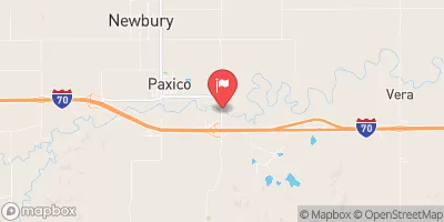
 Mill C Nr Paxico
|
54cfs |
 Neosho R At Council Grove
|
0cfs |
 Dragoon C Nr Burlingame
|
24cfs |
 Marais Des Cygnes R Nr Reading
|
43cfs |
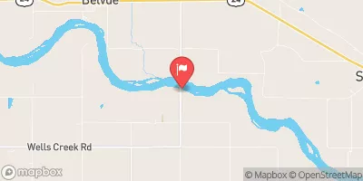
 Kansas R Nr Belvue
|
1190cfs |
 Kansas R At Wamego
|
1170cfs |
Dam Data Reference
Condition Assessment
SatisfactoryNo existing or potential dam safety deficiencies are recognized. Acceptable performance is expected under all loading conditions (static, hydrologic, seismic) in accordance with the minimum applicable state or federal regulatory criteria or tolerable risk guidelines.
Fair
No existing dam safety deficiencies are recognized for normal operating conditions. Rare or extreme hydrologic and/or seismic events may result in a dam safety deficiency. Risk may be in the range to take further action. Note: Rare or extreme event is defined by the regulatory agency based on their minimum
Poor A dam safety deficiency is recognized for normal operating conditions which may realistically occur. Remedial action is necessary. POOR may also be used when uncertainties exist as to critical analysis parameters which identify a potential dam safety deficiency. Investigations and studies are necessary.
Unsatisfactory
A dam safety deficiency is recognized that requires immediate or emergency remedial action for problem resolution.
Not Rated
The dam has not been inspected, is not under state or federal jurisdiction, or has been inspected but, for whatever reason, has not been rated.
Not Available
Dams for which the condition assessment is restricted to approved government users.
Hazard Potential Classification
HighDams assigned the high hazard potential classification are those where failure or mis-operation will probably cause loss of human life.
Significant
Dams assigned the significant hazard potential classification are those dams where failure or mis-operation results in no probable loss of human life but can cause economic loss, environment damage, disruption of lifeline facilities, or impact other concerns. Significant hazard potential classification dams are often located in predominantly rural or agricultural areas but could be in areas with population and significant infrastructure.
Low
Dams assigned the low hazard potential classification are those where failure or mis-operation results in no probable loss of human life and low economic and/or environmental losses. Losses are principally limited to the owner's property.
Undetermined
Dams for which a downstream hazard potential has not been designated or is not provided.
Not Available
Dams for which the downstream hazard potential is restricted to approved government users.

 Dd No 11