Summary
Completed in 2001, this earth dam stands at a height of 16.4 feet and has a length of 790 feet, providing flood risk reduction and debris control for the surrounding area. With a normal storage capacity of 25 acre-feet and a maximum discharge of 350 cubic feet per second, this dam plays a crucial role in managing water resources in the region.
Despite being classified as having a low hazard potential, Dd No 212 is considered to have a moderate risk level, indicating a need for ongoing monitoring and management. The dam does not have a state regulatory agency overseeing its operations, inspections, or enforcement, but it is included in the emergency action plan. The dam's condition is currently not rated, highlighting the importance of regular assessments to ensure its effectiveness in mitigating flood risks and protecting the local community.
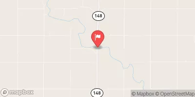
With its strategic location along the North Fork Black Vermillion River, Dd No 212 serves as a key infrastructure for flood risk reduction in Nemaha, Kansas. As climate change continues to impact water resources and weather patterns, the maintenance and management of dams like Dd No 212 are essential for ensuring the safety and resilience of communities in the face of unpredictable environmental conditions.
Year Completed |
2001 |
Dam Length |
790 |
Dam Height |
16.4 |
River Or Stream |
N FK BLACK VERMILLION RIVER-TR |
Primary Dam Type |
Earth |
Surface Area |
5 |
Drainage Area |
0.36 |
Nid Storage |
140 |
Outlet Gates |
None |
Hazard Potential |
Low |
Foundations |
Unlisted/Unknown |
Nid Height |
16 |
Seasonal Comparison
Hourly Weather Forecast
Nearby Streamflow Levels
 Turkey C Nr Seneca
|
21cfs |
 Black Vermillion R Nr Frankfort
|
35cfs |
 Big Blue R At Barneston Nebr
|
167cfs |
 Big Blue R At Marysville
|
200cfs |
 North Fork Big Nemaha River At Humboldt
|
54cfs |
 L Blue R Nr Barnes
|
171cfs |
Dam Data Reference
Condition Assessment
SatisfactoryNo existing or potential dam safety deficiencies are recognized. Acceptable performance is expected under all loading conditions (static, hydrologic, seismic) in accordance with the minimum applicable state or federal regulatory criteria or tolerable risk guidelines.
Fair
No existing dam safety deficiencies are recognized for normal operating conditions. Rare or extreme hydrologic and/or seismic events may result in a dam safety deficiency. Risk may be in the range to take further action. Note: Rare or extreme event is defined by the regulatory agency based on their minimum
Poor A dam safety deficiency is recognized for normal operating conditions which may realistically occur. Remedial action is necessary. POOR may also be used when uncertainties exist as to critical analysis parameters which identify a potential dam safety deficiency. Investigations and studies are necessary.
Unsatisfactory
A dam safety deficiency is recognized that requires immediate or emergency remedial action for problem resolution.
Not Rated
The dam has not been inspected, is not under state or federal jurisdiction, or has been inspected but, for whatever reason, has not been rated.
Not Available
Dams for which the condition assessment is restricted to approved government users.
Hazard Potential Classification
HighDams assigned the high hazard potential classification are those where failure or mis-operation will probably cause loss of human life.
Significant
Dams assigned the significant hazard potential classification are those dams where failure or mis-operation results in no probable loss of human life but can cause economic loss, environment damage, disruption of lifeline facilities, or impact other concerns. Significant hazard potential classification dams are often located in predominantly rural or agricultural areas but could be in areas with population and significant infrastructure.
Low
Dams assigned the low hazard potential classification are those where failure or mis-operation results in no probable loss of human life and low economic and/or environmental losses. Losses are principally limited to the owner's property.
Undetermined
Dams for which a downstream hazard potential has not been designated or is not provided.
Not Available
Dams for which the downstream hazard potential is restricted to approved government users.

 Dd No 212