Dd No 7-34 Reservoir Report
Nearby: Dd No 7-27 (Gray) Dd No 7-11
Last Updated: January 11, 2026
Dd No 7-34, located in Coffey County, Kansas, is a crucial structure designed for flood risk reduction along the Long Creek-TR river.
°F
°F
mph
Wind
%
Humidity
Summary
Constructed in 2003 by King Engineering, this earth dam stands at a height of 23.8 feet and spans 1300 feet in length, with a storage capacity of 1063 acre-feet. The primary purpose of Dd No 7-34 is to control debris and reduce flooding in the surrounding area, serving as a vital infrastructure for water resource management in the region.
Managed by the Kansas Department of Agriculture, Dd No 7-34 is regulated, inspected, and enforced by state authorities to ensure its structural integrity and functionality. Despite being classified as having low hazard potential, the dam carries a moderate risk assessment rating of 3, highlighting the importance of ongoing monitoring and risk management measures. With a surface area of 30.7 acres and a drainage area of 2.05 square miles, Dd No 7-34 plays a significant role in safeguarding communities and properties from potential flood events.
While the dam has not been assessed for its current condition, the last inspection conducted in September 2009 reflects the commitment to ensure the safety and reliability of Dd No 7-34. With no outlet gates and an uncontrolled spillway, this infrastructure is designed to efficiently manage water flow during periods of high discharge. As water resource and climate enthusiasts, understanding the significance of structures like Dd No 7-34 is essential for promoting sustainable water management practices and mitigating the impact of extreme weather events on local communities.
Year Completed |
2003 |
Dam Length |
1300 |
Dam Height |
23.8 |
River Or Stream |
LONG CREEK-TR |
Primary Dam Type |
Earth |
Surface Area |
30.7 |
Drainage Area |
2.05 |
Nid Storage |
1063 |
Outlet Gates |
None |
Hazard Potential |
Low |
Foundations |
Unlisted/Unknown |
Nid Height |
24 |
Seasonal Comparison
Weather Forecast
Nearby Streamflow Levels
 Marais Des Cygnes R At Melvern
|
59cfs |
 Neosho R At Burlington
|
825cfs |
 Salt C At Lyndon
|
24cfs |
 Marais Des Cygnes R Nr Pomona
|
206cfs |
 Hundred And Ten Mile C Nr Quenemo
|
19cfs |
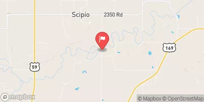 Pottawatomie C Nr Scipio
|
15cfs |
Dam Data Reference
Condition Assessment
SatisfactoryNo existing or potential dam safety deficiencies are recognized. Acceptable performance is expected under all loading conditions (static, hydrologic, seismic) in accordance with the minimum applicable state or federal regulatory criteria or tolerable risk guidelines.
Fair
No existing dam safety deficiencies are recognized for normal operating conditions. Rare or extreme hydrologic and/or seismic events may result in a dam safety deficiency. Risk may be in the range to take further action. Note: Rare or extreme event is defined by the regulatory agency based on their minimum
Poor A dam safety deficiency is recognized for normal operating conditions which may realistically occur. Remedial action is necessary. POOR may also be used when uncertainties exist as to critical analysis parameters which identify a potential dam safety deficiency. Investigations and studies are necessary.
Unsatisfactory
A dam safety deficiency is recognized that requires immediate or emergency remedial action for problem resolution.
Not Rated
The dam has not been inspected, is not under state or federal jurisdiction, or has been inspected but, for whatever reason, has not been rated.
Not Available
Dams for which the condition assessment is restricted to approved government users.
Hazard Potential Classification
HighDams assigned the high hazard potential classification are those where failure or mis-operation will probably cause loss of human life.
Significant
Dams assigned the significant hazard potential classification are those dams where failure or mis-operation results in no probable loss of human life but can cause economic loss, environment damage, disruption of lifeline facilities, or impact other concerns. Significant hazard potential classification dams are often located in predominantly rural or agricultural areas but could be in areas with population and significant infrastructure.
Low
Dams assigned the low hazard potential classification are those where failure or mis-operation results in no probable loss of human life and low economic and/or environmental losses. Losses are principally limited to the owner's property.
Undetermined
Dams for which a downstream hazard potential has not been designated or is not provided.
Not Available
Dams for which the downstream hazard potential is restricted to approved government users.

 Redmond Cove South - John Redmond Reservoir
 Riverside East - John Redmond Reservoir
 Redmond Cove North - John Redmond Reservoir
 Dam Site Area - John Redmond Reservoir
 Hickory Creek East - John Redmond Reservoir
 Riverside West - John Redmond Reservoir
 Dd No 7-34
 Melvern Lk Nr Melvern