Summary
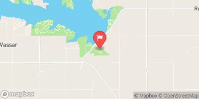
With a height of 24.8 feet and a storage capacity of 418 acre-feet, this dam plays a significant role in managing water resources in the area. The dam covers a surface area of 9.43 acres and has a drainage area of 0.71 square miles, making it a vital structure for water management in the region.
Managed by the local government and regulated by the Kansas Department of Agriculture, Frd 115 has a fair condition assessment and a significant hazard potential. The dam has a spillway width of 50 feet and is designated as uncontrolled. In case of emergencies, the dam has an inspection frequency of 5 years to ensure its safety and functionality. With a moderate risk assessment rating, Frd 115 serves as a crucial infrastructure for flood risk reduction and water resource management in Lyon County, Kansas.
Overall, Frd 115 is a key element in the water resource infrastructure of Lyon County, Kansas. With its completion in 2002, the dam provides essential flood risk reduction services and storage capacity to the region. Managed and regulated by local authorities, the dam plays a crucial role in managing water resources and ensuring the safety of the surrounding areas. With its fair condition assessment and significant hazard potential, Frd 115 is an important structure for water resource and climate enthusiasts to monitor and support for the sustainable management of water in Lyon County.
°F
°F
mph
Wind
%
Humidity
15-Day Weather Outlook
Year Completed |
2002 |
Dam Length |
1170 |
Dam Height |
24.8 |
Primary Dam Type |
Earth |
Surface Area |
9.43 |
Drainage Area |
0.71 |
Nid Storage |
418 |
Outlet Gates |
None |
Hazard Potential |
Significant |
Foundations |
Unlisted/Unknown |
Nid Height |
25 |
Seasonal Comparison
5-Day Hourly Forecast Detail
Nearby Streamflow Levels
 Marais Des Cygnes R Nr Reading
|
43cfs |
 Dragoon C Nr Burlingame
|
24cfs |
 Salt C At Lyndon
|
24cfs |
 Marais Des Cygnes R At Melvern
|
1400cfs |
 Neosho R Nr Americus
|
109cfs |
 Hundred And Ten Mile C Nr Quenemo
|
485cfs |
Dam Data Reference
Condition Assessment
SatisfactoryNo existing or potential dam safety deficiencies are recognized. Acceptable performance is expected under all loading conditions (static, hydrologic, seismic) in accordance with the minimum applicable state or federal regulatory criteria or tolerable risk guidelines.
Fair
No existing dam safety deficiencies are recognized for normal operating conditions. Rare or extreme hydrologic and/or seismic events may result in a dam safety deficiency. Risk may be in the range to take further action. Note: Rare or extreme event is defined by the regulatory agency based on their minimum
Poor A dam safety deficiency is recognized for normal operating conditions which may realistically occur. Remedial action is necessary. POOR may also be used when uncertainties exist as to critical analysis parameters which identify a potential dam safety deficiency. Investigations and studies are necessary.
Unsatisfactory
A dam safety deficiency is recognized that requires immediate or emergency remedial action for problem resolution.
Not Rated
The dam has not been inspected, is not under state or federal jurisdiction, or has been inspected but, for whatever reason, has not been rated.
Not Available
Dams for which the condition assessment is restricted to approved government users.
Hazard Potential Classification
HighDams assigned the high hazard potential classification are those where failure or mis-operation will probably cause loss of human life.
Significant
Dams assigned the significant hazard potential classification are those dams where failure or mis-operation results in no probable loss of human life but can cause economic loss, environment damage, disruption of lifeline facilities, or impact other concerns. Significant hazard potential classification dams are often located in predominantly rural or agricultural areas but could be in areas with population and significant infrastructure.
Low
Dams assigned the low hazard potential classification are those where failure or mis-operation results in no probable loss of human life and low economic and/or environmental losses. Losses are principally limited to the owner's property.
Undetermined
Dams for which a downstream hazard potential has not been designated or is not provided.
Not Available
Dams for which the downstream hazard potential is restricted to approved government users.

 Frd 115