Dd No 3-11 Reservoir Report
Nearby: Dd No 3-35 Site 3-16
Last Updated: February 3, 2026
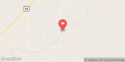
Dd No 3-11, located in Ford County, Kansas, is a local government-owned dam designed by Agriculture Eng.
°F
°F
mph
Wind
%
Humidity
15-Day Weather Outlook
Summary
Assoc. It was completed in 1994 and serves the primary purpose of flood risk reduction along the Saw Log Creek-TR. This earth dam is 29.5 feet high and 1300 feet long, with a storage capacity of 1108.11 acre-feet and a drainage area of 5.81 square miles. The dam has a low hazard potential and is currently in a not rated condition.
Despite being regulated by the Kansas Department of Agriculture and meeting state permitting, inspection, and enforcement requirements, Dd No 3-11 has not been assessed for its condition in recent years. The dam has a moderate risk level of 3, indicating the need for ongoing monitoring and risk management measures. With a maximum discharge capacity of 2020 cubic feet per second and an uncontrolled spillway, the dam plays a vital role in controlling debris and reducing flood risks in the area.
Overall, Dd No 3-11 is an essential infrastructure for flood risk reduction in Ford County, Kansas. Its strategic location, design, and capacity contribute to the overall water resource management efforts in the region. As climate change continues to pose challenges to water resources, it is crucial to ensure the proper maintenance and monitoring of dams like Dd No 3-11 to protect communities from potential flood hazards.
Year Completed |
1994 |
Dam Length |
1300 |
Dam Height |
29.5 |
River Or Stream |
SAW LOG CREEK-TR |
Primary Dam Type |
Earth |
Surface Area |
16.35 |
Drainage Area |
5.81 |
Nid Storage |
1108.11 |
Outlet Gates |
None |
Hazard Potential |
Low |
Foundations |
Unlisted/Unknown |
Nid Height |
30 |
Seasonal Comparison
Hourly Weather Forecast
Nearby Streamflow Levels
 Pawnee R Nr Burdett
|
0cfs |
 Pawnee R At Rozel
|
4cfs |
 Arkansas R At Garden City
|
0cfs |
 Walnut C At Nekoma
|
3cfs |
 Farmers Ditch Nr Deerfield
|
0cfs |
 Arkansas R Nr Larned
|
10cfs |
Dam Data Reference
Condition Assessment
SatisfactoryNo existing or potential dam safety deficiencies are recognized. Acceptable performance is expected under all loading conditions (static, hydrologic, seismic) in accordance with the minimum applicable state or federal regulatory criteria or tolerable risk guidelines.
Fair
No existing dam safety deficiencies are recognized for normal operating conditions. Rare or extreme hydrologic and/or seismic events may result in a dam safety deficiency. Risk may be in the range to take further action. Note: Rare or extreme event is defined by the regulatory agency based on their minimum
Poor A dam safety deficiency is recognized for normal operating conditions which may realistically occur. Remedial action is necessary. POOR may also be used when uncertainties exist as to critical analysis parameters which identify a potential dam safety deficiency. Investigations and studies are necessary.
Unsatisfactory
A dam safety deficiency is recognized that requires immediate or emergency remedial action for problem resolution.
Not Rated
The dam has not been inspected, is not under state or federal jurisdiction, or has been inspected but, for whatever reason, has not been rated.
Not Available
Dams for which the condition assessment is restricted to approved government users.
Hazard Potential Classification
HighDams assigned the high hazard potential classification are those where failure or mis-operation will probably cause loss of human life.
Significant
Dams assigned the significant hazard potential classification are those dams where failure or mis-operation results in no probable loss of human life but can cause economic loss, environment damage, disruption of lifeline facilities, or impact other concerns. Significant hazard potential classification dams are often located in predominantly rural or agricultural areas but could be in areas with population and significant infrastructure.
Low
Dams assigned the low hazard potential classification are those where failure or mis-operation results in no probable loss of human life and low economic and/or environmental losses. Losses are principally limited to the owner's property.
Undetermined
Dams for which a downstream hazard potential has not been designated or is not provided.
Not Available
Dams for which the downstream hazard potential is restricted to approved government users.
Area Campgrounds
| Location | Reservations | Toilets |
|---|---|---|
 Dodge City Roadside Park
|
||
 Jetmore City Lake
|
||
 Buckner Valley Park
|

 Dd No 3-11