Dd No 2-30c Reservoir Report
Nearby: Dd No 3-29 Gs Dd No 3-31
Last Updated: February 24, 2026
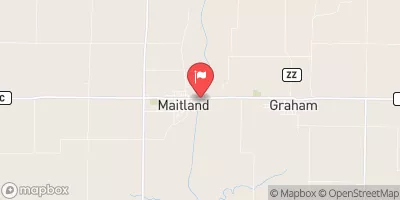
Dd No 2-30c, located in Brown County, Kansas, is a critical local government-owned earth dam constructed in 1980 for flood risk reduction along Roy's Creek-TR.
Summary
With a height of 35 feet and a length of 725 feet, this dam provides a storage capacity of 99.5 acre-feet and a surface area of 4.8 acres. Despite its low hazard potential and moderate risk assessment, the dam has not been rated for its condition, with the last inspection conducted in August 2005.
Managed by the Kansas Department of Agriculture, Dd No 2-30c is state-regulated and permitted, inspected, and enforced for compliance with safety standards. The dam features an uncontrolled spillway with a width of 60 feet, providing an essential outlet for excess water during flood events. Although no emergency action plan (EAP) or inundation maps have been prepared, the dam is maintained at a low hazard potential level, ensuring the safety of surrounding communities in case of any unforeseen emergencies.
Overall, Dd No 2-30c serves as a vital infrastructure for flood risk reduction in the region, showcasing the importance of proper dam maintenance and monitoring to mitigate potential risks associated with extreme weather events. As climate change continues to impact water resources, the resilience of structures like Dd No 2-30c becomes increasingly crucial in safeguarding communities and ecosystems from the threats of flooding and water scarcity.
°F
°F
mph
Wind
%
Humidity
15-Day Weather Outlook
Year Completed |
1980 |
Dam Length |
725 |
Dam Height |
35 |
River Or Stream |
ROY'S CREEK-TR |
Primary Dam Type |
Earth |
Surface Area |
4.8 |
Nid Storage |
99.5 |
Outlet Gates |
None |
Hazard Potential |
Low |
Foundations |
Unlisted/Unknown |
Nid Height |
35 |
Seasonal Comparison
5-Day Hourly Forecast Detail
Nearby Streamflow Levels
 Missouri River At Rulo
|
22600cfs |
 Big Nemaha River At Falls City
|
99cfs |
 Nodaway River Near Graham
|
92cfs |
 Tarkio River At Fairfax Mo
|
62cfs |
 Delaware R Nr Muscotah
|
30cfs |
 North Fork Big Nemaha River At Humboldt
|
28cfs |
Dam Data Reference
Condition Assessment
SatisfactoryNo existing or potential dam safety deficiencies are recognized. Acceptable performance is expected under all loading conditions (static, hydrologic, seismic) in accordance with the minimum applicable state or federal regulatory criteria or tolerable risk guidelines.
Fair
No existing dam safety deficiencies are recognized for normal operating conditions. Rare or extreme hydrologic and/or seismic events may result in a dam safety deficiency. Risk may be in the range to take further action. Note: Rare or extreme event is defined by the regulatory agency based on their minimum
Poor A dam safety deficiency is recognized for normal operating conditions which may realistically occur. Remedial action is necessary. POOR may also be used when uncertainties exist as to critical analysis parameters which identify a potential dam safety deficiency. Investigations and studies are necessary.
Unsatisfactory
A dam safety deficiency is recognized that requires immediate or emergency remedial action for problem resolution.
Not Rated
The dam has not been inspected, is not under state or federal jurisdiction, or has been inspected but, for whatever reason, has not been rated.
Not Available
Dams for which the condition assessment is restricted to approved government users.
Hazard Potential Classification
HighDams assigned the high hazard potential classification are those where failure or mis-operation will probably cause loss of human life.
Significant
Dams assigned the significant hazard potential classification are those dams where failure or mis-operation results in no probable loss of human life but can cause economic loss, environment damage, disruption of lifeline facilities, or impact other concerns. Significant hazard potential classification dams are often located in predominantly rural or agricultural areas but could be in areas with population and significant infrastructure.
Low
Dams assigned the low hazard potential classification are those where failure or mis-operation results in no probable loss of human life and low economic and/or environmental losses. Losses are principally limited to the owner's property.
Undetermined
Dams for which a downstream hazard potential has not been designated or is not provided.
Not Available
Dams for which the downstream hazard potential is restricted to approved government users.

 Dd No 2-30c