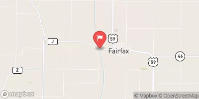
Summary
Completed in 2006, this earth dam stands at a height of 38.2 feet and has a storage capacity of 386 acre-feet. The primary purpose of Dd No 19 is flood risk reduction, with secondary purposes including debris control.
Situated on Pony Creek, Dd No 19 is regulated by the Kansas Department of Agriculture and undergoes regular inspections to ensure its structural integrity. Despite being classified as having a low hazard potential, the risk assessment for this dam indicates a very high risk level. However, the dam's condition is currently not rated, and emergency action plans are not documented.
Enthusiasts of water resources and climate change will find Dd No 19 to be an intriguing case study, as it highlights the importance of maintaining aging infrastructure for flood control purposes. With its location in a high-risk area and the potential for significant impact in the event of failure, the management and maintenance of Dd No 19 serve as crucial components in ensuring the safety and protection of surrounding communities.
°F
°F
mph
Wind
%
Humidity
15-Day Weather Outlook
Year Completed |
2006 |
Dam Length |
1050 |
Dam Height |
38.2 |
River Or Stream |
PONY CREEK |
Primary Dam Type |
Earth |
Surface Area |
11.2 |
Nid Storage |
386 |
Outlet Gates |
None |
Hazard Potential |
Low |
Foundations |
Unlisted/Unknown |
Nid Height |
38 |
Seasonal Comparison
5-Day Hourly Forecast Detail
Nearby Streamflow Levels
 Big Nemaha River At Falls City
|
99cfs |
 Missouri River At Rulo
|
22600cfs |
 North Fork Big Nemaha River At Humboldt
|
28cfs |
 Turkey C Nr Seneca
|
8cfs |
 Little Nemaha River At Auburn
|
70cfs |
 Tarkio River At Fairfax Mo
|
62cfs |
Dam Data Reference
Condition Assessment
SatisfactoryNo existing or potential dam safety deficiencies are recognized. Acceptable performance is expected under all loading conditions (static, hydrologic, seismic) in accordance with the minimum applicable state or federal regulatory criteria or tolerable risk guidelines.
Fair
No existing dam safety deficiencies are recognized for normal operating conditions. Rare or extreme hydrologic and/or seismic events may result in a dam safety deficiency. Risk may be in the range to take further action. Note: Rare or extreme event is defined by the regulatory agency based on their minimum
Poor A dam safety deficiency is recognized for normal operating conditions which may realistically occur. Remedial action is necessary. POOR may also be used when uncertainties exist as to critical analysis parameters which identify a potential dam safety deficiency. Investigations and studies are necessary.
Unsatisfactory
A dam safety deficiency is recognized that requires immediate or emergency remedial action for problem resolution.
Not Rated
The dam has not been inspected, is not under state or federal jurisdiction, or has been inspected but, for whatever reason, has not been rated.
Not Available
Dams for which the condition assessment is restricted to approved government users.
Hazard Potential Classification
HighDams assigned the high hazard potential classification are those where failure or mis-operation will probably cause loss of human life.
Significant
Dams assigned the significant hazard potential classification are those dams where failure or mis-operation results in no probable loss of human life but can cause economic loss, environment damage, disruption of lifeline facilities, or impact other concerns. Significant hazard potential classification dams are often located in predominantly rural or agricultural areas but could be in areas with population and significant infrastructure.
Low
Dams assigned the low hazard potential classification are those where failure or mis-operation results in no probable loss of human life and low economic and/or environmental losses. Losses are principally limited to the owner's property.
Undetermined
Dams for which a downstream hazard potential has not been designated or is not provided.
Not Available
Dams for which the downstream hazard potential is restricted to approved government users.

 Dd No 19