Dd No 222 Reservoir Report
Nearby: Dd No 219 (King) Dd No 106
Last Updated: February 23, 2026
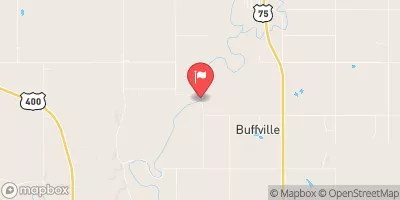
Dd No 222, located in Woodson County, Kansas, is a local government-owned dam that serves the primary purpose of flood risk reduction along the Cherry Creek-TR.
Summary
Completed in 2007, this earth dam stands at a height of 20 feet with a length of 811 feet, providing a storage capacity of 234.54 acre-feet. Despite its low hazard potential and moderate risk assessment, the dam is not currently rated for its condition and has not been inspected since 2008.
With a spillway width of 100 feet and a maximum discharge capacity of 1700 cubic feet per second, Dd No 222 plays a crucial role in managing floodwaters and protecting the surrounding area from potential inundation. While the dam's emergency action plan status and risk management measures remain unclear, its presence underscores the importance of infrastructure in mitigating the impacts of extreme weather events in the region.
As water resource and climate enthusiasts, the data on Dd No 222 highlights the intersection of infrastructure, environmental protection, and community safety. By understanding the technical specifications and operational status of dams like this, stakeholders can work towards enhancing resilience to climate change impacts and ensuring the long-term sustainability of water resources in Kansas and beyond.
°F
°F
mph
Wind
%
Humidity
15-Day Weather Outlook
Year Completed |
2007 |
Dam Length |
811 |
Dam Height |
20 |
River Or Stream |
CHERRY CREEK-TR |
Primary Dam Type |
Earth |
Surface Area |
1.43 |
Nid Storage |
234.54 |
Outlet Gates |
None |
Hazard Potential |
Low |
Foundations |
Unlisted/Unknown |
Nid Height |
20 |
Seasonal Comparison
5-Day Hourly Forecast Detail
Nearby Streamflow Levels
 Neosho R Nr Iola
|
5140cfs |
 Verdigris R Nr Virgil
|
199cfs |
 Neosho R At Burlington
|
4550cfs |
 Verdigris R Nr Altoona
|
1810cfs |
 Fall R At Fredonia
|
858cfs |
 Marmaton R Nr Uniontown
|
3cfs |
Dam Data Reference
Condition Assessment
SatisfactoryNo existing or potential dam safety deficiencies are recognized. Acceptable performance is expected under all loading conditions (static, hydrologic, seismic) in accordance with the minimum applicable state or federal regulatory criteria or tolerable risk guidelines.
Fair
No existing dam safety deficiencies are recognized for normal operating conditions. Rare or extreme hydrologic and/or seismic events may result in a dam safety deficiency. Risk may be in the range to take further action. Note: Rare or extreme event is defined by the regulatory agency based on their minimum
Poor A dam safety deficiency is recognized for normal operating conditions which may realistically occur. Remedial action is necessary. POOR may also be used when uncertainties exist as to critical analysis parameters which identify a potential dam safety deficiency. Investigations and studies are necessary.
Unsatisfactory
A dam safety deficiency is recognized that requires immediate or emergency remedial action for problem resolution.
Not Rated
The dam has not been inspected, is not under state or federal jurisdiction, or has been inspected but, for whatever reason, has not been rated.
Not Available
Dams for which the condition assessment is restricted to approved government users.
Hazard Potential Classification
HighDams assigned the high hazard potential classification are those where failure or mis-operation will probably cause loss of human life.
Significant
Dams assigned the significant hazard potential classification are those dams where failure or mis-operation results in no probable loss of human life but can cause economic loss, environment damage, disruption of lifeline facilities, or impact other concerns. Significant hazard potential classification dams are often located in predominantly rural or agricultural areas but could be in areas with population and significant infrastructure.
Low
Dams assigned the low hazard potential classification are those where failure or mis-operation results in no probable loss of human life and low economic and/or environmental losses. Losses are principally limited to the owner's property.
Undetermined
Dams for which a downstream hazard potential has not been designated or is not provided.
Not Available
Dams for which the downstream hazard potential is restricted to approved government users.
Area Campgrounds
| Location | Reservations | Toilets |
|---|---|---|
 South Owl Lake
|
||
 Camp Hunter Park
|
||
 Iola RV Park & Storage
|
||
 Yates Center Reservoir
|

 Dd No 222