Dd No 115 Reservoir Report
Last Updated: February 21, 2026
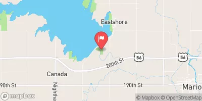
Dd No 115 is a local government-owned dam in Chase, Kansas, completed in 1980 for the primary purpose of flood risk reduction.
Summary
This earth-type dam stands at a height of 31.5 feet and spans 410 feet in length, with a storage capacity of 156 acre-feet and a surface area of 5.1 acres. Located in a low hazard area, Dd No 115 is regulated and inspected by the Kansas Department of Agriculture, with state jurisdiction and permitting in place for enforcement and inspection.
Despite its low hazard potential, Dd No 115 is classified as having a moderate risk level and has not been rated for its current condition. The dam features an uncontrolled spillway with a width of 40 feet, and lacks outlet gates. The structure has not undergone any modifications in recent years, and no emergency action plan (EAP) has been prepared or updated for the site. The dam is not owned or funded by any federal agencies, and is not under the purview of the U.S. Army Corps of Engineers.
For water resource and climate enthusiasts, Dd No 115 presents an interesting case study in local dam management and flood risk reduction efforts. With its unique design and purpose, this dam serves as a vital infrastructure asset in the region, highlighting the importance of state-regulated dam safety programs and the need for regular inspections and maintenance to ensure public safety and environmental protection.
°F
°F
mph
Wind
%
Humidity
15-Day Weather Outlook
Year Completed |
1980 |
Dam Length |
410 |
Dam Height |
31.5 |
Primary Dam Type |
Earth |
Surface Area |
5.1 |
Drainage Area |
0.64 |
Nid Storage |
156 |
Outlet Gates |
None |
Hazard Potential |
Low |
Foundations |
Unlisted/Unknown |
Nid Height |
32 |
Seasonal Comparison
5-Day Hourly Forecast Detail
Nearby Streamflow Levels
 Neosho R At Council Grove
|
1cfs |
 Cottonwood R Nr Florence
|
251cfs |
 Cottonwood R Nr Plymouth
|
934cfs |
 N Cottonwood R Bl Marion Lk
|
409cfs |
 Cedar C Nr Cedar Point
|
64cfs |
 Neosho R Nr Americus
|
216cfs |
Dam Data Reference
Condition Assessment
SatisfactoryNo existing or potential dam safety deficiencies are recognized. Acceptable performance is expected under all loading conditions (static, hydrologic, seismic) in accordance with the minimum applicable state or federal regulatory criteria or tolerable risk guidelines.
Fair
No existing dam safety deficiencies are recognized for normal operating conditions. Rare or extreme hydrologic and/or seismic events may result in a dam safety deficiency. Risk may be in the range to take further action. Note: Rare or extreme event is defined by the regulatory agency based on their minimum
Poor A dam safety deficiency is recognized for normal operating conditions which may realistically occur. Remedial action is necessary. POOR may also be used when uncertainties exist as to critical analysis parameters which identify a potential dam safety deficiency. Investigations and studies are necessary.
Unsatisfactory
A dam safety deficiency is recognized that requires immediate or emergency remedial action for problem resolution.
Not Rated
The dam has not been inspected, is not under state or federal jurisdiction, or has been inspected but, for whatever reason, has not been rated.
Not Available
Dams for which the condition assessment is restricted to approved government users.
Hazard Potential Classification
HighDams assigned the high hazard potential classification are those where failure or mis-operation will probably cause loss of human life.
Significant
Dams assigned the significant hazard potential classification are those dams where failure or mis-operation results in no probable loss of human life but can cause economic loss, environment damage, disruption of lifeline facilities, or impact other concerns. Significant hazard potential classification dams are often located in predominantly rural or agricultural areas but could be in areas with population and significant infrastructure.
Low
Dams assigned the low hazard potential classification are those where failure or mis-operation results in no probable loss of human life and low economic and/or environmental losses. Losses are principally limited to the owner's property.
Undetermined
Dams for which a downstream hazard potential has not been designated or is not provided.
Not Available
Dams for which the downstream hazard potential is restricted to approved government users.

 Dd No 115