C-134 Reservoir Report
Nearby: Dd No C-130 (Hallauer) Gs Dd No C-133
Last Updated: February 23, 2026
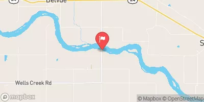
Located in Larkinburg, Kansas, C-134 is a local government-owned earth dam designed by King Engineering Associates for flood risk reduction along Bill's Creek.
Summary
With a height of 31 feet and a hydraulic height of 34 feet, this structure serves to protect the surrounding area from potential flooding events. The dam has a normal storage capacity of 102 acre-feet and a maximum discharge rate of 4400 cubic feet per second, making it a vital component in managing water resources in the region.
Despite being classified as a low hazard potential structure, C-134 is maintained and regulated by the Kansas Department of Agriculture to ensure its structural integrity and operational effectiveness. Its uncontrolled spillway, with a width of 130 feet, provides a crucial outlet for excess water during heavy rainfall events. The dam also has a moderate risk assessment rating of 3, indicating the need for ongoing risk management measures to mitigate any potential threats to its functionality. With a history of consistent inspections and compliance with state regulations, C-134 stands as a key asset in the local flood risk reduction infrastructure.
Overall, C-134 plays a crucial role in protecting the residents and land in Jackson County, Kansas, from the impacts of flooding. With its strategic location along Bill's Creek and efficient design features, this earth dam serves as a reliable barrier against excess water flow while also contributing to the overall water resource management efforts in the region. As climate change continues to pose challenges to water availability and quality, structures like C-134 are essential for safeguarding communities and ecosystems against the impacts of extreme weather events.
°F
°F
mph
Wind
%
Humidity
15-Day Weather Outlook
Dam Length |
800 |
Dam Height |
31 |
River Or Stream |
BIILL'S CREEK-TR |
Primary Dam Type |
Earth |
Surface Area |
22.6 |
Hydraulic Height |
34 |
Drainage Area |
2.67 |
Nid Storage |
728 |
Structural Height |
37 |
Outlet Gates |
None |
Hazard Potential |
Low |
Foundations |
Unlisted/Unknown |
Nid Height |
37 |
Seasonal Comparison
5-Day Hourly Forecast Detail
Nearby Streamflow Levels
 Delaware R Nr Muscotah
|
30cfs |
 Soldier C Nr Delia
|
4cfs |
 Soldier C Nr Topeka
|
9cfs |
 Kansas R At Topeka
|
1120cfs |
 Vermillion C Nr Wamego
|
5cfs |
 Kansas R Nr Belvue
|
1170cfs |
Dam Data Reference
Condition Assessment
SatisfactoryNo existing or potential dam safety deficiencies are recognized. Acceptable performance is expected under all loading conditions (static, hydrologic, seismic) in accordance with the minimum applicable state or federal regulatory criteria or tolerable risk guidelines.
Fair
No existing dam safety deficiencies are recognized for normal operating conditions. Rare or extreme hydrologic and/or seismic events may result in a dam safety deficiency. Risk may be in the range to take further action. Note: Rare or extreme event is defined by the regulatory agency based on their minimum
Poor A dam safety deficiency is recognized for normal operating conditions which may realistically occur. Remedial action is necessary. POOR may also be used when uncertainties exist as to critical analysis parameters which identify a potential dam safety deficiency. Investigations and studies are necessary.
Unsatisfactory
A dam safety deficiency is recognized that requires immediate or emergency remedial action for problem resolution.
Not Rated
The dam has not been inspected, is not under state or federal jurisdiction, or has been inspected but, for whatever reason, has not been rated.
Not Available
Dams for which the condition assessment is restricted to approved government users.
Hazard Potential Classification
HighDams assigned the high hazard potential classification are those where failure or mis-operation will probably cause loss of human life.
Significant
Dams assigned the significant hazard potential classification are those dams where failure or mis-operation results in no probable loss of human life but can cause economic loss, environment damage, disruption of lifeline facilities, or impact other concerns. Significant hazard potential classification dams are often located in predominantly rural or agricultural areas but could be in areas with population and significant infrastructure.
Low
Dams assigned the low hazard potential classification are those where failure or mis-operation results in no probable loss of human life and low economic and/or environmental losses. Losses are principally limited to the owner's property.
Undetermined
Dams for which a downstream hazard potential has not been designated or is not provided.
Not Available
Dams for which the downstream hazard potential is restricted to approved government users.
Area Campgrounds
| Location | Reservations | Toilets |
|---|---|---|
 Banner Creek
|
||
 Main Camp Site
|
||
 God's Country
|
||
 Geremy's Point
|

 C-134
C-134