


Ashuelot Paper Mill Dam Reservoir Report
Last Updated: April 27, 2026
°F
°F
mph
Wind
%
Humidity
The Ashuelot Paper Mill Dam, located in Winchester, New Hampshire, has been a key structure on the Ashuelot River since its completion in 1910.
Summary
This concrete dam, with a height of 18 feet and a length of 260 feet, primarily serves a hydroelectric purpose, contributing to the local energy supply and water management. The dam is state-regulated by the NHDES Dam Bureau and has a low hazard potential, with a very high risk assessment rating.
Despite its age, the Ashuelot Paper Mill Dam has not been rated for its condition, but it undergoes regular inspections every six years to ensure its stability and safety. The dam's controlled spillway, with a width of 79 feet, helps manage water flow during periods of high discharge, while the dam's storage capacity of 59 acre-feet provides essential water resources for the surrounding area. With its historical significance and ongoing role in water resource management, the Ashuelot Paper Mill Dam remains a vital structure for both the local community and climate enthusiasts.
Regional Streamflow Levels
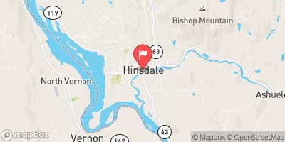 Ashuelot River At Hinsdale
|
621cfs |
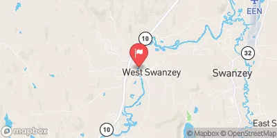 Ashuelot River At West Swanzey
|
489cfs |
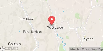 Green River Near Colrain
|
59cfs |
 Ashuelot River Above The Branch
|
21cfs |
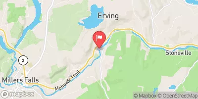 Millers River At Erving
|
380cfs |
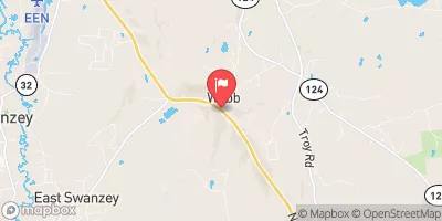 S Br Ashuelot River At Webb
|
25cfs |
15-Day Long Term Forecast
Year Completed |
1910 |
Dam Length |
260 |
Dam Height |
18 |
River Or Stream |
ASHUELOT RIVER |
Primary Dam Type |
Concrete |
Surface Area |
2.5 |
Drainage Area |
412 |
Nid Storage |
59 |
Hazard Potential |
Low |
Foundations |
Unlisted/Unknown |
Nid Height |
18 |
Seasonal Comparison
5-Day Hourly Forecast Detail
Dam Data Reference
Condition Assessment
SatisfactoryNo existing or potential dam safety deficiencies are recognized. Acceptable performance is expected under all loading conditions (static, hydrologic, seismic) in accordance with the minimum applicable state or federal regulatory criteria or tolerable risk guidelines.
Fair
No existing dam safety deficiencies are recognized for normal operating conditions. Rare or extreme hydrologic and/or seismic events may result in a dam safety deficiency. Risk may be in the range to take further action. Note: Rare or extreme event is defined by the regulatory agency based on their minimum
Poor A dam safety deficiency is recognized for normal operating conditions which may realistically occur. Remedial action is necessary. POOR may also be used when uncertainties exist as to critical analysis parameters which identify a potential dam safety deficiency. Investigations and studies are necessary.
Unsatisfactory
A dam safety deficiency is recognized that requires immediate or emergency remedial action for problem resolution.
Not Rated
The dam has not been inspected, is not under state or federal jurisdiction, or has been inspected but, for whatever reason, has not been rated.
Not Available
Dams for which the condition assessment is restricted to approved government users.
Hazard Potential Classification
HighDams assigned the high hazard potential classification are those where failure or mis-operation will probably cause loss of human life.
Significant
Dams assigned the significant hazard potential classification are those dams where failure or mis-operation results in no probable loss of human life but can cause economic loss, environment damage, disruption of lifeline facilities, or impact other concerns. Significant hazard potential classification dams are often located in predominantly rural or agricultural areas but could be in areas with population and significant infrastructure.
Low
Dams assigned the low hazard potential classification are those where failure or mis-operation results in no probable loss of human life and low economic and/or environmental losses. Losses are principally limited to the owner's property.
Undetermined
Dams for which a downstream hazard potential has not been designated or is not provided.
Not Available
Dams for which the downstream hazard potential is restricted to approved government users.
Area Campgrounds
| Location | Reservations | Toilets |
|---|---|---|
 Fort Dummer State Park
|
||
 Richardson-Zlogar Cabin
|
||
 Swanzey Lake Camping Area
|
||
 Pilgrim Pines Camping Area
|
||
 Falls Brook Shelter
|
 Connecticut River boat launch