Myers-henderson Detention Pond Dam

Myers-Henderson Detention Pond
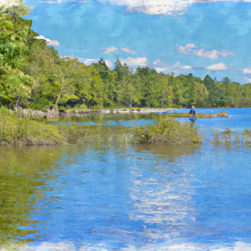
The Myers-Henderson Detention Pond in Grand Ledge, Michigan, serves as a vital structure for flood risk reduction in the area. Completed in 1992, this earth dam stands at a height of 13 feet and has a hydraulic height of 11 feet. With a storage capacity of 150 acre-feet, it plays a crucial role in managing water levels during heavy rainfall events. Situated along Miller Creek, this pond covers a surface area of 28 acres and has a drainage area of 3.6 square miles.
Managed by a private owner, the Myers-Henderson Detention Pond is subject to state regulation and inspection by the MICHIGAN DEGLE. The dam's condition assessment as of October 2020 was deemed satisfactory, although its hazard potential is categorized as high. With an inspection frequency of 3 years, the pond is equipped with an uncontrolled spillway and stands ready to handle any potential flood events in the region. Despite its moderate risk assessment, the detention pond continues to play a crucial role in safeguarding the surrounding communities from water-related risks.
Located within the Detroit District of Michigan, the Myers-Henderson Detention Pond not only mitigates flood risks but also contributes to environmental sustainability in the area. With its strategic placement and efficient design, this structure exemplifies the intersection of water resource management and climate resilience. As climate change continues to impact water systems, structures like the Myers-Henderson Detention Pond will play an increasingly crucial role in safeguarding communities and ecosystems against the threats of flooding and water scarcity.
Plan around the weather
Same NOAA / yr.no feed Snoflo's iOS app uses. Watch the precipitation column on the meteogram -- rain on the basin upstream typically lifts inflow 24-72 hours later.
Next 5 days, hour by hour
Temperature line with weather symbols on top, snow + rain accumulation as columns, humidity as a dotted line.
5-day forecast table
Every 3 hours, broken out across temperature, snow, rain, humidity, and wind. Each cell is colour-coded relative to the column min/max.
| Time | Condition | Temp (°F) | Snow (in) | Rain (in) | Humidity (%) | Wind (mps) | Wind dir |
|---|---|---|---|---|---|---|---|
| Loading detailed forecast… | |||||||
15-day temperature & precipitation
Daily temperatures, snow, and rain projected over the next two weeks.
Nearby streamflow gauges
USGS streamgauges around Myers-Henderson Detention Pond -- inflows here typically show up in storage 24-72 hours later.
| Streamgauge | Discharge | View |
|---|---|---|
| Red Cedar River At East Lansing | 45 cfs | → |
| Sloan Creek Near Williamston | 0 cfs | → |
| Grand River At Lansing | 213 cfs | → |
| Red Cedar River Near Williamston | 29 cfs | → |
| Shiawassee River At Owosso | 65 cfs | → |
| Sycamore Creek At Holt Road Near Holt | 12 cfs | → |


About Myers-Henderson Detention Pond
Where does the data for Myers-henderson Detention Pond come from?
Structural and regulatory data come from the U.S. Army Corps of Engineers' National Inventory of Dams (NID). Weather forecast comes from NOAA / yr.no -- the same feed Snoflo's iOS app uses.
How often is the report updated?
NID structural data refreshes annually as the Corps publishes updated assessments. The weather forecast refreshes throughout the day.
What does the High hazard rating mean?
The Corps of Engineers' hazard potential classification grades probable consequences if the dam fails: High = probable loss of human life; Significant = no probable loss of human life but possible economic loss / environmental damage; Low = no probable loss of human life, only minor economic / environmental losses. See the Dam Data Reference card below for the full definitions.
What's "% of normal"?
The current storage value compared to the historical average storage on this calendar day. 100% = right on average; values above 100% mean above-normal storage (wet year); values below mean below-normal (dry year or drought).
Can I get alerts when storage crosses a threshold?
Yes -- alerts are managed in the Snoflo iOS app. Favorite this dam, set a threshold, and you'll get a push the moment conditions cross.
Dam data reference
Condition Assessment
- Satisfactory
- No existing or potential dam safety deficiencies are recognized. Acceptable performance is expected under all loading conditions (static, hydrologic, seismic) in accordance with the minimum applicable state or federal regulatory criteria or tolerable risk guidelines.
- Fair
- No existing dam safety deficiencies are recognized for normal operating conditions. Rare or extreme hydrologic and/or seismic events may result in a dam safety deficiency. Risk may be in the range to take further action.
- Poor
- A dam safety deficiency is recognized for normal operating conditions which may realistically occur. Remedial action is necessary. POOR may also be used when uncertainties exist as to critical analysis parameters which identify a potential dam safety deficiency.
- Unsatisfactory
- A dam safety deficiency is recognized that requires immediate or emergency remedial action for problem resolution.
- Not Rated
- The dam has not been inspected, is not under state or federal jurisdiction, or has been inspected but, for whatever reason, has not been rated.
Hazard Potential Classification
- High
- Dams assigned the high hazard potential classification are those where failure or mis-operation will probably cause loss of human life.
- Significant
- Dams assigned the significant hazard potential classification are those dams where failure or mis-operation results in no probable loss of human life but can cause economic loss, environmental damage, disruption of lifeline facilities, or impact other concerns. Significant hazard potential classification dams are often located in predominantly rural or agricultural areas but could be in areas with population and significant infrastructure.
- Low
- Dams assigned the low hazard potential classification are those where failure or mis-operation results in no probable loss of human life and low economic and/or environmental losses. Losses are principally limited to the owner's property.
- Undetermined
- Dams for which a downstream hazard potential has not been designated or is not provided.