


Muddy Creek #21 Reservoir Report
Last Updated: May 9, 2026
Nearby: Ms06844 Lake Dam Ms06848 Lake Dam
°F
°F
mph
Wind
%
Humidity
Located in Hardeman, Tennessee, Muddy Creek #21, also known as Muddy Creek 21 Lake Dam, is a local government-owned structure designed by the USDA NRCS.
Summary
This earth dam, built in 1961, serves as a flood risk reduction measure along Colonel Fork. With a structural height of 23.5 feet and a hydraulic height of 12.5 feet, the dam provides a normal storage capacity of 302 acre-feet and a maximum storage of 2,341 acre-feet, covering a surface area of 92 acres.
Managed by the Tennessee Safe Dams Program, Muddy Creek #21 has a low hazard potential and is in satisfactory condition as of the last inspection in July 2020. While the dam does not have outlet gates, it features an uncontrolled spillway and is state-regulated and permitted for operation and inspection. The risk assessment for this dam is moderate, with a rating of 3, indicating a need for ongoing monitoring and risk management measures to ensure its continued safety and effectiveness in flood control along Colonel Fork.
Water resource and climate enthusiasts will appreciate the significance of Muddy Creek #21 in mitigating flood risks in the region and its adherence to state regulations and inspections for dam safety. The dam's design by the USDA NRCS and its location within the Memphis District underscore the collaborative efforts involved in managing water resources and protecting the surrounding community from potential inundation events. As part of the larger network of dams in Tennessee, Muddy Creek #21 plays a vital role in water management and underscores the importance of proactive risk assessment and management in ensuring the resilience of critical infrastructure in the face of changing climate conditions.
Regional Streamflow Levels
 Hatchie River Near Walnut
|
2080cfs |
 Hatchie River At Bolivar
|
4640cfs |
 Wolf River At Lagrange
|
416cfs |
 Wolf River At Rossville
|
1640cfs |
 Horse Creek Near Savannah
|
192cfs |
 Little Tallahatchie River At Etta
|
464cfs |
15-Day Long Term Forecast
Year Completed |
1961 |
Dam Length |
1975 |
River Or Stream |
COLONEL FORK |
Primary Dam Type |
Earth |
Surface Area |
92 |
Hydraulic Height |
12.5 |
Drainage Area |
5.7 |
Nid Storage |
2341 |
Structural Height |
23.5 |
Outlet Gates |
None |
Hazard Potential |
Low |
Foundations |
Soil |
Nid Height |
24 |
Seasonal Comparison
5-Day Hourly Forecast Detail
Dam Data Reference
Condition Assessment
SatisfactoryNo existing or potential dam safety deficiencies are recognized. Acceptable performance is expected under all loading conditions (static, hydrologic, seismic) in accordance with the minimum applicable state or federal regulatory criteria or tolerable risk guidelines.
Fair
No existing dam safety deficiencies are recognized for normal operating conditions. Rare or extreme hydrologic and/or seismic events may result in a dam safety deficiency. Risk may be in the range to take further action. Note: Rare or extreme event is defined by the regulatory agency based on their minimum
Poor A dam safety deficiency is recognized for normal operating conditions which may realistically occur. Remedial action is necessary. POOR may also be used when uncertainties exist as to critical analysis parameters which identify a potential dam safety deficiency. Investigations and studies are necessary.
Unsatisfactory
A dam safety deficiency is recognized that requires immediate or emergency remedial action for problem resolution.
Not Rated
The dam has not been inspected, is not under state or federal jurisdiction, or has been inspected but, for whatever reason, has not been rated.
Not Available
Dams for which the condition assessment is restricted to approved government users.
Hazard Potential Classification
HighDams assigned the high hazard potential classification are those where failure or mis-operation will probably cause loss of human life.
Significant
Dams assigned the significant hazard potential classification are those dams where failure or mis-operation results in no probable loss of human life but can cause economic loss, environment damage, disruption of lifeline facilities, or impact other concerns. Significant hazard potential classification dams are often located in predominantly rural or agricultural areas but could be in areas with population and significant infrastructure.
Low
Dams assigned the low hazard potential classification are those where failure or mis-operation results in no probable loss of human life and low economic and/or environmental losses. Losses are principally limited to the owner's property.
Undetermined
Dams for which a downstream hazard potential has not been designated or is not provided.
Not Available
Dams for which the downstream hazard potential is restricted to approved government users.
Area Campgrounds
| Location | Reservations | Toilets |
|---|---|---|
 Big Hill Pond SP - Grassy Point Shelter
|
||
 Big Hill Pond State Park Campground
|
||
 Tippah County Lake - MDWFP
|
||
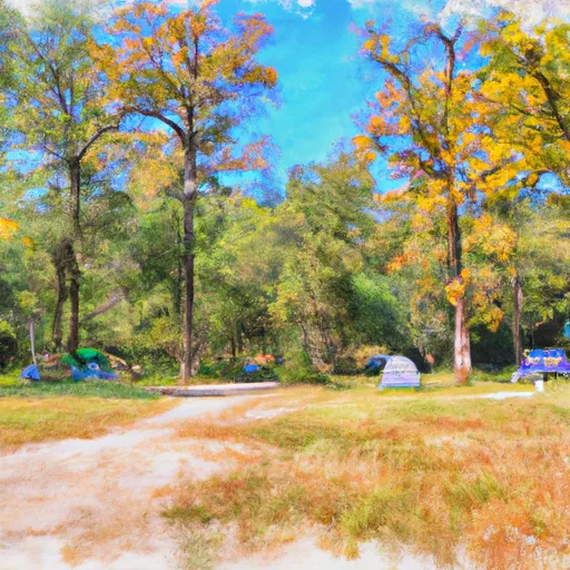 Chickasaw State Park - Tent
|