


East Fork Big Cr Wtrshd Site Z-5-2 Reservoir Report
Last Updated: April 25, 2026
°F
°F
mph
Wind
%
Humidity
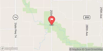
East Fork Big Creek Watershed Site Z-5-2, located in Decatur, Iowa, is a flood risk reduction structure designed by the USDA NRCS and completed in 2003.
Summary
This Earth dam stands at a height of 23 feet and has a length of 471 feet, providing a storage capacity of 55 acre-feet. The dam serves the primary purpose of flood risk reduction and is regulated by the Iowa DNR.
With a low hazard potential and a moderate risk assessment rating, the East Fork Big Creek Watershed Site Z-5-2 is an important asset for managing water resources in the region. The dam's uncontrolled spillway and soil foundation contribute to its functionality in handling excess water flow. Although the condition assessment is currently not rated, the structure is inspected, permitted, and regulated by state authorities to ensure its proper operation and maintenance.
Overall, the East Fork Big Creek Watershed Site Z-5-2 plays a crucial role in protecting the surrounding area from potential flooding events. With its location in a critical watershed and its strategic design for flood risk reduction, this structure serves as a valuable resource for water management and climate resilience efforts in Iowa.
Regional Streamflow Levels

15-Day Long Term Forecast
Year Completed |
2003 |
Dam Length |
471 |
Dam Height |
23 |
River Or Stream |
TR- ZADIE CREEK |
Primary Dam Type |
Earth |
Surface Area |
2.9 |
Drainage Area |
0.17 |
Nid Storage |
55 |
Hazard Potential |
Low |
Foundations |
Soil |
Nid Height |
23 |
Seasonal Comparison
5-Day Hourly Forecast Detail
Dam Data Reference
Condition Assessment
SatisfactoryNo existing or potential dam safety deficiencies are recognized. Acceptable performance is expected under all loading conditions (static, hydrologic, seismic) in accordance with the minimum applicable state or federal regulatory criteria or tolerable risk guidelines.
Fair
No existing dam safety deficiencies are recognized for normal operating conditions. Rare or extreme hydrologic and/or seismic events may result in a dam safety deficiency. Risk may be in the range to take further action. Note: Rare or extreme event is defined by the regulatory agency based on their minimum
Poor A dam safety deficiency is recognized for normal operating conditions which may realistically occur. Remedial action is necessary. POOR may also be used when uncertainties exist as to critical analysis parameters which identify a potential dam safety deficiency. Investigations and studies are necessary.
Unsatisfactory
A dam safety deficiency is recognized that requires immediate or emergency remedial action for problem resolution.
Not Rated
The dam has not been inspected, is not under state or federal jurisdiction, or has been inspected but, for whatever reason, has not been rated.
Not Available
Dams for which the condition assessment is restricted to approved government users.
Hazard Potential Classification
HighDams assigned the high hazard potential classification are those where failure or mis-operation will probably cause loss of human life.
Significant
Dams assigned the significant hazard potential classification are those dams where failure or mis-operation results in no probable loss of human life but can cause economic loss, environment damage, disruption of lifeline facilities, or impact other concerns. Significant hazard potential classification dams are often located in predominantly rural or agricultural areas but could be in areas with population and significant infrastructure.
Low
Dams assigned the low hazard potential classification are those where failure or mis-operation results in no probable loss of human life and low economic and/or environmental losses. Losses are principally limited to the owner's property.
Undetermined
Dams for which a downstream hazard potential has not been designated or is not provided.
Not Available
Dams for which the downstream hazard potential is restricted to approved government users.