


Gunn Park Lake Reservoir Report
Last Updated: May 2, 2026
Nearby: Rock Creek Dam Dd No Kerr Site
°F
°F
mph
Wind
%
Humidity
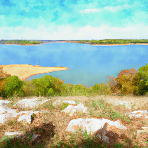
Gunn Park Lake, located in Fort Scott, Kansas, is a picturesque Earth dam constructed in 1937 for water supply purposes.
Summary
With a height of 28 feet and a storage capacity of 81 acre-feet, the dam sits on the Marmaton River, providing both recreational opportunities and essential water resources for the local community. The dam's spillway, with a width of 30 feet, is uncontrolled, and the overall hazard potential is classified as low, making it a safe and enjoyable destination for water resource and climate enthusiasts.
The 6.2-acre surface area of Gunn Park Lake offers a tranquil setting for outdoor activities such as fishing, boating, and birdwatching. The dam's condition is currently not rated, but its risk assessment is moderate, indicating the need for ongoing management and monitoring. Despite its age, the dam remains a reliable water source for the city of Fort Scott, serving as a testament to the enduring importance of sustainable water infrastructure in the face of changing climate conditions. Whether enjoying the scenic views or learning about the dam's engineering history, visitors to Gunn Park Lake will find a captivating blend of natural beauty and human ingenuity.
Regional Streamflow Levels
 Marmaton R Nr Fort Scott
|
121cfs |
 Marmaton R Nr Marmaton
|
194cfs |
 L Osage R At Fulton
|
266cfs |
 Marmaton R Nr Uniontown
|
41cfs |
 Marmaton River Near Nevada
|
244cfs |
 East Drywood Creek At Prairie State Park
|
0cfs |
15-Day Long Term Forecast
Year Completed |
1937 |
Dam Length |
485 |
Dam Height |
28 |
River Or Stream |
MARMATON RIVER-TR |
Primary Dam Type |
Earth |
Surface Area |
6.2 |
Hydraulic Height |
22 |
Drainage Area |
0.5 |
Nid Storage |
81 |
Structural Height |
28 |
Outlet Gates |
None |
Hazard Potential |
Low |
Foundations |
Unlisted/Unknown |
Nid Height |
28 |
Seasonal Comparison
5-Day Hourly Forecast Detail
Dam Data Reference
Condition Assessment
SatisfactoryNo existing or potential dam safety deficiencies are recognized. Acceptable performance is expected under all loading conditions (static, hydrologic, seismic) in accordance with the minimum applicable state or federal regulatory criteria or tolerable risk guidelines.
Fair
No existing dam safety deficiencies are recognized for normal operating conditions. Rare or extreme hydrologic and/or seismic events may result in a dam safety deficiency. Risk may be in the range to take further action. Note: Rare or extreme event is defined by the regulatory agency based on their minimum
Poor A dam safety deficiency is recognized for normal operating conditions which may realistically occur. Remedial action is necessary. POOR may also be used when uncertainties exist as to critical analysis parameters which identify a potential dam safety deficiency. Investigations and studies are necessary.
Unsatisfactory
A dam safety deficiency is recognized that requires immediate or emergency remedial action for problem resolution.
Not Rated
The dam has not been inspected, is not under state or federal jurisdiction, or has been inspected but, for whatever reason, has not been rated.
Not Available
Dams for which the condition assessment is restricted to approved government users.
Hazard Potential Classification
HighDams assigned the high hazard potential classification are those where failure or mis-operation will probably cause loss of human life.
Significant
Dams assigned the significant hazard potential classification are those dams where failure or mis-operation results in no probable loss of human life but can cause economic loss, environment damage, disruption of lifeline facilities, or impact other concerns. Significant hazard potential classification dams are often located in predominantly rural or agricultural areas but could be in areas with population and significant infrastructure.
Low
Dams assigned the low hazard potential classification are those where failure or mis-operation results in no probable loss of human life and low economic and/or environmental losses. Losses are principally limited to the owner's property.
Undetermined
Dams for which a downstream hazard potential has not been designated or is not provided.
Not Available
Dams for which the downstream hazard potential is restricted to approved government users.
Area Campgrounds
| Location | Reservations | Toilets |
|---|---|---|
 Gunn Park
|
||
 Rock Creek Lake - Fort Scott
|
||
 Fort Scott Lake
|
||
 Best Camping Spot on lake
|
||
 Prairie State Park
|
||
 Backpack Camp
|
 Stockton Lake Near Stockton
 Kansas Road Marmaton