Norman George Lake Reservoir Report
Nearby: Bear Lake Dam Woodbury Lake Dam
Last Updated: February 24, 2026
Norman George Lake, located in Buchanan, Missouri, is a privately owned earth dam built in 1980 primarily for flood risk reduction along the TR-Platte River.
Summary
With a structural height of 26 feet and a length of 370 feet, the dam has a normal storage capacity of 11 acre-feet and a maximum storage of 37 acre-feet, serving a drainage area of 265 square miles. Despite its low hazard potential and moderate risk assessment, the dam is currently not rated for its condition and lacks emergency action plans and inspection data.
The dam features an uncontrolled spillway with a width of 38 feet and is constructed with stone core types on a soil foundation. While Norman George Lake serves purposes such as fire protection, stock, and small fish pond, its main function remains flood risk reduction. The surrounding area covers 4 acres with a maximum discharge capacity of 292 cubic feet per second, making it a vital structure in managing water resources and mitigating potential flood damage in the region.
Managed by a private owner, Norman George Lake is a crucial component in the water infrastructure of Buchanan County, Missouri. While the dam is currently not regulated or inspected by state agencies, its role in protecting the local community from floods underscores the importance of proactive maintenance and risk management measures to ensure its continued effectiveness in the face of changing climate patterns and water resource demands.
°F
°F
mph
Wind
%
Humidity
15-Day Weather Outlook
Year Completed |
1980 |
Dam Length |
370 |
Dam Height |
26 |
River Or Stream |
TR-PLATTE RIVER |
Primary Dam Type |
Earth |
Surface Area |
4 |
Hydraulic Height |
26 |
Drainage Area |
265 |
Nid Storage |
37 |
Structural Height |
26 |
Outlet Gates |
None |
Hazard Potential |
Low |
Foundations |
Soil |
Nid Height |
26 |
Seasonal Comparison
5-Day Hourly Forecast Detail
Nearby Streamflow Levels
 Platte River Near Agency
|
91cfs |
 Missouri River At St. Joseph
|
22300cfs |
 Little Platte River Near Plattsburg
|
2cfs |
 Platte River At Sharps Station
|
87cfs |
 Little Platte River At Smithville
|
11cfs |
 Stranger C Nr Potter
|
199cfs |
Dam Data Reference
Condition Assessment
SatisfactoryNo existing or potential dam safety deficiencies are recognized. Acceptable performance is expected under all loading conditions (static, hydrologic, seismic) in accordance with the minimum applicable state or federal regulatory criteria or tolerable risk guidelines.
Fair
No existing dam safety deficiencies are recognized for normal operating conditions. Rare or extreme hydrologic and/or seismic events may result in a dam safety deficiency. Risk may be in the range to take further action. Note: Rare or extreme event is defined by the regulatory agency based on their minimum
Poor A dam safety deficiency is recognized for normal operating conditions which may realistically occur. Remedial action is necessary. POOR may also be used when uncertainties exist as to critical analysis parameters which identify a potential dam safety deficiency. Investigations and studies are necessary.
Unsatisfactory
A dam safety deficiency is recognized that requires immediate or emergency remedial action for problem resolution.
Not Rated
The dam has not been inspected, is not under state or federal jurisdiction, or has been inspected but, for whatever reason, has not been rated.
Not Available
Dams for which the condition assessment is restricted to approved government users.
Hazard Potential Classification
HighDams assigned the high hazard potential classification are those where failure or mis-operation will probably cause loss of human life.
Significant
Dams assigned the significant hazard potential classification are those dams where failure or mis-operation results in no probable loss of human life but can cause economic loss, environment damage, disruption of lifeline facilities, or impact other concerns. Significant hazard potential classification dams are often located in predominantly rural or agricultural areas but could be in areas with population and significant infrastructure.
Low
Dams assigned the low hazard potential classification are those where failure or mis-operation results in no probable loss of human life and low economic and/or environmental losses. Losses are principally limited to the owner's property.
Undetermined
Dams for which a downstream hazard potential has not been designated or is not provided.
Not Available
Dams for which the downstream hazard potential is restricted to approved government users.
Area Campgrounds
| Location | Reservations | Toilets |
|---|---|---|
 Strong Bull
|
||
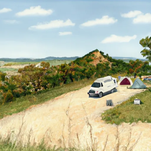 Sky Hawk
|
||
 Short Arrow
|

 Norman George Lake