
Big Creek-Hurricane Creek B- 94a Reservoir Report
Last Updated: January 11, 2026
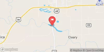
Big Creek-Hurricane Creek B-94a is a private-owned Earth dam located in Carroll County, Missouri, designed by USDA NRCS and completed in 2008 for the primary purpose of flood risk reduction.
°F
°F
mph
Wind
%
Humidity
Summary
The dam, standing at a height of 20.2 feet with a hydraulic height of 20 feet and a structural height of 25 feet, has a storage capacity of 186.3 acre-feet and serves a drainage area of 277 square miles. This uncontrolled spillway dam on a tributary of Big Creek is crucial for managing water flow and reducing the risk of flooding in the region.
With a moderate risk assessment rating of 3, Big Creek-Hurricane Creek B-94a is considered to have low hazard potential and is currently in a not-rated condition assessment status. Despite its low hazard potential, the dam plays a significant role in mitigating flood risks and protecting the surrounding area from potential water damage. The dam's strategic location in S34, T54N, R22W, and its design by the Natural Resources Conservation Service make it a key component of the flood risk reduction infrastructure in the region. Water resource and climate enthusiasts will appreciate the vital role that Big Creek-Hurricane Creek B-94a plays in safeguarding the local community from the impacts of extreme weather events.
Year Completed |
2008 |
Dam Length |
939 |
Dam Height |
20.2 |
River Or Stream |
TRIB. BIG CREEK |
Primary Dam Type |
Earth |
Surface Area |
7 |
Hydraulic Height |
20 |
Drainage Area |
277 |
Nid Storage |
186.3 |
Structural Height |
25 |
Outlet Gates |
None |
Hazard Potential |
Low |
Foundations |
Soil |
Nid Height |
25 |
Seasonal Comparison
Weather Forecast
Nearby Streamflow Levels
 Wakenda Creek At Carrollton
|
9cfs |
 Grand River Near Sumner
|
2210cfs |
 Missouri River At Waverly
|
33000cfs |
 Mussel Fork Near Musselfork
|
92cfs |
 Grand River At Chillicothe
|
361cfs |
 Shoal Creek Near Braymer Mo
|
117cfs |
Dam Data Reference
Condition Assessment
SatisfactoryNo existing or potential dam safety deficiencies are recognized. Acceptable performance is expected under all loading conditions (static, hydrologic, seismic) in accordance with the minimum applicable state or federal regulatory criteria or tolerable risk guidelines.
Fair
No existing dam safety deficiencies are recognized for normal operating conditions. Rare or extreme hydrologic and/or seismic events may result in a dam safety deficiency. Risk may be in the range to take further action. Note: Rare or extreme event is defined by the regulatory agency based on their minimum
Poor A dam safety deficiency is recognized for normal operating conditions which may realistically occur. Remedial action is necessary. POOR may also be used when uncertainties exist as to critical analysis parameters which identify a potential dam safety deficiency. Investigations and studies are necessary.
Unsatisfactory
A dam safety deficiency is recognized that requires immediate or emergency remedial action for problem resolution.
Not Rated
The dam has not been inspected, is not under state or federal jurisdiction, or has been inspected but, for whatever reason, has not been rated.
Not Available
Dams for which the condition assessment is restricted to approved government users.
Hazard Potential Classification
HighDams assigned the high hazard potential classification are those where failure or mis-operation will probably cause loss of human life.
Significant
Dams assigned the significant hazard potential classification are those dams where failure or mis-operation results in no probable loss of human life but can cause economic loss, environment damage, disruption of lifeline facilities, or impact other concerns. Significant hazard potential classification dams are often located in predominantly rural or agricultural areas but could be in areas with population and significant infrastructure.
Low
Dams assigned the low hazard potential classification are those where failure or mis-operation results in no probable loss of human life and low economic and/or environmental losses. Losses are principally limited to the owner's property.
Undetermined
Dams for which a downstream hazard potential has not been designated or is not provided.
Not Available
Dams for which the downstream hazard potential is restricted to approved government users.
Area Campgrounds
| Location | Reservations | Toilets |
|---|---|---|
 Bogard City Park
|
||
 Carrollton City Park
|
||
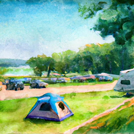 Herring Memorial Park - Brunswick
|
 Big Creek-Hurricane Creek B- 94a