
Johnsons Draw Ws Scs Site 6 Dam Reservoir Report
Last Updated: January 12, 2026
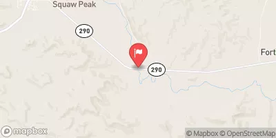
Johnsons Draw WS SCS Site 6 Dam, located in Crockett, Texas, is a key structure managed by the local government for flood risk reduction along the Newton Draw river.
°F
°F
mph
Wind
%
Humidity
Summary
Built in 1958 by the USDA NRCS, this earth dam stands at a height of 44 feet and spans a length of 2200 feet, with a storage capacity of 6145 acre-feet and a drainage area of 10.3 square miles. The dam features an uncontrolled spillway with a width of 253 feet and outlet gates for water control.
Despite its age, the dam is in satisfactory condition according to the last assessment in October 2016, with a moderate risk level. The Texas Commission on Environmental Quality (TCEQ) regulates and inspects the dam periodically to ensure its safe operation. The structure has not been modified in recent years and is equipped with emergency action plans and contacts. With its crucial role in flood risk reduction and water management, Johnsons Draw WS SCS Site 6 Dam is a significant asset in safeguarding the surrounding area from potential hazards and ensuring water resource sustainability in the region.
Year Completed |
1958 |
Dam Length |
2200 |
Dam Height |
44 |
River Or Stream |
NEWTON DRAW |
Primary Dam Type |
Earth |
Surface Area |
33 |
Hydraulic Height |
44 |
Drainage Area |
10.3 |
Nid Storage |
6145 |
Structural Height |
45 |
Outlet Gates |
Slide (sluice gate) - 1, Uncontrolled - 2 |
Hazard Potential |
Not Available |
Foundations |
Rock, Soil |
Nid Height |
45 |
Seasonal Comparison
Weather Forecast
Nearby Streamflow Levels


Dam Data Reference
Condition Assessment
SatisfactoryNo existing or potential dam safety deficiencies are recognized. Acceptable performance is expected under all loading conditions (static, hydrologic, seismic) in accordance with the minimum applicable state or federal regulatory criteria or tolerable risk guidelines.
Fair
No existing dam safety deficiencies are recognized for normal operating conditions. Rare or extreme hydrologic and/or seismic events may result in a dam safety deficiency. Risk may be in the range to take further action. Note: Rare or extreme event is defined by the regulatory agency based on their minimum
Poor A dam safety deficiency is recognized for normal operating conditions which may realistically occur. Remedial action is necessary. POOR may also be used when uncertainties exist as to critical analysis parameters which identify a potential dam safety deficiency. Investigations and studies are necessary.
Unsatisfactory
A dam safety deficiency is recognized that requires immediate or emergency remedial action for problem resolution.
Not Rated
The dam has not been inspected, is not under state or federal jurisdiction, or has been inspected but, for whatever reason, has not been rated.
Not Available
Dams for which the condition assessment is restricted to approved government users.
Hazard Potential Classification
HighDams assigned the high hazard potential classification are those where failure or mis-operation will probably cause loss of human life.
Significant
Dams assigned the significant hazard potential classification are those dams where failure or mis-operation results in no probable loss of human life but can cause economic loss, environment damage, disruption of lifeline facilities, or impact other concerns. Significant hazard potential classification dams are often located in predominantly rural or agricultural areas but could be in areas with population and significant infrastructure.
Low
Dams assigned the low hazard potential classification are those where failure or mis-operation results in no probable loss of human life and low economic and/or environmental losses. Losses are principally limited to the owner's property.
Undetermined
Dams for which a downstream hazard potential has not been designated or is not provided.
Not Available
Dams for which the downstream hazard potential is restricted to approved government users.
 Johnsons Draw Ws Scs Site 6 Dam