
Lake Perry Dam Reservoir Report
Nearby: Ms05079 Lake Dam Perry Lake Dam
Last Updated: December 25, 2025
Lake Perry Dam in Perry, Mississippi, is a state-owned structure regulated by the Mississippi Department of Environmental Quality.
°F
°F
mph
Wind
%
Humidity
Summary
The dam, primarily designed for recreational purposes, is an earth dam with a height of 20 feet and a hydraulic height of 17 feet. It has a storage capacity of 672 acre-feet and covers a surface area of 50 acres. The dam's spillway type is uncontrolled, with a low hazard potential and a moderate risk assessment rating.
Located at coordinates 31.13236711 latitude and -88.89951371 longitude, Lake Perry Dam is managed by the Mobile District of the US Army Corps of Engineers. While the dam's condition is currently not rated, it undergoes regular state inspections, permitting, and enforcement to ensure its safety and compliance. With a primary purpose of recreation, the dam serves as a popular spot for outdoor enthusiasts and visitors looking to enjoy water activities in the area.
Overall, Lake Perry Dam plays a crucial role in providing recreational opportunities and water resource management in Perry, Mississippi. With its moderate risk assessment rating and state-regulated status, the dam remains a key infrastructure for both local residents and climate enthusiasts interested in the conservation and preservation of water resources in the region.
Dam Length |
600 |
Dam Height |
20 |
Primary Dam Type |
Earth |
Surface Area |
50 |
Hydraulic Height |
17 |
Nid Storage |
672 |
Hazard Potential |
Low |
Nid Height |
20 |
Seasonal Comparison
Weather Forecast
Nearby Streamflow Levels
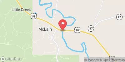 Leaf River Nr Mclain
|
1090cfs |
 Cypress Creek Nr Janice
|
17cfs |
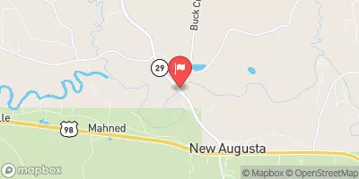 Leaf River Nr New Augusta
|
878cfs |
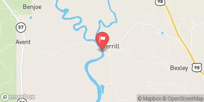 Pascagoula River At Merrill
|
2020cfs |
 Tallahala Creek Nr Runnelstown
|
93cfs |
 Black Creek Nr Brooklyn
|
153cfs |
Dam Data Reference
Condition Assessment
SatisfactoryNo existing or potential dam safety deficiencies are recognized. Acceptable performance is expected under all loading conditions (static, hydrologic, seismic) in accordance with the minimum applicable state or federal regulatory criteria or tolerable risk guidelines.
Fair
No existing dam safety deficiencies are recognized for normal operating conditions. Rare or extreme hydrologic and/or seismic events may result in a dam safety deficiency. Risk may be in the range to take further action. Note: Rare or extreme event is defined by the regulatory agency based on their minimum
Poor A dam safety deficiency is recognized for normal operating conditions which may realistically occur. Remedial action is necessary. POOR may also be used when uncertainties exist as to critical analysis parameters which identify a potential dam safety deficiency. Investigations and studies are necessary.
Unsatisfactory
A dam safety deficiency is recognized that requires immediate or emergency remedial action for problem resolution.
Not Rated
The dam has not been inspected, is not under state or federal jurisdiction, or has been inspected but, for whatever reason, has not been rated.
Not Available
Dams for which the condition assessment is restricted to approved government users.
Hazard Potential Classification
HighDams assigned the high hazard potential classification are those where failure or mis-operation will probably cause loss of human life.
Significant
Dams assigned the significant hazard potential classification are those dams where failure or mis-operation results in no probable loss of human life but can cause economic loss, environment damage, disruption of lifeline facilities, or impact other concerns. Significant hazard potential classification dams are often located in predominantly rural or agricultural areas but could be in areas with population and significant infrastructure.
Low
Dams assigned the low hazard potential classification are those where failure or mis-operation results in no probable loss of human life and low economic and/or environmental losses. Losses are principally limited to the owner's property.
Undetermined
Dams for which a downstream hazard potential has not been designated or is not provided.
Not Available
Dams for which the downstream hazard potential is restricted to approved government users.
 Lake Perry Dam