Muff Dam Reservoir Report
Nearby: Walnut Creek 1 Blue River Lodge Dam
Last Updated: February 22, 2026
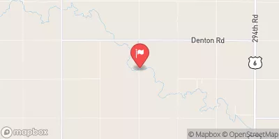
Muff Dam, located in Saline, Nebraska, is a privately owned structure designed by the USDA NRCS for flood risk reduction along the TR-Big Blue River.
Summary
Completed in 1971, this earth dam stands at a height of 29 feet and has a maximum storage capacity of 69 acre-feet. With a low hazard potential and satisfactory condition assessment, Muff Dam plays a crucial role in protecting the surrounding area from potential flooding events.
Managed by the Nebraska Department of Natural Resources, Muff Dam is regularly inspected and maintained to ensure its structural integrity and functionality. The dam's primary purpose extends beyond flood risk reduction to include other environmental benefits. Despite its modest size, covering a surface area of 4 acres with a drainage area of 0.3 square miles, Muff Dam serves as a vital water resource management infrastructure in the region.
For water resource and climate enthusiasts, Muff Dam stands as a testament to effective collaboration between private owners, government agencies, and environmental designers. Its location, design, and operational history make it a noteworthy example of sustainable water management practices in Nebraska. As climate change continues to impact water resources, structures like Muff Dam will be crucial for safeguarding communities and ecosystems against the threats of flooding and water scarcity.
°F
°F
mph
Wind
%
Humidity
15-Day Weather Outlook
Year Completed |
1971 |
Dam Length |
199 |
Dam Height |
29 |
River Or Stream |
TR-BIG BLUE RIVER |
Primary Dam Type |
Earth |
Surface Area |
4 |
Hydraulic Height |
27 |
Drainage Area |
0.3 |
Nid Storage |
69 |
Structural Height |
29 |
Hazard Potential |
Low |
Foundations |
Soil |
Nid Height |
29 |
Seasonal Comparison
5-Day Hourly Forecast Detail
Nearby Streamflow Levels
Dam Data Reference
Condition Assessment
SatisfactoryNo existing or potential dam safety deficiencies are recognized. Acceptable performance is expected under all loading conditions (static, hydrologic, seismic) in accordance with the minimum applicable state or federal regulatory criteria or tolerable risk guidelines.
Fair
No existing dam safety deficiencies are recognized for normal operating conditions. Rare or extreme hydrologic and/or seismic events may result in a dam safety deficiency. Risk may be in the range to take further action. Note: Rare or extreme event is defined by the regulatory agency based on their minimum
Poor A dam safety deficiency is recognized for normal operating conditions which may realistically occur. Remedial action is necessary. POOR may also be used when uncertainties exist as to critical analysis parameters which identify a potential dam safety deficiency. Investigations and studies are necessary.
Unsatisfactory
A dam safety deficiency is recognized that requires immediate or emergency remedial action for problem resolution.
Not Rated
The dam has not been inspected, is not under state or federal jurisdiction, or has been inspected but, for whatever reason, has not been rated.
Not Available
Dams for which the condition assessment is restricted to approved government users.
Hazard Potential Classification
HighDams assigned the high hazard potential classification are those where failure or mis-operation will probably cause loss of human life.
Significant
Dams assigned the significant hazard potential classification are those dams where failure or mis-operation results in no probable loss of human life but can cause economic loss, environment damage, disruption of lifeline facilities, or impact other concerns. Significant hazard potential classification dams are often located in predominantly rural or agricultural areas but could be in areas with population and significant infrastructure.
Low
Dams assigned the low hazard potential classification are those where failure or mis-operation results in no probable loss of human life and low economic and/or environmental losses. Losses are principally limited to the owner's property.
Undetermined
Dams for which a downstream hazard potential has not been designated or is not provided.
Not Available
Dams for which the downstream hazard potential is restricted to approved government users.


 Muff Dam
 Walnut Creek Public Use Area