Oak-Middle 79-A Reservoir Report
Nearby: Hudkins Road Dam Oak-Middle 81-A
Last Updated: February 22, 2026
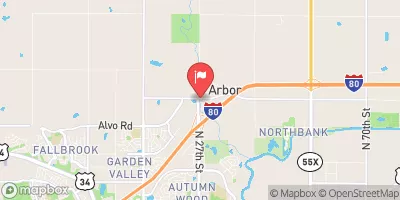
Oak-Middle 79-A is a crucial flood risk reduction structure located in Seward, Nebraska, along the TR-MIDDLE OAK CREEK.
Summary
Constructed in 1963 by the USDA NRCS, this Earth dam stands at a height of 43 feet and spans 836 feet in length, providing a storage capacity of 632 acre-feet for floodwaters. The dam serves to protect the surrounding area from potential flooding events, with a low hazard potential and a satisfactory condition assessment as of the last inspection in 2016.
Managed by the Natural Resources Conservation Service, Oak-Middle 79-A is regulated by the Nebraska Department of Natural Resources and undergoes regular inspection and maintenance to ensure its effectiveness in flood risk reduction. With a drainage area of 1.8 square miles and a maximum discharge capacity of 2760 cubic feet per second, this structure plays a vital role in managing water resources in the region. Despite its age, Oak-Middle 79-A continues to meet regulatory standards and remains a key asset in safeguarding the community from flood-related risks.
Located in the Kansas City District, Oak-Middle 79-A is part of the local government's efforts to mitigate the impacts of extreme weather events on water resources and climate. With its stone core and soil foundation, this dam exemplifies the importance of sustainable infrastructure in enhancing resilience to changing environmental conditions. As water resource and climate enthusiasts, understanding and supporting structures like Oak-Middle 79-A is crucial for promoting a more sustainable and secure future for communities in Nebraska and beyond.
°F
°F
mph
Wind
%
Humidity
15-Day Weather Outlook
Year Completed |
1963 |
Dam Length |
836 |
Dam Height |
43 |
River Or Stream |
TR-MIDDLE OAK CREEK |
Primary Dam Type |
Earth |
Surface Area |
17 |
Hydraulic Height |
43 |
Drainage Area |
1.8 |
Nid Storage |
632 |
Structural Height |
47 |
Hazard Potential |
Low |
Foundations |
Soil |
Nid Height |
47 |
Seasonal Comparison
5-Day Hourly Forecast Detail
Nearby Streamflow Levels
Dam Data Reference
Condition Assessment
SatisfactoryNo existing or potential dam safety deficiencies are recognized. Acceptable performance is expected under all loading conditions (static, hydrologic, seismic) in accordance with the minimum applicable state or federal regulatory criteria or tolerable risk guidelines.
Fair
No existing dam safety deficiencies are recognized for normal operating conditions. Rare or extreme hydrologic and/or seismic events may result in a dam safety deficiency. Risk may be in the range to take further action. Note: Rare or extreme event is defined by the regulatory agency based on their minimum
Poor A dam safety deficiency is recognized for normal operating conditions which may realistically occur. Remedial action is necessary. POOR may also be used when uncertainties exist as to critical analysis parameters which identify a potential dam safety deficiency. Investigations and studies are necessary.
Unsatisfactory
A dam safety deficiency is recognized that requires immediate or emergency remedial action for problem resolution.
Not Rated
The dam has not been inspected, is not under state or federal jurisdiction, or has been inspected but, for whatever reason, has not been rated.
Not Available
Dams for which the condition assessment is restricted to approved government users.
Hazard Potential Classification
HighDams assigned the high hazard potential classification are those where failure or mis-operation will probably cause loss of human life.
Significant
Dams assigned the significant hazard potential classification are those dams where failure or mis-operation results in no probable loss of human life but can cause economic loss, environment damage, disruption of lifeline facilities, or impact other concerns. Significant hazard potential classification dams are often located in predominantly rural or agricultural areas but could be in areas with population and significant infrastructure.
Low
Dams assigned the low hazard potential classification are those where failure or mis-operation results in no probable loss of human life and low economic and/or environmental losses. Losses are principally limited to the owner's property.
Undetermined
Dams for which a downstream hazard potential has not been designated or is not provided.
Not Available
Dams for which the downstream hazard potential is restricted to approved government users.


 Oak-Middle 79-A
 Meadow Lark