Buckley Creek 3-D Reservoir Report
Nearby: Buckley Creek 4-B Buckley Creek 3-A
Last Updated: February 22, 2026
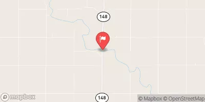
Buckley Creek 3-D, located in Jefferson County, Nebraska, is a vital earth dam designed by the USDA NRCS in 1963 for flood risk reduction along TR-Buckley Creek.
Summary
With a height of 34 feet and a length of 985 feet, this structure has a capacity to store 903 acre-feet of water, serving a drainage area of 2.4 square miles. The dam's primary purpose is flood risk reduction, with a hydraulic height of 33 feet and a structural height of 35 feet. Despite its low hazard potential, Buckley Creek 3-D is regulated, inspected, and enforced by the Nebraska Department of Natural Resources, ensuring its satisfactory condition for continued operation.
Owned by the local government, Buckley Creek 3-D is situated in a scenic location with a surface area of 27 acres and a normal storage capacity of 134 acre-feet. The dam's foundation is supported by soil, with a core made of stone to enhance its structural integrity. While there are no associated structures or federal agency involvement in funding or operating the dam, it is subject to regular inspections every five years to assess its condition and ensure compliance with state regulations. The last inspection conducted in May 2019 deemed the dam to be in satisfactory condition, with no identified risk management measures or emergency action plans currently in place.
In the event of an emergency, the local authorities are responsible for coordinating response efforts, as the dam's Emergency Action Plan (EAP) status is currently undetermined. With a history of reliable performance and a track record of effective flood risk reduction, Buckley Creek 3-D stands as a testament to the importance of sound infrastructure in managing water resources and climate-related challenges. As climate change continues to impact water systems, structures like Buckley Creek 3-D play a crucial role in safeguarding communities and ecosystems from the threat of flooding and ensuring sustainable water management practices in the face of evolving environmental conditions.
°F
°F
mph
Wind
%
Humidity
15-Day Weather Outlook
Year Completed |
1963 |
Dam Length |
985 |
Dam Height |
34 |
River Or Stream |
TR-BUCKLEY CREEK |
Primary Dam Type |
Earth |
Surface Area |
27 |
Hydraulic Height |
33 |
Drainage Area |
2.4 |
Nid Storage |
903 |
Structural Height |
35 |
Hazard Potential |
Low |
Foundations |
Soil |
Nid Height |
35 |
Seasonal Comparison
5-Day Hourly Forecast Detail
Nearby Streamflow Levels
 Little Blue River Near Fairbury
|
74cfs |
 Little Blue R At Hollenberg
|
96cfs |
 Mill C At Washington
|
9cfs |
 Turkey Creek Near De Witt
|
9cfs |
 Republican R At Scandia
|
170cfs |
 L Blue R Nr Barnes
|
107cfs |
Dam Data Reference
Condition Assessment
SatisfactoryNo existing or potential dam safety deficiencies are recognized. Acceptable performance is expected under all loading conditions (static, hydrologic, seismic) in accordance with the minimum applicable state or federal regulatory criteria or tolerable risk guidelines.
Fair
No existing dam safety deficiencies are recognized for normal operating conditions. Rare or extreme hydrologic and/or seismic events may result in a dam safety deficiency. Risk may be in the range to take further action. Note: Rare or extreme event is defined by the regulatory agency based on their minimum
Poor A dam safety deficiency is recognized for normal operating conditions which may realistically occur. Remedial action is necessary. POOR may also be used when uncertainties exist as to critical analysis parameters which identify a potential dam safety deficiency. Investigations and studies are necessary.
Unsatisfactory
A dam safety deficiency is recognized that requires immediate or emergency remedial action for problem resolution.
Not Rated
The dam has not been inspected, is not under state or federal jurisdiction, or has been inspected but, for whatever reason, has not been rated.
Not Available
Dams for which the condition assessment is restricted to approved government users.
Hazard Potential Classification
HighDams assigned the high hazard potential classification are those where failure or mis-operation will probably cause loss of human life.
Significant
Dams assigned the significant hazard potential classification are those dams where failure or mis-operation results in no probable loss of human life but can cause economic loss, environment damage, disruption of lifeline facilities, or impact other concerns. Significant hazard potential classification dams are often located in predominantly rural or agricultural areas but could be in areas with population and significant infrastructure.
Low
Dams assigned the low hazard potential classification are those where failure or mis-operation results in no probable loss of human life and low economic and/or environmental losses. Losses are principally limited to the owner's property.
Undetermined
Dams for which a downstream hazard potential has not been designated or is not provided.
Not Available
Dams for which the downstream hazard potential is restricted to approved government users.

 Buckley Creek 3-D