Schleusener Dam Reservoir Report
Nearby: Trease Dam Robert Wood Jr Dam
Last Updated: December 24, 2025
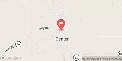
Schleusener Dam, located in Nebraska along Eley Creek, was completed in 1972 by the USDA NRCS with a primary purpose of flood risk reduction.
°F
°F
mph
Wind
%
Humidity
Summary
This private dam stands at a height of 21 feet and has a hydraulic height of 20 feet, providing a storage capacity of 289 acre-feet. Despite its low hazard potential, the dam is currently assessed as being in poor condition, with its last inspection date in November 2019.
Managed by the Nebraska Department of Natural Resources, Schleusener Dam plays a crucial role in protecting the surrounding area from potential flooding events. With a normal storage capacity of 13 acre-feet and a drainage area of 3.4 square miles, the dam is designed to mitigate the risk of high discharges up to 1200 cubic feet per second. However, its poor condition assessment highlights the need for ongoing maintenance and improvement to ensure the dam's long-term effectiveness in flood risk reduction.
As water resource and climate enthusiasts, it is essential to monitor and support the maintenance efforts of structures like Schleusener Dam to safeguard communities and ecosystems from the impacts of extreme weather events. By advocating for proper funding and regulatory oversight, we can help ensure the resilience and functionality of critical infrastructure like Schleusener Dam for the benefit of all stakeholders involved.
Year Completed |
1972 |
Dam Length |
585 |
Dam Height |
21 |
River Or Stream |
ELEY CREEK |
Primary Dam Type |
Earth |
Surface Area |
7 |
Hydraulic Height |
20 |
Drainage Area |
3.4 |
Nid Storage |
289 |
Structural Height |
21 |
Hazard Potential |
Low |
Foundations |
Soil |
Nid Height |
21 |
Seasonal Comparison
Weather Forecast
Nearby Streamflow Levels
 Elkhorn River At Ewing
|
89cfs |
 Verdigre C Nr Verdigre
|
206cfs |
 Bazile Creek At Center
|
85cfs |
 Niobrara River Nr. Verdel
|
517cfs |
 Bazile Creek Near Niobrara
|
192cfs |
 Ponca Creek At Verdel
|
23cfs |
Dam Data Reference
Condition Assessment
SatisfactoryNo existing or potential dam safety deficiencies are recognized. Acceptable performance is expected under all loading conditions (static, hydrologic, seismic) in accordance with the minimum applicable state or federal regulatory criteria or tolerable risk guidelines.
Fair
No existing dam safety deficiencies are recognized for normal operating conditions. Rare or extreme hydrologic and/or seismic events may result in a dam safety deficiency. Risk may be in the range to take further action. Note: Rare or extreme event is defined by the regulatory agency based on their minimum
Poor A dam safety deficiency is recognized for normal operating conditions which may realistically occur. Remedial action is necessary. POOR may also be used when uncertainties exist as to critical analysis parameters which identify a potential dam safety deficiency. Investigations and studies are necessary.
Unsatisfactory
A dam safety deficiency is recognized that requires immediate or emergency remedial action for problem resolution.
Not Rated
The dam has not been inspected, is not under state or federal jurisdiction, or has been inspected but, for whatever reason, has not been rated.
Not Available
Dams for which the condition assessment is restricted to approved government users.
Hazard Potential Classification
HighDams assigned the high hazard potential classification are those where failure or mis-operation will probably cause loss of human life.
Significant
Dams assigned the significant hazard potential classification are those dams where failure or mis-operation results in no probable loss of human life but can cause economic loss, environment damage, disruption of lifeline facilities, or impact other concerns. Significant hazard potential classification dams are often located in predominantly rural or agricultural areas but could be in areas with population and significant infrastructure.
Low
Dams assigned the low hazard potential classification are those where failure or mis-operation results in no probable loss of human life and low economic and/or environmental losses. Losses are principally limited to the owner's property.
Undetermined
Dams for which a downstream hazard potential has not been designated or is not provided.
Not Available
Dams for which the downstream hazard potential is restricted to approved government users.

 Schleusener Dam