Langemeier Dam Reservoir Report
Nearby: Silver Creek 3 Silver Creek 2
Last Updated: January 7, 2026
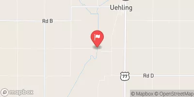
Langemeier Dam, located in Burt County, Nebraska, was completed in 1973 by the USDA NRCS and serves as a crucial flood risk reduction infrastructure along the TR-ELM Creek.
°F
°F
mph
Wind
%
Humidity
Summary
With a height of 45 feet and a length of 603 feet, this earth dam has a storage capacity of 204 acre-feet and a drainage area of 0.6 square miles. The dam, designed for the primary purpose of flood risk reduction, also supports other water resource management functions in the region.
Managed by a private owner, Langemeier Dam is regulated and inspected by the Nebraska Department of Natural Resources, ensuring its structural integrity and compliance with state regulations. The dam has a satisfactory condition assessment, low hazard potential, and a regular inspection schedule every five years. In case of emergencies, the dam's emergency action plan (EAP) is yet to be prepared, highlighting the importance of proactive risk management measures for this critical water infrastructure.
Overall, Langemeier Dam plays a vital role in protecting the local community from flooding events and managing water resources in the area. With its strategic location and design, this dam stands as a testament to effective collaboration between private owners, regulatory agencies, and design engineers in safeguarding the region's water supply and enhancing climate resilience.
Year Completed |
1973 |
Dam Length |
603 |
Dam Height |
45 |
River Or Stream |
TR-ELM CREEK |
Primary Dam Type |
Earth |
Surface Area |
8 |
Hydraulic Height |
44 |
Drainage Area |
0.6 |
Nid Storage |
204 |
Structural Height |
47 |
Hazard Potential |
Low |
Foundations |
Soil |
Nid Height |
47 |
Seasonal Comparison
Weather Forecast
Nearby Streamflow Levels
 Missouri River At Decatur
|
15700cfs |
 Monona-Harrison Ditch Near Turin
|
158cfs |
 Logan Creek Near Uehling
|
359cfs |
 Little Sioux River Near Turin
|
1040cfs |
 South Omaha Creek At Walthill
|
11cfs |
 Soldier River At Pisgah
|
112cfs |
Dam Data Reference
Condition Assessment
SatisfactoryNo existing or potential dam safety deficiencies are recognized. Acceptable performance is expected under all loading conditions (static, hydrologic, seismic) in accordance with the minimum applicable state or federal regulatory criteria or tolerable risk guidelines.
Fair
No existing dam safety deficiencies are recognized for normal operating conditions. Rare or extreme hydrologic and/or seismic events may result in a dam safety deficiency. Risk may be in the range to take further action. Note: Rare or extreme event is defined by the regulatory agency based on their minimum
Poor A dam safety deficiency is recognized for normal operating conditions which may realistically occur. Remedial action is necessary. POOR may also be used when uncertainties exist as to critical analysis parameters which identify a potential dam safety deficiency. Investigations and studies are necessary.
Unsatisfactory
A dam safety deficiency is recognized that requires immediate or emergency remedial action for problem resolution.
Not Rated
The dam has not been inspected, is not under state or federal jurisdiction, or has been inspected but, for whatever reason, has not been rated.
Not Available
Dams for which the condition assessment is restricted to approved government users.
Hazard Potential Classification
HighDams assigned the high hazard potential classification are those where failure or mis-operation will probably cause loss of human life.
Significant
Dams assigned the significant hazard potential classification are those dams where failure or mis-operation results in no probable loss of human life but can cause economic loss, environment damage, disruption of lifeline facilities, or impact other concerns. Significant hazard potential classification dams are often located in predominantly rural or agricultural areas but could be in areas with population and significant infrastructure.
Low
Dams assigned the low hazard potential classification are those where failure or mis-operation results in no probable loss of human life and low economic and/or environmental losses. Losses are principally limited to the owner's property.
Undetermined
Dams for which a downstream hazard potential has not been designated or is not provided.
Not Available
Dams for which the downstream hazard potential is restricted to approved government users.

 Langemeier Dam