Dry Creek South 2-A Reservoir Report
Nearby: Dry Creek South 4-A Nothnagel Dam 1
Last Updated: February 22, 2026
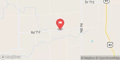
Dry Creek South 2-A is a crucial flood risk reduction structure located in Red Willow, Nebraska, designed by the USDA NRCS in 1964.
Summary
This earth dam stands at a height of 37 feet and stretches 1557 feet in length, providing storage of 827 acre-feet and serving a drainage area of 3.6 square miles. Despite its low hazard potential, the dam's condition is assessed as poor, raising concerns about its long-term effectiveness in mitigating flood risks in the region.
Managed by local government authorities and regulated by the Nebraska Department of Natural Resources, Dry Creek South 2-A plays a vital role in protecting the surrounding area from potential inundation. However, the dam's poor condition underscores the need for regular inspections and maintenance to ensure its continued functionality. With a maximum discharge capacity of 1300 cubic feet per second and a normal storage volume of 61 acre-feet, this structure is a critical component of the flood control infrastructure in the region.
As climate change continues to impact weather patterns and increase the frequency of extreme events, the importance of structures like Dry Creek South 2-A cannot be overstated. Investments in the rehabilitation and upkeep of this dam are essential to safeguarding the community against the escalating threats posed by flooding. It is imperative that stakeholders prioritize the maintenance of this vital infrastructure to ensure the resilience of the area in the face of mounting climate challenges.
°F
°F
mph
Wind
%
Humidity
15-Day Weather Outlook
Year Completed |
1964 |
Dam Length |
1557 |
Dam Height |
37 |
River Or Stream |
TR-DRY CREEK |
Primary Dam Type |
Earth |
Surface Area |
15 |
Hydraulic Height |
37 |
Drainage Area |
3.6 |
Nid Storage |
827 |
Structural Height |
41 |
Hazard Potential |
Low |
Foundations |
Soil |
Nid Height |
41 |
Seasonal Comparison
5-Day Hourly Forecast Detail
Nearby Streamflow Levels
Dam Data Reference
Condition Assessment
SatisfactoryNo existing or potential dam safety deficiencies are recognized. Acceptable performance is expected under all loading conditions (static, hydrologic, seismic) in accordance with the minimum applicable state or federal regulatory criteria or tolerable risk guidelines.
Fair
No existing dam safety deficiencies are recognized for normal operating conditions. Rare or extreme hydrologic and/or seismic events may result in a dam safety deficiency. Risk may be in the range to take further action. Note: Rare or extreme event is defined by the regulatory agency based on their minimum
Poor A dam safety deficiency is recognized for normal operating conditions which may realistically occur. Remedial action is necessary. POOR may also be used when uncertainties exist as to critical analysis parameters which identify a potential dam safety deficiency. Investigations and studies are necessary.
Unsatisfactory
A dam safety deficiency is recognized that requires immediate or emergency remedial action for problem resolution.
Not Rated
The dam has not been inspected, is not under state or federal jurisdiction, or has been inspected but, for whatever reason, has not been rated.
Not Available
Dams for which the condition assessment is restricted to approved government users.
Hazard Potential Classification
HighDams assigned the high hazard potential classification are those where failure or mis-operation will probably cause loss of human life.
Significant
Dams assigned the significant hazard potential classification are those dams where failure or mis-operation results in no probable loss of human life but can cause economic loss, environment damage, disruption of lifeline facilities, or impact other concerns. Significant hazard potential classification dams are often located in predominantly rural or agricultural areas but could be in areas with population and significant infrastructure.
Low
Dams assigned the low hazard potential classification are those where failure or mis-operation results in no probable loss of human life and low economic and/or environmental losses. Losses are principally limited to the owner's property.
Undetermined
Dams for which a downstream hazard potential has not been designated or is not provided.
Not Available
Dams for which the downstream hazard potential is restricted to approved government users.


 Dry Creek South 2-A