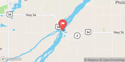
Mazour Irrigation Dam Reservoir Report
Nearby: Theresa Vap Dam Dooley Dam
Last Updated: February 23, 2026
Mazour Irrigation Dam, located in Deweese, Nebraska along Liberty Creek, stands as a vital structure for agricultural water management in the region.
Summary
Built in 1981 by the USDA NRCS, this earth dam with a height of 21 feet serves primarily for irrigation purposes. With a storage capacity of 120 acre-feet, the dam covers a surface area of 10 acres and drains a watershed area of 0.5 square miles.
Managed by a private owner, Mazour Irrigation Dam is regulated by the Nebraska Department of Natural Resources and undergoes state inspections regularly to ensure its structural integrity. With a low hazard potential and a satisfactory condition assessment, the dam has a history of reliable performance in delivering water for irrigation needs. The dam's spillway type, outlet gates, and other associated structures are not specified in the available data, but its hydraulic height of 20 feet and structural height of 24 feet highlight its efficiency in managing water flow.
In the event of emergencies, Mazour Irrigation Dam's emergency action plan (EAP) status and risk management measures remain unspecified. However, with its last inspection conducted in May 2018 and a designated inspection frequency of 5 years, the dam continues to play a crucial role in supporting agriculture in Clay County, Nebraska. Climate and water resource enthusiasts would find Mazour Irrigation Dam an integral component in the local water infrastructure, showcasing the intersection of human ingenuity and environmental stewardship in sustaining agricultural practices.
°F
°F
mph
Wind
%
Humidity
15-Day Weather Outlook
Year Completed |
1981 |
Dam Length |
358 |
Dam Height |
21 |
River Or Stream |
TR-LIBERTY CREEK |
Primary Dam Type |
Earth |
Surface Area |
10 |
Hydraulic Height |
20 |
Drainage Area |
0.5 |
Nid Storage |
120 |
Structural Height |
24 |
Hazard Potential |
Low |
Foundations |
Soil |
Nid Height |
24 |
Seasonal Comparison
5-Day Hourly Forecast Detail
Nearby Streamflow Levels
Dam Data Reference
Condition Assessment
SatisfactoryNo existing or potential dam safety deficiencies are recognized. Acceptable performance is expected under all loading conditions (static, hydrologic, seismic) in accordance with the minimum applicable state or federal regulatory criteria or tolerable risk guidelines.
Fair
No existing dam safety deficiencies are recognized for normal operating conditions. Rare or extreme hydrologic and/or seismic events may result in a dam safety deficiency. Risk may be in the range to take further action. Note: Rare or extreme event is defined by the regulatory agency based on their minimum
Poor A dam safety deficiency is recognized for normal operating conditions which may realistically occur. Remedial action is necessary. POOR may also be used when uncertainties exist as to critical analysis parameters which identify a potential dam safety deficiency. Investigations and studies are necessary.
Unsatisfactory
A dam safety deficiency is recognized that requires immediate or emergency remedial action for problem resolution.
Not Rated
The dam has not been inspected, is not under state or federal jurisdiction, or has been inspected but, for whatever reason, has not been rated.
Not Available
Dams for which the condition assessment is restricted to approved government users.
Hazard Potential Classification
HighDams assigned the high hazard potential classification are those where failure or mis-operation will probably cause loss of human life.
Significant
Dams assigned the significant hazard potential classification are those dams where failure or mis-operation results in no probable loss of human life but can cause economic loss, environment damage, disruption of lifeline facilities, or impact other concerns. Significant hazard potential classification dams are often located in predominantly rural or agricultural areas but could be in areas with population and significant infrastructure.
Low
Dams assigned the low hazard potential classification are those where failure or mis-operation results in no probable loss of human life and low economic and/or environmental losses. Losses are principally limited to the owner's property.
Undetermined
Dams for which a downstream hazard potential has not been designated or is not provided.
Not Available
Dams for which the downstream hazard potential is restricted to approved government users.


 Mazour Irrigation Dam