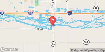
Niemeier Dam Reservoir Report
Nearby: Duval Dam Vavricka Dam
Last Updated: February 24, 2026
Niemeier Dam, located in Webster County, Nebraska, is a vital structure designed by the USDA NRCS for flood risk reduction along Indian Creek.
Summary
Completed in 1966, this private-owned Earth type dam stands at 17 feet in height and spans 585 feet in length, providing a storage capacity of 212 acre-feet to mitigate potential flooding in the area. Despite its low hazard potential, the dam's condition assessment in 2016 indicated poor maintenance, highlighting the need for ongoing inspection and potential rehabilitation efforts to ensure its effectiveness in safeguarding the surrounding community.
Managed by the Nebraska Department of Natural Resources, Niemeier Dam plays a crucial role in regulating water flow and protecting downstream areas from potential inundation during high flow events. While the dam's primary purpose is flood risk reduction, its operational capacity and structural integrity are essential factors in maintaining the safety and stability of the surrounding region. With a drainage area of 2.5 square miles and a maximum discharge rate of 508 cubic feet per second, the dam serves as a key component in the overall water resource management strategy for the region.
As climate change continues to impact precipitation patterns and water availability, the significance of structures like Niemeier Dam in mitigating flood risks and ensuring water security cannot be overstated. Efforts to monitor and maintain the dam's condition, coupled with effective emergency preparedness measures, are essential to safeguarding both the dam's structural integrity and the well-being of the local community. With ongoing support from regulatory agencies and stakeholders, Niemeier Dam will continue to play a vital role in managing water resources and enhancing climate resilience in the region.
°F
°F
mph
Wind
%
Humidity
15-Day Weather Outlook
Year Completed |
1966 |
Dam Length |
585 |
Dam Height |
17 |
River Or Stream |
INDIAN CREEK |
Primary Dam Type |
Earth |
Surface Area |
5 |
Hydraulic Height |
17 |
Drainage Area |
2.5 |
Nid Storage |
212 |
Structural Height |
17 |
Hazard Potential |
Low |
Foundations |
Soil |
Nid Height |
17 |
Seasonal Comparison
5-Day Hourly Forecast Detail
Nearby Streamflow Levels
Dam Data Reference
Condition Assessment
SatisfactoryNo existing or potential dam safety deficiencies are recognized. Acceptable performance is expected under all loading conditions (static, hydrologic, seismic) in accordance with the minimum applicable state or federal regulatory criteria or tolerable risk guidelines.
Fair
No existing dam safety deficiencies are recognized for normal operating conditions. Rare or extreme hydrologic and/or seismic events may result in a dam safety deficiency. Risk may be in the range to take further action. Note: Rare or extreme event is defined by the regulatory agency based on their minimum
Poor A dam safety deficiency is recognized for normal operating conditions which may realistically occur. Remedial action is necessary. POOR may also be used when uncertainties exist as to critical analysis parameters which identify a potential dam safety deficiency. Investigations and studies are necessary.
Unsatisfactory
A dam safety deficiency is recognized that requires immediate or emergency remedial action for problem resolution.
Not Rated
The dam has not been inspected, is not under state or federal jurisdiction, or has been inspected but, for whatever reason, has not been rated.
Not Available
Dams for which the condition assessment is restricted to approved government users.
Hazard Potential Classification
HighDams assigned the high hazard potential classification are those where failure or mis-operation will probably cause loss of human life.
Significant
Dams assigned the significant hazard potential classification are those dams where failure or mis-operation results in no probable loss of human life but can cause economic loss, environment damage, disruption of lifeline facilities, or impact other concerns. Significant hazard potential classification dams are often located in predominantly rural or agricultural areas but could be in areas with population and significant infrastructure.
Low
Dams assigned the low hazard potential classification are those where failure or mis-operation results in no probable loss of human life and low economic and/or environmental losses. Losses are principally limited to the owner's property.
Undetermined
Dams for which a downstream hazard potential has not been designated or is not provided.
Not Available
Dams for which the downstream hazard potential is restricted to approved government users.


 Niemeier Dam