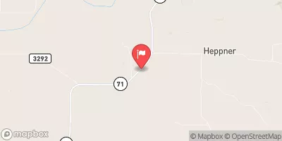
Mayfield Dam Reservoir Report
Nearby: Spring Creek Dam 1606 Fox Dam
Last Updated: February 4, 2026
Mayfield Dam, located in Dawes, Nebraska, is a privately owned structure designed by the USDA NRCS for irrigation purposes.
°F
°F
mph
Wind
%
Humidity
15-Day Weather Outlook
Summary
Completed in 1950, this earth dam stands at a height of 15 feet and has a maximum storage capacity of 144 acre-feet. The dam's primary purpose is to provide water for irrigation in the area, with a normal storage capacity of 84 acre-feet and a surface area of 16 acres.
Managed by the NE DNR, Mayfield Dam is regulated and inspected by the state, with a low hazard potential but a poor condition assessment as of the last inspection in April 2019. Despite its condition, the dam still plays a vital role in water resource management in the region, with a drainage area of 1.1 square miles and a maximum discharge capacity of 643 cubic feet per second. The dam's location on the TR-CHADRON CREEK serves as a crucial water source for agricultural activities in the surrounding area.
While Mayfield Dam may face challenges in terms of its condition, its importance in providing water for irrigation cannot be understated. As climate change continues to impact water resources, structures like Mayfield Dam will play a crucial role in managing and distributing water in a sustainable manner. Climate enthusiasts and water resource experts alike can appreciate the significance of structures like Mayfield Dam in ensuring water security for agricultural operations in the region.
Year Completed |
1950 |
Dam Length |
385 |
Dam Height |
15 |
River Or Stream |
TR-CHADRON CREEK |
Primary Dam Type |
Earth |
Surface Area |
16 |
Hydraulic Height |
11 |
Drainage Area |
1.1 |
Nid Storage |
144 |
Structural Height |
17 |
Hazard Potential |
Low |
Foundations |
Soil |
Nid Height |
17 |
Seasonal Comparison
Hourly Weather Forecast
Nearby Streamflow Levels
Dam Data Reference
Condition Assessment
SatisfactoryNo existing or potential dam safety deficiencies are recognized. Acceptable performance is expected under all loading conditions (static, hydrologic, seismic) in accordance with the minimum applicable state or federal regulatory criteria or tolerable risk guidelines.
Fair
No existing dam safety deficiencies are recognized for normal operating conditions. Rare or extreme hydrologic and/or seismic events may result in a dam safety deficiency. Risk may be in the range to take further action. Note: Rare or extreme event is defined by the regulatory agency based on their minimum
Poor A dam safety deficiency is recognized for normal operating conditions which may realistically occur. Remedial action is necessary. POOR may also be used when uncertainties exist as to critical analysis parameters which identify a potential dam safety deficiency. Investigations and studies are necessary.
Unsatisfactory
A dam safety deficiency is recognized that requires immediate or emergency remedial action for problem resolution.
Not Rated
The dam has not been inspected, is not under state or federal jurisdiction, or has been inspected but, for whatever reason, has not been rated.
Not Available
Dams for which the condition assessment is restricted to approved government users.
Hazard Potential Classification
HighDams assigned the high hazard potential classification are those where failure or mis-operation will probably cause loss of human life.
Significant
Dams assigned the significant hazard potential classification are those dams where failure or mis-operation results in no probable loss of human life but can cause economic loss, environment damage, disruption of lifeline facilities, or impact other concerns. Significant hazard potential classification dams are often located in predominantly rural or agricultural areas but could be in areas with population and significant infrastructure.
Low
Dams assigned the low hazard potential classification are those where failure or mis-operation results in no probable loss of human life and low economic and/or environmental losses. Losses are principally limited to the owner's property.
Undetermined
Dams for which a downstream hazard potential has not been designated or is not provided.
Not Available
Dams for which the downstream hazard potential is restricted to approved government users.
Area Campgrounds
| Location | Reservations | Toilets |
|---|---|---|
 Chadron State Park
|
||
 Red Cloud
|
||
 Roberts Tract Campground
|


 Mayfield Dam