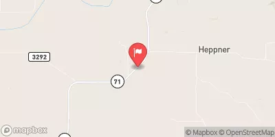
Dodd Dam Reservoir Report
Nearby: Mcdowell Dam 1 Squaw Creek Dam
Last Updated: February 4, 2026
Dodd Dam, located in Crawford, Nebraska, is a significant earth dam designed by USDA NRCS in 1962 for flood risk reduction along the White Clay Creek.
°F
°F
mph
Wind
%
Humidity
15-Day Weather Outlook
Summary
Standing at a height of 42 feet, the dam has a normal storage capacity of 87 acre-feet and a maximum storage of 448.8 acre-feet, serving a drainage area of 11 square miles. However, despite its important role in managing flood risks in the region, Dodd Dam has been assessed as being in poor condition, with a significant hazard potential, highlighting the need for regular inspections and maintenance to ensure its structural integrity.
Managed by the Nebraska Department of Natural Resources, Dodd Dam is subject to state regulation and enforcement, with permitting and inspection processes in place to monitor its safety and functionality. The dam's poor condition assessment in 2020 raises concerns about its ability to effectively mitigate flood risks in the area, highlighting the importance of proactive risk management measures to address potential hazards. With a history of modifications and ongoing regulatory oversight, Dodd Dam remains a critical infrastructure for flood control in Dawes County, Nebraska.
As a key component of the flood risk reduction strategy in the region, Dodd Dam plays a vital role in protecting surrounding communities from the impacts of high water events. With its location in a significant hazard potential area and a history of poor condition assessment, it is essential for state regulators and dam owners to prioritize maintenance and risk management measures to ensure the continued effectiveness and safety of this important water resource infrastructure. As climate change brings more frequent and intense precipitation events, the proper maintenance and operation of dams like Dodd Dam are critical for safeguarding lives and properties against the increasing threat of flooding.
Year Completed |
1962 |
Dam Length |
1133 |
Dam Height |
38 |
River Or Stream |
WHITE CLAY CREEK |
Primary Dam Type |
Earth |
Surface Area |
17 |
Hydraulic Height |
38 |
Drainage Area |
11 |
Nid Storage |
448.8 |
Structural Height |
42 |
Hazard Potential |
Significant |
Foundations |
Soil |
Nid Height |
42 |
Seasonal Comparison
Hourly Weather Forecast
Nearby Streamflow Levels
Dam Data Reference
Condition Assessment
SatisfactoryNo existing or potential dam safety deficiencies are recognized. Acceptable performance is expected under all loading conditions (static, hydrologic, seismic) in accordance with the minimum applicable state or federal regulatory criteria or tolerable risk guidelines.
Fair
No existing dam safety deficiencies are recognized for normal operating conditions. Rare or extreme hydrologic and/or seismic events may result in a dam safety deficiency. Risk may be in the range to take further action. Note: Rare or extreme event is defined by the regulatory agency based on their minimum
Poor A dam safety deficiency is recognized for normal operating conditions which may realistically occur. Remedial action is necessary. POOR may also be used when uncertainties exist as to critical analysis parameters which identify a potential dam safety deficiency. Investigations and studies are necessary.
Unsatisfactory
A dam safety deficiency is recognized that requires immediate or emergency remedial action for problem resolution.
Not Rated
The dam has not been inspected, is not under state or federal jurisdiction, or has been inspected but, for whatever reason, has not been rated.
Not Available
Dams for which the condition assessment is restricted to approved government users.
Hazard Potential Classification
HighDams assigned the high hazard potential classification are those where failure or mis-operation will probably cause loss of human life.
Significant
Dams assigned the significant hazard potential classification are those dams where failure or mis-operation results in no probable loss of human life but can cause economic loss, environment damage, disruption of lifeline facilities, or impact other concerns. Significant hazard potential classification dams are often located in predominantly rural or agricultural areas but could be in areas with population and significant infrastructure.
Low
Dams assigned the low hazard potential classification are those where failure or mis-operation results in no probable loss of human life and low economic and/or environmental losses. Losses are principally limited to the owner's property.
Undetermined
Dams for which a downstream hazard potential has not been designated or is not provided.
Not Available
Dams for which the downstream hazard potential is restricted to approved government users.
Area Campgrounds
| Location | Reservations | Toilets |
|---|---|---|
 Crawford City Park
|
||
 Fort Robinson State Park
|
||
 Soldier Creek
|
||
 Roberts Tract Campground
|


 Dodd Dam