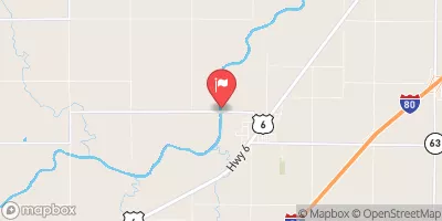
Wilson Creek 2-2 Reservoir Report
Nearby: Wilson Creek 2-2b Gibbs Dam
Last Updated: February 22, 2026
Wilson Creek 2-2, located in Otoe, Nebraska, is a local government-owned earth dam designed by USDA NRCS and completed in 1963.
Summary
With a height of 35 feet and a length of 600 feet, this dam serves multiple purposes including flood risk reduction. It has a storage capacity of 102 acre-feet and a drainage area of 0.5 square miles, making it a vital structure for managing water resources in the area.
Despite its importance, Wilson Creek 2-2 is facing challenges. The dam has a poor condition assessment and is classified as having a low hazard potential. The last inspection in May 2019 highlighted these concerns, prompting the need for regular monitoring and maintenance to ensure its continued effectiveness in protecting the surrounding community from potential risks.
As climate change continues to impact water resources and weather patterns, the importance of maintaining and improving infrastructure like Wilson Creek 2-2 cannot be understated. With the potential for increased flooding events and extreme weather conditions, the resilience of dams like this one is crucial for mitigating risks and protecting the local environment and communities. It is essential for stakeholders to collaborate and invest in the necessary upgrades and repairs to enhance the dam's performance and ensure its long-term viability.
°F
°F
mph
Wind
%
Humidity
15-Day Weather Outlook
Year Completed |
1963 |
Dam Length |
600 |
Dam Height |
35 |
River Or Stream |
TR-N FK LITTLE NEMAHA RIVER |
Primary Dam Type |
Earth |
Surface Area |
5 |
Hydraulic Height |
34 |
Drainage Area |
0.5 |
Nid Storage |
102 |
Structural Height |
35 |
Hazard Potential |
Low |
Foundations |
Soil |
Nid Height |
35 |
Seasonal Comparison
5-Day Hourly Forecast Detail
Nearby Streamflow Levels
 Weeping Water Creek At Union
|
18cfs |
 Missouri River At Nebraska City
|
24700cfs |
 Platte R At Louisville Ne
|
6210cfs |
 Nishnabotna River Above Hamburg
|
681cfs |
 Little Nemaha River At Auburn
|
81cfs |
 Salt Creek At Greenwood
|
139cfs |
Dam Data Reference
Condition Assessment
SatisfactoryNo existing or potential dam safety deficiencies are recognized. Acceptable performance is expected under all loading conditions (static, hydrologic, seismic) in accordance with the minimum applicable state or federal regulatory criteria or tolerable risk guidelines.
Fair
No existing dam safety deficiencies are recognized for normal operating conditions. Rare or extreme hydrologic and/or seismic events may result in a dam safety deficiency. Risk may be in the range to take further action. Note: Rare or extreme event is defined by the regulatory agency based on their minimum
Poor A dam safety deficiency is recognized for normal operating conditions which may realistically occur. Remedial action is necessary. POOR may also be used when uncertainties exist as to critical analysis parameters which identify a potential dam safety deficiency. Investigations and studies are necessary.
Unsatisfactory
A dam safety deficiency is recognized that requires immediate or emergency remedial action for problem resolution.
Not Rated
The dam has not been inspected, is not under state or federal jurisdiction, or has been inspected but, for whatever reason, has not been rated.
Not Available
Dams for which the condition assessment is restricted to approved government users.
Hazard Potential Classification
HighDams assigned the high hazard potential classification are those where failure or mis-operation will probably cause loss of human life.
Significant
Dams assigned the significant hazard potential classification are those dams where failure or mis-operation results in no probable loss of human life but can cause economic loss, environment damage, disruption of lifeline facilities, or impact other concerns. Significant hazard potential classification dams are often located in predominantly rural or agricultural areas but could be in areas with population and significant infrastructure.
Low
Dams assigned the low hazard potential classification are those where failure or mis-operation results in no probable loss of human life and low economic and/or environmental losses. Losses are principally limited to the owner's property.
Undetermined
Dams for which a downstream hazard potential has not been designated or is not provided.
Not Available
Dams for which the downstream hazard potential is restricted to approved government users.
Area Campgrounds
| Location | Reservations | Toilets |
|---|---|---|
 Camp Woodmen
|
||
 Riverview Marina State Rec Area
|
||
 Victorian Acres Campground
|

 Wilson Creek 2-2