Stone Dam Reservoir Report
Nearby: Perry Dam 1987 Kolar Dam
Last Updated: January 3, 2026
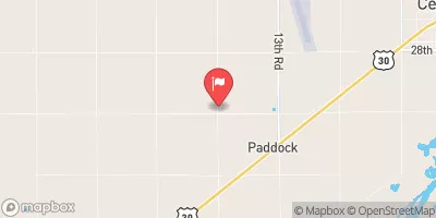
Stone Dam, located in Howard County, Nebraska, is a privately owned structure designed by the USDA NRCS for fire protection, stock, or small fish pond purposes.
°F
°F
mph
Wind
%
Humidity
Summary
Completed in 1970, this Earth-type dam stands at a height of 20 feet and has a storage capacity of 72 acre-feet, with a normal storage level of 25 acre-feet. The dam, built with a combination of stone and buttress core types on a soil foundation, spans 120 feet in length and serves the TR-SPRING CREEK as its primary water source.
Despite its low hazard potential, Stone Dam's condition assessment is rated as poor, with the last inspection conducted in June 2019. The dam's inspection frequency is set at every 5 years, and it is regulated, permitted, inspected, and enforced by the Nebraska Department of Natural Resources. As an essential water resource structure in CUSHING, Nebraska, Stone Dam plays a crucial role in providing water for firefighting, livestock, and recreational fishing, highlighting the intersection of water resource management and climate resilience in the region.
Year Completed |
1970 |
Dam Length |
120 |
Dam Height |
20 |
River Or Stream |
TR-SPRING CREEK |
Primary Dam Type |
Earth |
Surface Area |
4 |
Hydraulic Height |
17 |
Drainage Area |
0.9 |
Nid Storage |
72 |
Structural Height |
23 |
Hazard Potential |
Low |
Foundations |
Soil |
Nid Height |
23 |
Seasonal Comparison
Weather Forecast
Nearby Streamflow Levels
 North Loup River Nr St Paul Nebr
|
1430cfs |
 Middle Loup R. At St. Paul
|
1330cfs |
 Warm Slough Nr Central City
|
0cfs |
 South Loup R At St. Michael
|
149cfs |
 Loup River Power Canal Near Genoa
|
1420cfs |
 Beaver Creek At Genoa
|
114cfs |
Dam Data Reference
Condition Assessment
SatisfactoryNo existing or potential dam safety deficiencies are recognized. Acceptable performance is expected under all loading conditions (static, hydrologic, seismic) in accordance with the minimum applicable state or federal regulatory criteria or tolerable risk guidelines.
Fair
No existing dam safety deficiencies are recognized for normal operating conditions. Rare or extreme hydrologic and/or seismic events may result in a dam safety deficiency. Risk may be in the range to take further action. Note: Rare or extreme event is defined by the regulatory agency based on their minimum
Poor A dam safety deficiency is recognized for normal operating conditions which may realistically occur. Remedial action is necessary. POOR may also be used when uncertainties exist as to critical analysis parameters which identify a potential dam safety deficiency. Investigations and studies are necessary.
Unsatisfactory
A dam safety deficiency is recognized that requires immediate or emergency remedial action for problem resolution.
Not Rated
The dam has not been inspected, is not under state or federal jurisdiction, or has been inspected but, for whatever reason, has not been rated.
Not Available
Dams for which the condition assessment is restricted to approved government users.
Hazard Potential Classification
HighDams assigned the high hazard potential classification are those where failure or mis-operation will probably cause loss of human life.
Significant
Dams assigned the significant hazard potential classification are those dams where failure or mis-operation results in no probable loss of human life but can cause economic loss, environment damage, disruption of lifeline facilities, or impact other concerns. Significant hazard potential classification dams are often located in predominantly rural or agricultural areas but could be in areas with population and significant infrastructure.
Low
Dams assigned the low hazard potential classification are those where failure or mis-operation results in no probable loss of human life and low economic and/or environmental losses. Losses are principally limited to the owner's property.
Undetermined
Dams for which a downstream hazard potential has not been designated or is not provided.
Not Available
Dams for which the downstream hazard potential is restricted to approved government users.

 Stone Dam